Brazil
Maranhão, Brazil — Towns & Travel Guide


Maranhão is a state on Brazil's northern Atlantic coast, known for the Lençóis Maranhenses dunes and the colonial capital of São Luís.
About Maranhão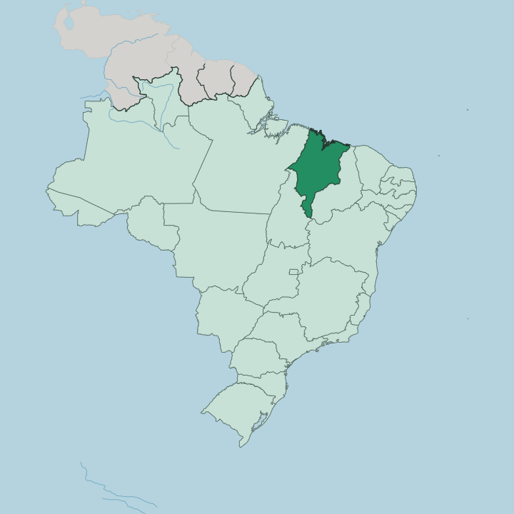
Towns & cities in Maranhão
Pick a town or city — each links to where to stay.
São Luís is the arrival point and first base, its grid of tiled sobrados set on São Luís Island in the Baía de São Marcos. Most dune trips start inland at Barreirinhas, the launch town on the Preguiças River where boats and 4x4 vehicles set off into the Lençóis Maranhenses. Atins sits further out, at the river mouth.
Choose Imperatriz for the far interior, on the northeastern bank of the Tocantins River facing the state of Tocantins. Pick the base for the trip.
About Maranhão
Two landscapes define the state.
What is Maranhão known for?
The Lençóis Maranhenses spreads a vast field of white dunes along the Atlantic coast east of São Luís, and after the rains its valleys fill with thousands of clear rain-fed lagoons that last into the dry months. São Luís itself, the capital, sits on an island in the Baía de São Marcos and keeps the largest collection of colonial azulejos in Brazil. Reggae plays loud here.
Bumba-meu-boi, the state's great June festival, fills both the capital and the interior with drumming and costumed oxen.
Where is Maranhão?
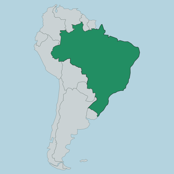
Maranhão fills the western corner of Brazil's Northeast, its coast facing north onto the Atlantic. The Parnaíba River draws the whole eastern boundary with Piauí. Pará lies to the west and Tocantins to the south, and it is on the Tocantins River in the far south-west that the city of Imperatriz stands.
The land is low and wet near the sea and rises into scrubby plateau inland. Rivers cross the state northward to the sea. The Mearim, Pindaré and Itapecuru all drain toward the two great bays, the Baía de São Marcos and the Baía de São José, and the Mearim carries a pororoca tidal bore up its lower channel.
Between those bays and the open ocean the Lençóis Maranhenses piles the largest dune field in South America, its hollows flooding into freshwater lagoons after the rains. Inland the ground shifts through three biomes at once. Groves of babaçu palm mark the transition, rooted between the Amazon rainforest to the west, the Cerrado savanna to the south and the dry Caatinga to the east.
Wetlands spread across the Baixada Maranhense in the north. It is a state of edges.
What is Maranhão like?
Maranhão holds one of the deepest Afro-Brazilian cultures in Brazil's Northeast. Its signature is Bumba-meu-boi, the drum-and-costume drama of a resurrected ox that fills São Luís and the interior towns through June and July, and which the country recognises as intangible heritage. Tambor de Crioula belongs to the state alone.
Dancers circle to three hand-drums in a form carried down from enslaved Africans, and no other part of Brazil keeps it. São Luís answers to another sound entirely. The city took up Jamaican reggae from Caribbean radio and made it a local institution, earning the name of Brazil's reggae capital and its own reggae museum.
Portuguese is the language of daily life across the state. The old capital wears its past in stone. Rows of tiled sobrados line the historic grid, and Alcântara across the bay keeps colonial ruins beside a modern rocket range.
Music sets the pace here.
What is the history of Maranhão?
The capital was a French creation. Daniel de la Touche founded São Luís in 1612 and named it for the boy-king Louis XIII, making it the only Brazilian state capital laid out by France. Portugal seized the town in 1615, and Dutch forces held the town briefly before the Portuguese returned for good.
Cotton and later sugar bound the colony to Atlantic slavery, and that labour built both the tiled townhouses of São Luís and the Afro-Brazilian traditions the state carries. Maranhão took its place among the states of the Brazilian republic in 1889.
What is the climate of Maranhão?
The state stays hot and humid the year round. Rain rules the calendar rather than temperature, with a long wet season pouring from around January to June and a drier spell over the back half of the year. São Luís and the coast catch some of the heaviest rain in Brazil, which is what floods the hollows of the Lençóis Maranhenses into lagoons.
The dunes hold their clearest pools once the rains ease, from about July onward. Inland toward the Cerrado the dry months bite harder. Pack for the heat.
How do you get to Maranhão?
Flights land at Marechal Cunha Machado airport in São Luís. The international terminal there links the state to the rest of Brazil and is the usual first step toward the dunes. From the airport a paved road runs east to Barreirinhas, roughly a half-day by shuttle or hired car, where boats and 4x4 vehicles take over for the sand.
Alcântara sits across the Baía de São Marcos, reached by ferry from the capital. Roads carry on south toward Imperatriz and the interior. The rivers stay navigable inland.
Good for
Updated July 2026