Brazil
Sergipe, Brazil — Towns & Travel Guide


Sergipe is Brazil's smallest state, a strip of Atlantic coast and dry caatinga interior in the Northeast, its capital Aracaju on the Sergipe River.
About Sergipe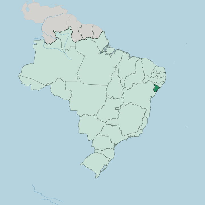
Towns & cities in Sergipe
Pick a town or city — each links to where to stay.
Most travellers base themselves in Aracaju, and the Orla de Atalaia is the obvious address, a beachfront strip of hotels, crab shacks, and the Passarela do Caranguejo. Rooms thin out fast beyond it. South along the coast, Praia do Saco near Estância trades the city for quiet sand and mangrove estuaries.
For colonial architecture, São Cristóvão and nearby Laranjeiras sit close enough for a day trip. If you want the Xingó Canyon, sleep inland at Canindé de São Francisco, close to the walls the São Francisco River has carved along the border with Alagoas.
About Sergipe
What is Sergipe known for?
Sergipe packs a lot into the smallest of Brazil's states. Aracaju anchors it. The capital's Orla de Atalaia runs for kilometres of beach kiosks and seafood, and the Passarela do Caranguejo made the city a byword for crab.
Inland, the São Francisco River carves the Xingó Canyon along the border with Alagoas, where boats thread walls of red rock. Farther south, São Cristóvão guards Brazil's fourth-oldest town and a UNESCO-listed colonial square.
Where is Sergipe?
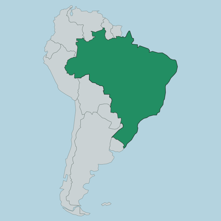
Sergipe is the smallest state in Brazil, a compact wedge on the Atlantic in the country's Northeast Region. Bahia wraps around it to the south and west. To the north, the São Francisco River draws the whole border with Alagoas, running to the sea past sandbars and lagoons. The Atlantic forms the entire eastern edge.
Distances here are short. From the beaches at Aracaju to the dry interior is a matter of a few hours' drive, not days. The land climbs as it goes inland.
A narrow coastal lowland of mangroves, estuaries, and sandy restinga gives way to rolling tablelands, and then to the thorny caatinga scrub of the sertão in the west, where rain is scarce and the rivers run seasonal. Water drains two ways off that slope. The northern half feeds the São Francisco River; the southern half runs straight to the Atlantic through the Vaza-Barris, Real, and Cotinguiba.
Aracaju sits at the mouth of the Sergipe River on the ocean. Upstream on the São Francisco, near the Bahia line, the water has cut the Xingó Canyon into walls of red rock that draw tour boats. It is a small state that holds coast, cane country, and near-desert at once.
What is Sergipe like?
Culture in Sergipe runs Northeastern to the core. June is the loud month. The São João festivals fill Aracaju with forró, bonfires, and long nights of quadrilha dancing across the squares.
Accordion-driven forró is the sound of it, and the Forró Caju street party draws crowds through Aracaju every June. Food leans on the water. Crab is close to an emblem, eaten by hand at the Passarela do Caranguejo, served beside shrimp and the fish of the estuaries.
Beyond the plate, the coast lives by fishing and the tides of the mangrove estuaries. The state's deepest heritage is colonial and religious. São Cristóvão holds the UNESCO-listed São Francisco Square, a plaza of baroque churches and a Franciscan convent from the seventeenth century.
Nearby Laranjeiras earned the nickname the Athens of Sergipe for its churches and its sacred-music tradition. That heritage bred writers. The poet Tobias Barreto and the critic Sílvio Romero were both born in Sergipe, and both shaped Brazilian letters far beyond the state in the nineteenth century.
Portuguese is the everyday language, carried in the songs and the Catholic processions that still mark the year.
What is the history of Sergipe?
Cattlemen and sugar planters pushed north from Bahia to take this land, and in 1590 Cristóvão de Barros founded São Cristóvão as its first capital. The Dutch held the coast briefly in the seventeenth century before the Portuguese drove them out. Bahia ruled it for two centuries.
It broke away as a separate captaincy in 1820. The capital shifted from São Cristóvão to the new port of Aracaju in 1855, and Sergipe became a state of the Brazilian republic in 1889.
What is the climate of Sergipe?
Two climates share the state. The coast around Aracaju stays warm and humid the year round, cooled by an Atlantic breeze off the water. Its wettest stretch runs through the southern-hemisphere autumn and winter, when grey skies settle from about March into July.
Head inland and the air dries out fast. The caatinga of the sertão bakes under a semi-arid sky, where rain is thin and drought can hold for months on end.
How do you get to Sergipe?
Most visitors reach Sergipe by air. Aracaju's Santa Maria airport takes direct flights from São Paulo, Rio de Janeiro, Brasília, and the nearer Northeastern hubs of Salvador and Recife. Overland, the BR-101 highway runs the length of the coast, linking Aracaju with Salvador down in Bahia and, to the north, crossing the São Francisco River into Alagoas toward Maceió.
From the airport it is a short hop to the beaches at Atalaia.
Good for
Updated July 2026