Canada
Northwest Territories, Canada — Towns & Travel Guide


The Northwest Territories fills the northwest of Canada, drained by the Mackenzie River flowing from Great Slave Lake to the Arctic Ocean.
About Northwest Territories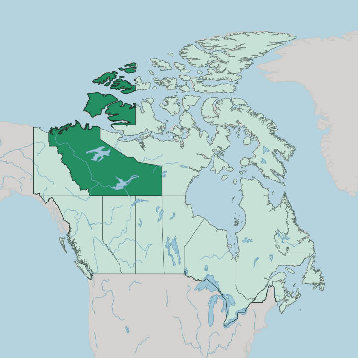
Towns & cities in Northwest Territories
Pick a town or city — each links to where to stay.
Yellowknife is the natural first base. It is the territory's only city, the airport almost every trip passes through, and the place that holds most of the hotels and the aurora tours out over Great Slave Lake. Hay River sits at the south end of the same lake, where the Mackenzie Highway arrives from Alberta and the commercial fishery works the water.
Inuvik marks the end of the road far north, in the Mackenzie River delta, reached overland by the Dempster Highway. Choose Yellowknife for the northern lights; choose Hay River as the southern road hub, and Inuvik when you want the far Arctic delta.
About Northwest Territories
What is Northwest Territories known for?
The Northwest Territories is one of Canada's three northern territories, a vast land north of the provinces. Yellowknife anchors it. The capital sits on the north shore of Great Slave Lake, the deepest lake in North America and the source of the Mackenzie River.
Beyond the city the land runs from boreal forest in the south to open tundra along the Arctic Ocean, cut by the Mackenzie Mountains toward the Yukon border. Winter brings the aurora borealis. Under those dark skies the territory has become one of the surest places on the continent to watch the northern lights.
Where is Northwest Territories?
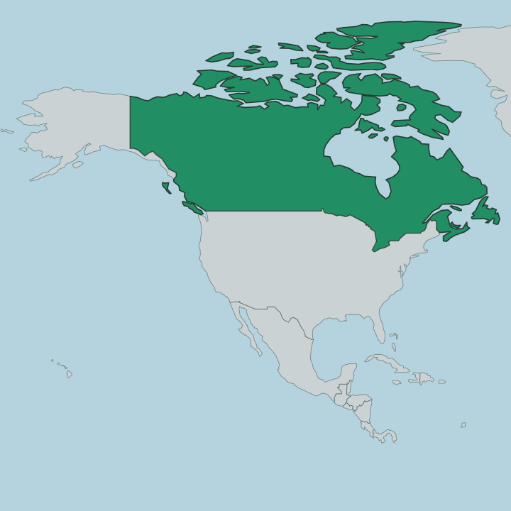
The Northwest Territories covers the northwest of Canada, north of the sixtieth parallel and reaching to the Arctic Ocean. It is enormous. Only Nunavut, split from it in 1999, is larger among Canada's territories, and it stretches far enough that a single land can hold boreal forest, subarctic taiga, and open Arctic tundra all at once.
Yukon lies to the west, Nunavut to the east, and the provinces of British Columbia, Alberta, and Saskatchewan run along the southern border. The Mackenzie River is the spine of the whole territory. It leaves the western end of Great Slave Lake and flows north-west across the interior toward the Beaufort Sea, spreading into a broad delta near Inuvik before it reaches salt water.
Two of the continent's great lakes sit here as well. Great Slave Lake is the deepest in North America, and Great Bear Lake, further north, is the largest lake lying wholly within Canada. Along the western edge the Mackenzie Mountains rise toward the Yukon boundary.
Nahanni National Park Reserve guards the South Nahanni River there, where Virginia Falls drops roughly twice the height of Niagara. The far north is treeless. Islands of the Arctic Archipelago trail off the mainland into frozen sea, and much of that ground stays locked under permafrost the year round.
What is Northwest Territories like?
The Northwest Territories is Indigenous country first of all. Most of it is Denendeh, the homeland of the Dene, who have lived in the boreal forest of the interior for thousands of years. Along the Arctic coast and through the Mackenzie River delta live the Inuvialuit, the western Canadian Inuit who reached that shore about a thousand years ago.
Together those peoples make up a large share of the territory's population, and their presence is why the place counts eleven official languages, more than anywhere else in Canada. English and French sit alongside the Dene tongues. Chipewyan, Tłı̨chǫ, and several Slavey and Gwich'in languages are official too, next to Inuktitut and Inuvialuktun of the coast.
That range is unusual. Governance here leans on land-claim agreements and self-government worked out community by community, from the Tłı̨chǫ around Behchokǫ̀ to the Inuvialuit of the delta. Yellowknife grew from a gold rush in the boreal forest, and mining and the diamond fields still shape the modern economy.
The seasons order daily life as much as any of that. Summer brings the midnight sun, and winter the long dark that draws travellers north for the aurora.
What is the history of Northwest Territories?
The territory entered Canada in 1870, when Britain transferred the vast North-Western Territory and Rupert's Land to the new dominion. It was huge. Over the following decades the prairie provinces and, in 1999, Nunavut were carved out of that first sweep, shrinking the North-West Territories to its modern bounds in the north-west.
Yellowknife itself grew only after gold was found on Great Slave Lake in the 1930s, and it took over as territorial capital in 1967. Long before any of that, the Dene and the Inuvialuit were already here.
What is the climate of Northwest Territories?
The Northwest Territories is cold, and the cold deepens as you go north. Around Great Slave Lake the southern interior has a subarctic climate, with brief warm summers and hard winters. Colder still is the Arctic coast, frozen for much of the year and treeless under permafrost that never fully thaws.
Seasons swing hard. Around midsummer the sun barely sets, while the long winter darkness is exactly what makes the territory such reliable country for the aurora borealis.
How do you get to Northwest Territories?
Air travel rules the north. Most travellers fly into Yellowknife, the territory's main airport and the connecting point for the scattered smaller communities beyond it. By road, the Mackenzie Highway climbs north out of Alberta through Hay River toward the capital on Great Slave Lake.
Reaching the Arctic edge means driving the Dempster Highway all the way to Inuvik in the Mackenzie River delta, the farthest north the Canadian road network goes. Many settlements have no road. They are served instead by bush plane, by winter ice roads frozen across lakes and rivers, or by summer barges running down the Mackenzie River.
Good for
Updated July 2026