Chile
Región de los Lagos, Chile — Towns & Travel Guide


Región de los Lagos is Chile's lake-and-volcano south, where glacial lakes, snow-capped cones and the Chiloé islands meet the Pacific.
About Región de los Lagos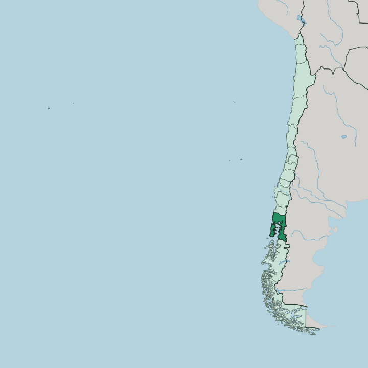
Towns & cities in Región de los Lagos
Pick a town or city — each links to where to stay.
Base yourself by the lake. Puerto Varas is the easy choice, a town on Lake Llanquihue looking straight across the water at the Osorno cone, close to the trailheads and the boat piers. Frutillar, smaller and quieter up the same shore, keeps a German colonial museum and a concert hall built out over the lake.
Choose Puerto Montt for the airport and the ferry port. On Chiloé, stay in Castro among the stilt-raised palafitos, or in Ancud near the northern wooden churches. Cross to Castro when the island itself is the point.
About Región de los Lagos
Two things carry the name.
What is Región de los Lagos known for?
Glacial lakes ring the base of the Andes, and Lake Llanquihue spreads out beneath the near-perfect cone of the Osorno volcano. Puerto Varas and Frutillar sit on its shore, both settled by German colonists in the 1850s and still lined with their timber houses and lakeside cafés. West across the water lies the other draw, the Chiloé Archipelago, where wooden churches and stilt-house palafitos face a cold, tide-swept sea.
Puerto Montt anchors the region as its capital and the last stop before Patagonia.
Where is Región de los Lagos?
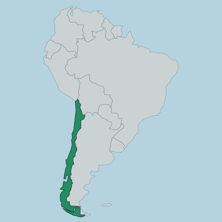
Región de los Lagos fills the middle of Chile's long south, with the Los Ríos Region above it and the Aisén Region below. Argentina lies over the Andes to the east. The Pacific Ocean forms the whole western edge. Between them the land is split three ways, into mountain, water and island.
Along the eastern side the Andes rise into a chain of volcanoes and glacier-fed lakes, and Lake Llanquihue, the second-largest in the country, sits at the foot of the Osorno cone with Todos los Santos and Rupanco lakes nearby. Puerto Montt stands at the head of the Reloncaví Sound, the point where the continental road running down from the north finally meets the sea. West of the mainland the land breaks apart into the Chiloé Archipelago, more than forty islands scattered off the coast, of which Chiloé Island is the largest in Chile after the mainland.
Fjords and channels thread the seaward south. This is where the road network of continental Chile runs out and the sea takes over.
What is Región de los Lagos like?
Two cultures share the region, and they do not blend. On the mainland lakes the imprint is German. Colonists arrived from the 1850s to clear the forest around Lake Llanquihue, and their descendants left steep-roofed timber houses, kuchen and beer, and the museum and lake-stage concert hall at Frutillar that anchor its yearly music week.
Chiloé is another world. Cut off by water for centuries, the islands grew their own seagoing culture around wooden boats, the shared-labour minga, and a dense folklore of forest and sea spirits like the Trauco and the Pincoya. Its sixteen Jesuit and Franciscan wooden churches, raised without a single nail and roofed in native larch, were inscribed by UNESCO in 2000.
Along the shore stand the palafitos, houses built on stilts over the tide. Fishing, mussels and potatoes still set the rhythm of island life. The everyday language across both worlds is Spanish, but the accent and the words shift once you cross to the archipelago.
What is the history of Región de los Lagos?
The Spanish reached Chiloé early, founding Castro on the island in 1567, but the archipelago stayed a remote outpost for centuries. The mainland lakes changed hands later. From the 1850s the Chilean state recruited German settlers to clear and farm the forested land around Lake Llanquihue, founding Puerto Varas and Frutillar and re-founding Puerto Montt as its outlet to the sea.
Those two strands, an old island frontier and a young colonist frontier, were drawn together as one administrative region, given its present shape and name over the century that followed.
What is the climate of Región de los Lagos?
Rain defines the region. Puerto Montt and the coast have a wet oceanic climate, with mild winters, cool summers and heavy rainfall spread across the whole year but heaviest from April to September. It is that steady rain that feeds the Valdivian rainforest and keeps the lakes full.
Chiloé, further out in the Pacific, is wetter and greyer still, with few truly dry days. High on the Andes the volcano peaks above Lake Llanquihue hold snow year-round. Come in the southern summer for the clearest views of Osorno.
How do you get to Región de los Lagos?
Most travellers fly into Puerto Montt, whose El Tepual airport is the main air link to Santiago and the south. The Pan-American Highway runs the length of Chile from the north and ends here, at the sea, where the Carretera Austral takes over and heads on into Patagonia. Ferries leave the port for the fjords and the far south.
Chiloé sits just offshore. A short car ferry across the Chacao channel, or the new bridge, carries the road on to Ancud and Castro.
Good for
Updated July 2026