Chile
Región del Biobío, Chile — Towns & Travel Guide


Chile's timber-and-coal heartland on the Bío Bío River, running from the Andes across the Central Valley to Concepción and the Pacific.
About Región del Biobío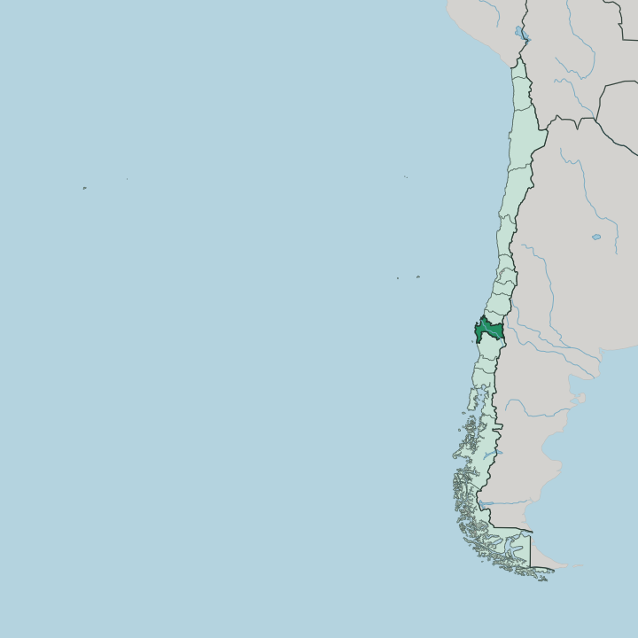
Towns & cities in Región del Biobío
Pick a town or city — each links to where to stay.
Concepción is the obvious base, a compact grid of universities, theatres and bars near the mouth of the Bío Bío River. Most trips start here. Los Ángeles sits inland on the road south, the handiest stop for the waterfalls at Salto del Laja and the Andean foothills beyond.
On the coast, the old coal town of Lota keeps its miners' pavilions and the Parque de Lota above the sea. Pick Concepción for city nights and transport; pick the inland or coastal towns when you want the river valley and the pits at closer range.
About Región del Biobío
The Bío Bío River gives the region its name and its shape.
What is Región del Biobío known for?
It rises in the Andes and runs north-west to reach the Pacific near Concepción, the port city and regional capital that anchors the second-largest urban area in Chile. Coal built the coast: the pits at Lota once ran out under the sea, and their pavilions and shafts still draw visitors down the coast. Inland, timber plantations, the Laja River, and the waterfalls at Salto del Laja fill the fertile Central Valley.
Concepción hums with students and rock.
Where is Región del Biobío?
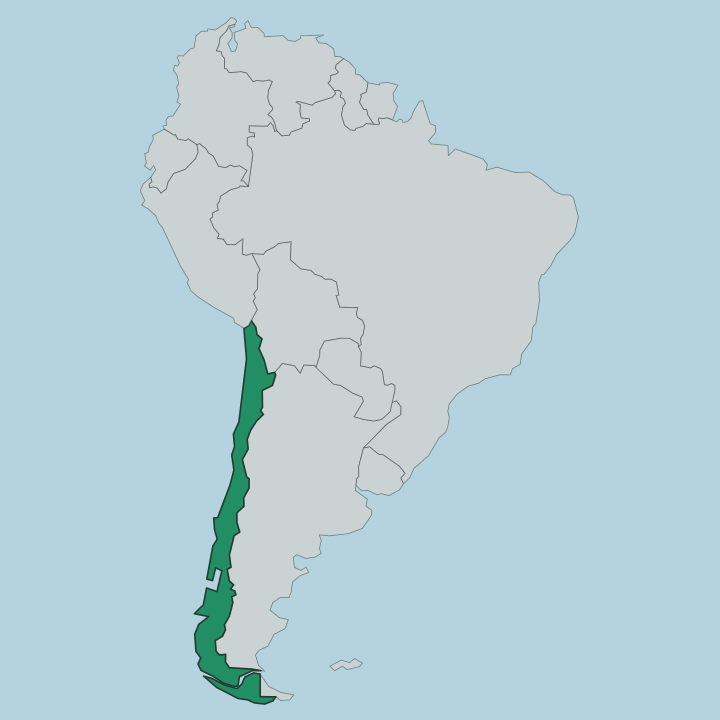
The Región del Biobío lies in south-central Chile, one of a string of regions running down the long, narrow country. Its western edge is the Pacific Ocean. Its eastern edge is the Andes, the high cordillera that carries the border with Argentina.
Between the two, the land falls in three bands that repeat the whole length of Chile: a coastal mountain range, the fertile Central Valley in the middle, and the Andean wall to the east. The Ñuble Region borders it to the north, and the Araucanía Region to the south. Water defines the middle of it.
The Bío Bío River is the second-longest in Chile, rising from the Icalma and Galletué lakes high in the Andes and running north-west for some 380 kilometres to meet the Pacific near Concepción. The Laja River feeds it from the east, dropping over the ledges at Salto del Laja on the way down through the valley. Concepción and its neighbours crowd the river's mouth, where the plain meets the sea.
Everything else spreads out from that line: coal ports south along the shore, farms and timber across the valley floor, and the volcanoes and lakes climbing east into the mountains.
What is Región del Biobío like?
Concepción sets the tone. The city holds the University of Concepción and a cluster of other campuses, and the students give it a loud and musical streak that runs through the whole region. Penquista rock is the local badge of honour: bands out of Concepción shaped the sound of Chilean rock, and bars across the city still put live music on most nights of the week.
Spanish is the everyday language, as across Chile, carried here with the flat vowels and quick slang of the south. South of the Bío Bío River the older story is Mapuche. For two centuries the river marked La Frontera, the line the Spanish crown fixed in 1612 between the colony to the north and the independent Mapuche lands beyond.
That border never fully closed. Trade, raiding and intermarriage crossed it for generations, and the region's towns, place names and food still carry both inheritances. On the coast, the pits at Lota added a third layer: a mining culture of pavilions, brass bands and hard union politics that outlasted the coal itself.
Three worlds share the ground.
What is the history of Región del Biobío?
Pedro de Valdivia founded Concepción in 1550, on the coast north of the Bío Bío River. The river soon became a wall. In 1612 the Spanish crown fixed it as La Frontera, the formal border between the colony to the north and the Mapuche lands that stayed independent to the south.
That line held for two centuries. Concepción served as a royalist stronghold in the wars of independence, and its coast later turned to coal, with the shafts at Lota driving the region's industry into the modern age.
What is the climate of Región del Biobío?
The Región del Biobío has a temperate Mediterranean climate, dry in summer and wet in winter. Rain arrives with the cold. Most of the year's water falls between May and August, and the wetter valley around Los Ángeles takes well over a metre of it.
The coast at Lota and Concepción stays mild and damp, moderated by the Pacific, while the Andean foothills in the east turn colder and hold snow through the winter. Green winters, golden summers.
How do you get to Región del Biobío?
Most travellers reach the region through Concepción, which has the region's main airport and frequent flights up to Santiago. The drive is straightforward too. Route 5, the Pan-American Highway, runs the length of Chile and cuts down the Central Valley past Los Ángeles and the falls at Salto del Laja, roughly 500 kilometres south of the capital.
Long-distance buses follow the same road all day. From Concepción, local roads fan out to the coal towns on the coast and up the Bío Bío River into the Andean foothills.
Good for
Updated July 2026