Colombia
Departamento del Meta, Colombia — Towns & Travel Guide


Departamento del Meta opens onto Colombia's eastern Llanos, a plains region of cattle ranches, joropo music, and the coloured river Caño Cristales.
About Departamento del Meta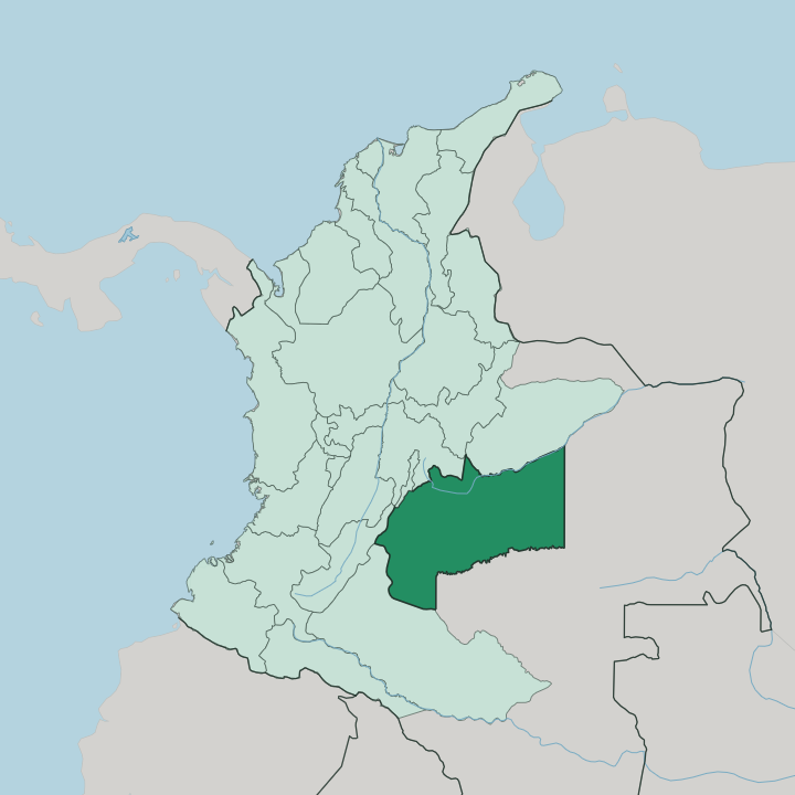
Towns & cities in Departamento del Meta
Pick a town or city — each links to where to stay.
Most trips start in Villavicencio. The capital sits where the road down from Bogotá spills onto the plain by the Guatiquía River, and it holds the department's hotels, its airport, and its onward transport. From there the region splits by purpose.
If you have come for Caño Cristales, you fly on to the town of La Macarena in the far south, the only sensible base for the coloured river and the Serranía. Stay in Villavicencio to reach a working cattle hato or the geographic-centre obelisk at Puerto López; fly to La Macarena when the plains river is the whole point of the trip.
About Departamento del Meta
Meta is Llanero country.
What is Departamento del Meta known for?
Its flat grasslands, the Llanos, roll east from the Andes toward the Orinoco, grazed by cattle and set to the harp-and-maraca beat of joropo. The single draw that pulls travellers across the plains is Caño Cristales, the river in the Serranía de la Macarena whose bed flushes red, green, and yellow when the Macarenia clavigera plant blooms. Villavicencio, the capital, is the trading hub that links Bogotá to the plain.
Where is Departamento del Meta?
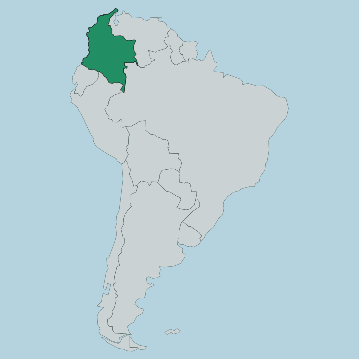
Meta lies near the centre of Colombia, on the eastern side of the Andes. Its western edge climbs into the Cordillera Oriental, the ridge that walls the plains off from Bogotá just beyond. Everything east of that ridge is Llanos.
These are the grass plains of the Orinoquía, Colombia's share of the vast lowland it divides with Venezuela, and they cover most of the department's land. The plain is not flat everywhere. In the far south-west a single range breaks the horizon, the Serranía de la Macarena, an old block of rock older than the Andes where the Andean, Amazon, and Orinoco ecosystems meet.
Water orders the land here. The Meta River runs along the north-eastern border and carries the department's name toward the Orinoco. The Guatiquía comes down off the mountains past Villavicencio, and the Ariari drains the southern plains toward the Guaviare.
Rivers are the roads across much of this country. The Caño Cristales itself is only a small stream in the Macarena hills, but it is the one every visitor crosses the plains to find.
What is Departamento del Meta like?
Meta belongs to the Llaneros, the plainsmen of the eastern grasslands. Their world grew out of the cattle hato, the open ranch, and the daily work of horse and herd shaped almost everything about how the region sees itself. The music is joropo, driven by the arpa llanera, the four-string cuatro, and maracas, with fast footwork and improvised sung coplas about horses, rivers, and the open plain.
Villavicencio hosts a joropo tournament that draws harpists, dancers, and coplero singers from across the Colombian and Venezuelan Llanos each year. It is the plain set to music. Older roots run under the cattle culture.
Indigenous peoples including the Sikuani and the Guayupe lived on these plains long before the ranches, and their communities endure across the department. Jesuit missionaries brought the first great herds in the colonial centuries, and the hato has anchored Llanero life ever since. Beef and the plain still set the table.
Regional cooking turns on mamona, whole beef splayed on wooden stakes and roasted slowly over open coals in the ranching tradition.
What is the history of Departamento del Meta?
Meta was carved out as a full department of Colombia in 1960, but its story on the plains runs much further back. Indigenous Llanero peoples held the grasslands first. Spanish colonists and Jesuit missionaries pushed east from the Andes in the colonial period, founding the first cattle hatos that would define the region.
Villavicencio itself dates to 1840 and grew into the trading gate between Bogotá and the plains. Much of Meta lay under armed control during Colombia's long internal conflict, and only after the 2016 peace settlement did the far south open to travellers heading for Caño Cristales.
What is the climate of Departamento del Meta?
Meta runs hot and humid on the plains all year, with the calendar split between a wet season and a dry one rather than by temperature. The rains fall roughly from April into November, and the dry months follow. That cycle governs travel.
Caño Cristales only shows its colours in the wetter half of the year, when the Macarenia clavigera plant blooms red under the current, so the river closes to visitors in the driest stretch. Up in the Serranía de la Macarena and along the Cordillera Oriental the air cools with the height.
How do you get to Departamento del Meta?
Villavicencio is the front door. The old mountain highway drops down from Bogotá to the capital in a few hours, cut through the Cordillera Oriental past the Guatiquía, and it carries most of the traffic onto the plain. The city's airport links Meta to the rest of Colombia.
Reaching Caño Cristales is a separate leg. Because no through road runs safely to the deep south, travellers fly from Villavicencio or Bogotá to a small airstrip at La Macarena, then continue to the river by boat and on foot.
Good for
Updated July 2026