Algeria
Wilaya de Bordj Bou Arréridj, Algeria — Towns & Travel Guide


Wilaya de Bordj Bou Arréridj spans Algeria's eastern high plateaus, between the Bibans and the Hodna, and turns out much of the country's electronics.
About Wilaya de Bordj Bou Arréridj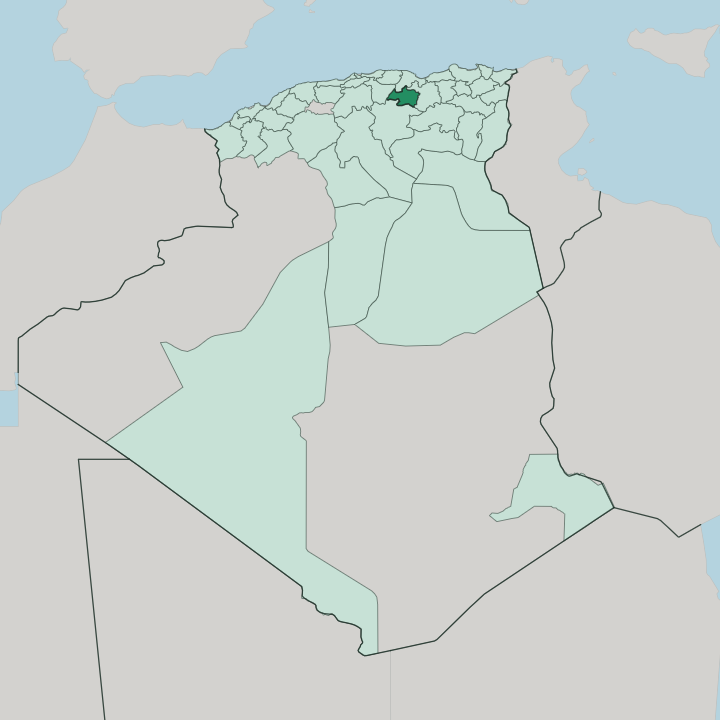


Towns & cities in Wilaya de Bordj Bou Arréridj
Pick a town or city — each links to where to stay.
Beds gather in one place here. The capital, Bordj Bou Arréridj, holds nearly every hotel in the wilaya, strung along the Medjana plain where an Ottoman fort on Bou Arréridj tribal land first gave the town its name. Elsewhere the province is farm and mountain country, thin on rooms: Medjana keeps the memory of the Mokrani lords, the Bibans carry olive terraces and stone oil mills, and Ras El Oued marks the eastern road toward Sétif.
Choose the capital if you want a room at all; take the countryside only for a day's drive. Most stays start in town.
About Wilaya de Bordj Bou Arréridj
What is Wilaya de Bordj Bou Arréridj known for?
Electronics built the province's name. Factories around the capital, Bordj Bou Arréridj, assemble televisions, phones and appliances, and the group Condor Electronics grew big enough that the wilaya is nicknamed the Capital of Electronics. Away from the plants, the land does older work: wheat and barley ripen across the Hautes Plaines, while olive and fig groves climb the Bibans to the north.
The province straddles the main road and rail line halfway between Algiers and Constantine, which is partly why the industry landed here.
Where is Wilaya de Bordj Bou Arréridj?
Wilaya de Bordj Bou Arréridj sits inland, on the eastern high plateaus of northern Algeria, roughly halfway along the old road between Algiers and Constantine. Bordj Bou Arréridj touches no sea. Four provinces ring it: Sétif to the east, Bouira to the west, Béjaïa over the mountains to the north, and M'Sila down in the south.
The land falls into three bands. Across the north the Bibans rise in folded flysch ridges, wooded and prone to slipping after heavy rain, and the passes there earned the whole district its old name, the Portes de Fer. The middle is open high plain, the Hautes Plaines, a rolling floor of wheat and barley that holds most of the towns.
Southward the ground dries into steppe as it nears the Hodna, grazing land more than farmland. Water is scarce and seasonal. The Oued Bousselam drains the eastern edge, where the province drops to its lowest ground, carrying water down from the Sétif country and on toward the Soummam and the coast at Béjaïa.
The capital, Bordj Bou Arréridj, stands on the Medjana plain in the centre, penned between the Bibans to the north and the Hodna to the south. Everything here is high, and winters bite because of it.
What is Wilaya de Bordj Bou Arréridj like?
The province sits on a cultural seam. Kabyle Berber traditions drift down from the mountains to the north, the plains carry the settled Arabic-speaking farming culture of the old Sétif country, and the dry south leans toward the tents and herds of the Hodna. That mix runs deep.
For generations the Mokrani lords governed the Medjana plain as a near-independent Berber lordship inside Ottoman Algeria, and that memory of self-rule still colours how the region carries itself. Life follows the land. Olive oil is pressed in stone mills through the northern autumn, and the spring festival each March fills the tables with honey, butter, semolina, and dates.
Weaving, metalwork and pressed oil still change hands at the weekly markets of towns like Ras El Oued and Medjana. Arabic is the everyday tongue across the towns, with Berber still heard in the hill villages that climb toward Kabylia. It stays a working province, not a resort one, and it wears that plainly.
People come for the roots, the food and the mountain passes of the Bibans, not for beaches the province does not have.
What is the history of Wilaya de Bordj Bou Arréridj?
The town began as a fort. Ottoman troops from the Constantine beylik raised a stronghold, the bordj, to hold the Medjana plain, and it took the name of the Bou Arréridj tribe whose ground it stood on. The Mokrani lords later held sway here, until Mohamed El Mokrani led the Mokrani Revolt against French rule in 1871.
Crushed and burned, the town rose again a decade later. Bordj Bou Arréridj gained its own wilaya, split from Sétif, in 1984.
What is the climate of Wilaya de Bordj Bou Arréridj?
Height sets the weather here. This is a semi-arid continental climate, and the altitude of the Hautes Plaines makes the winters hard: frost is normal, and snow falls heavily enough across the Bibans to shut the mountain roads for days at a time. Summers swing the other way, hot and dry over the open plain.
Rain is thin and comes mostly in the cooler months, heavier on the northern ridges than on the steppe running south toward the Hodna. Spring and autumn are the kind seasons.
How do you get to Wilaya de Bordj Bou Arréridj?
There is no airport of its own. Most travellers come overland, since the province lies square on the East-West Highway and the railway that ties Algiers to Constantine, with trains stopping at the capital. The nearest airports are eastward at Sétif and, much further west, at Algiers.
From either, it is a run along the high-plain corridor to reach the town. Buses and shared taxis work the same road. Coming from the north means crossing the Bibans by the old passes.
Good for
Updated July 2026