Algeria
Wilaya de Mila, Algeria — Towns & Travel Guide


Mila province spreads across the hills and cereal plains west of Constantine, holding Algeria's largest dam and the Roman town of Milev.
Find your area →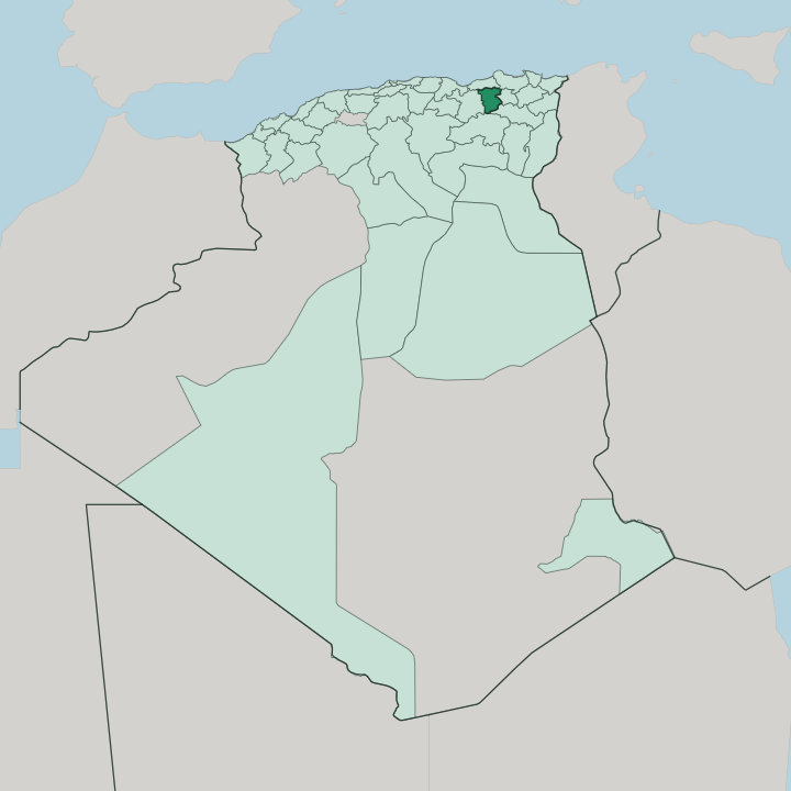


Towns & cities in Wilaya de Mila
Pick a town or city — each links to where to stay.
Base in Constantine. Rooms inside the province stay few, so most travellers sleep in that city just to the east and drive out on day trips, since it keeps the region's only international airport and the hotels Mila town cannot match. Mila itself suits anyone who wants to wake beside the old Byzantine walls.
Chelghoum Laïd, on the high plains, is the handy stop for drivers crossing between Constantine and Sétif. For the dam, base at Grarem Gouga.
About Wilaya de Mila
Two things put Mila on the map.
What is Wilaya de Mila known for?
The Beni Haroun dam holds back the largest reservoir in Algeria, and its water reaches taps as far off as Batna and Khenchela. The other draw is age: the provincial capital, Mila, grew from Roman Milev, and the Sidi Ghanem mosque inside its old walls dates to the seventh century. Between the two sit olive terraces on the northern slopes and wide cereal plains around Chelghoum Laïd, fed by the Rhummel, the main river of the Constantinois.
Where is Wilaya de Mila?
Mila province sits in the Constantinois, the highland country inland from the Mediterranean, a few hours east of Algiers. Constantine, the regional metropolis, lies just over its eastern edge; the capital city of Mila stands roughly forty kilometres west of it. Jijel and the Mediterranean shore are to the north, screened off by mountains. The wilaya shares its other borders with Skikda, Oum El Bouaghi, Batna and Sétif, so it is landlocked on every side.
Mila has no shoreline of its own. The land climbs in three steps. Wooded ranges of the Tell Atlas fill the north, rising well past a thousand metres above the valleys and catching the rain that rolls in off the sea.
Through the middle runs the Rhummel, the largest river of the Constantinois, which gathers the Oued Endja and pools behind the Beni Haroun dam before escaping north as the Oued El Kébir toward the coast. South of the river the ground opens into the high cereal plains around Chelghoum Laïd and Teleghma, drier and flatter, where wheat replaces the northern oak and olive. Water ties the whole province together.
What is Wilaya de Mila like?
Life here is Arabic-speaking and rural. The everyday tongue is the Constantinois dialect of the wider east, laid over an older Amazigh substrate that still surfaces in village and place names up in the hills. Islam orders the calendar, and the seventh-century Sidi Ghanem mosque at Mila, raised on the columns of Roman Milev, counts among the oldest in the Maghreb.
Away from the towns, the year turns on the land: olives pressed on the northern slopes, wheat and barley cut on the southern plains, orchards of fig and pomegranate in between. Weekly souks pull the villages together. Few Algerian towns wear their age as openly as Mila.
The old quarter still sits inside its Byzantine ramparts, the walls the emperor Justinian threw up in the sixth century, and Roman stone is built straight into the houses and the mosque. In antiquity the town was Milev, one of the Four Colonies of Numidia alongside Cirta, now Constantine. That long Roman and Byzantine past sets the tone.
The kitchen leans on the Constantinois table, with slow tajines and the almond sweets that mark weddings and feast days across the region.
What is the history of Wilaya de Mila?
Mila is old. The town began as Numidian and Punic Milev, became a Roman colony in the confederation of the Four Colonies, and was walled anew by Byzantine Justinian before Arab armies took it in the seventh century and raised the Sidi Ghanem mosque. Centuries of Islamic rule followed.
The province itself is a modern line on the map, carved in 1984 out of pieces of Constantine, Jijel, Oum El Bouaghi and Sétif. A harsher chapter came in 2020, when an earthquake and its landslides tore through the El Kherba quarter of Mila town.
What is the climate of Wilaya de Mila?
Mila runs on a Mediterranean rhythm bent by altitude. Summers are hot and dry, winters cold and wet, with most rain falling between autumn and early spring. The northern mountains wring the moisture out of the sea air, so their slopes stay green and can hold snow on the higher crests, while the southern high plains around Chelghoum Laïd turn drier and more continental, baking in summer and frosting hard in winter.
Spring is the short green window. The great sheet of the Beni Haroun reservoir even softens the air in the valleys around it.
How do you get to Wilaya de Mila?
Most journeys begin at Constantine. Mohamed Boudiaf airport, the region's only international field, sits just east of the province and puts Mila within a short drive; from there a hire car or shared taxi covers the rest. The province has no airport of its own.
Rail helps too, since the Algiers-Constantine main line crosses the southern plains and stops at Chelghoum Laïd. Once inside, roads climb north from the plains through Mila town toward the Beni Haroun dam and the mountains beyond.
Common questions
What is the best area to stay in Wilaya de Mila?
Constantine: hotels and the airport nearest Mila.
Good for
Updated July 2026