Iran
Lorestan Province, Iran — Towns & Travel Guide


Lorestan is a Zagros mountain province in western Iran, the heartland of the Lurs, centred on Khorramabad below its Falak-ol-Aflak castle.
About Lorestan Province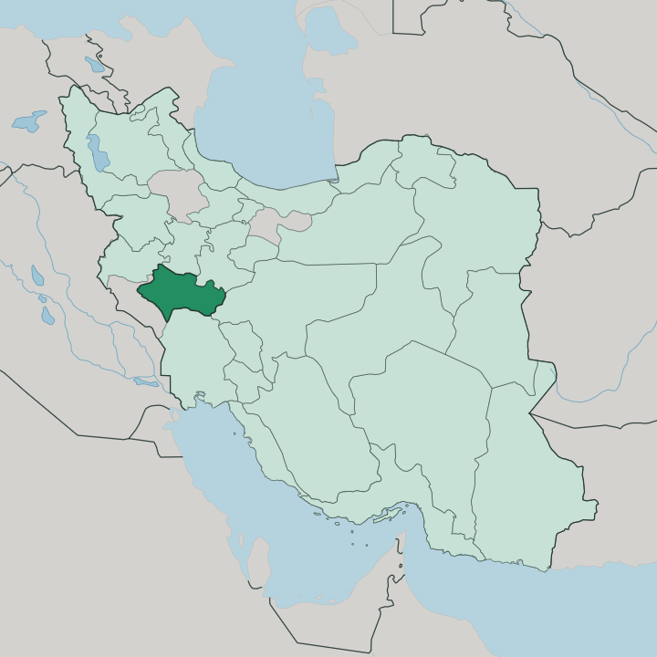
Towns & cities in Lorestan Province
Pick a town or city — each links to where to stay.
Khorramabad is the natural first base, the capital and the only city in Lorestan with an airport and a broad range of hotels. The rest divides by terrain. Dorud, up in the eastern mountains, sits on the Trans-Iranian Railway and serves as the trailhead for Gahar Lake and the Oshtorankuh peaks.
Borujerd anchors the northern Silakhor plain, with its old Jameh Mosque and bazaar. Pol-e Dokhtar lies south, warmer and lower, at the point the Kashkan runs into the Karkheh. Choose Khorramabad for a first visit, and move on to Dorud or Pol-e Dokhtar when the high mountains or the warm southern rivers are the real reason you came.
About Lorestan Province
What is Lorestan Province known for?
Lorestan is the land of the Lurs, and its name means exactly that. The Zagros Mountains define almost everything here. Khorramabad, the capital, sits in a valley below Falak-ol-Aflak, a Sassanid-era fortress that crowns a rock at the town's centre and gives the province its best-known silhouette.
The province also lent its name to the Luristan bronzes, small cast weapons and horse-fittings lifted from Iron Age graves across these valleys and carried off to museums far beyond Iran. Water is the other signature. Rivers such as the Dez and the Kashkan rise in these ranges, and Lorestan holds a large share of Iran's fresh water.
Where is Lorestan Province?
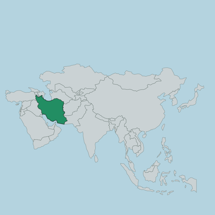
Lorestan sits in western Iran, deep in the folds of the Zagros Mountains. It is a province of parallel ridges and long valleys, tilted between the high interior and the lowlands of Khuzestan to the south-west. Kermanshah lies to the north-west, Hamadan and Markazi to the north and east, and the Iraqi frontier is only about a hundred kilometres beyond the western ridges. The land climbs hard.
Oshtorankuh, the province's highest wall of rock, rises above four thousand metres in the east and carries snow long into the warm months. Water is what makes Lorestan unusual in a dry country. The province gathers a large slice of Iran's fresh water off these slopes.
The Dez drains the eastern mountains southward toward Khuzestan, while the Kashkan, the longest river held entirely within Lorestan, cuts west through Pol-e Dokhtar to join the Karkheh. Between the ridges lie sudden pockets of green. Gahar Lake sits in a bowl below the Oshtorankuh peaks, dammed behind rockfall from an old earthquake, and the Bisheh waterfall drops through oak forest beside the railway.
Oak covers much of the middle slopes, giving way to walnut and almond in the sheltered pockets.
What is Lorestan Province like?
This is the country of the Lurs, and the province takes its name from them. Most people here speak Northern Luri, with Laki common in the western districts around Kuhdasht and Nurabad. Lur society was built on herding, and until living memory whole clans moved twice a year between winter camps in the warm river valleys and summer pastures high on the Zagros.
Black goat-hair tents still appear on the upland meadows in the warm season. The old tribal confederations of the Lurs shaped the map long before the modern province did. Music carries a lot of that heritage.
Luri weddings and mourning rites turn on the dohol drum and the sorna, a piercing double-reed horn, and the bowed kamancheh threads through the slower songs. Women weave dense goat-hair rugs and saddlebags in geometric patterns tied to particular clans. The table leans on lamb, thick yoghurt and flatbread, built on the herds and the wild herbs of the mountains rather than on rice.
Much of it is displayed inside Falak-ol-Aflak, where the province keeps its ethnographic collection. Hospitality is close to a law here.
What is the history of Lorestan Province?
These mountains were old long before Persia. The Kassites, who once ruled Babylon, came out of these valleys, and the whole region lay within the orbit of Elam before the Iranian peoples arrived. From the Iron Age graves came the Luristan bronzes, cast between roughly 1000 and 650 BC.
The Sassanids raised the fortress of Falak-ol-Aflak on its hill above Khorramabad, and in medieval times the Khorshidi atabegs ruled Lesser Lorestan from that same town for four centuries. Empires came and went below. The Lurs held the high ground throughout.
What is the climate of Lorestan Province?
Altitude decides the weather in Lorestan. High in the east, around Dorud and Aligudarz, winters are long and snowbound, and the peaks of Oshtorankuh hold snow into early summer. Khorramabad, lower in its valley, keeps a semi-humid Mediterranean rhythm: wet, green springs and warm, dry summers.
Lower valleys run warmer. Drop south toward Pol-e Dokhtar and Khuzestan and the summers turn genuinely hot. Rain and snowmelt feed the Dez and the Kashkan, which run hardest as the winter snow lets go.
From snowbound peaks to hot southern valleys, the seasons in Lorestan run to extremes.
How do you get to Lorestan Province?
Most visitors come overland from Tehran. Khorramabad Airport, the only airport in Lorestan, links the capital to Tehran and Mashhad by a short hop. The more memorable arrival is by train: the Trans-Iranian Railway, a UNESCO World Heritage line, threads the Zagros through Lorestan on its way down to the Khuzestan plain, curling through spiral tunnels and over high bridges past the stations at Dorud and Bisheh.
Main roads run in from Arak and Borujerd in the north and down toward Andimeshk in the south. From there the mountains take over.
Good for
Updated July 2026