Japan
Wakayama, Japan — Towns & Travel Guide


Wakayama covers the forested southern tip of Japan's Kii Peninsula, from the temples of Mount Kōya to the Kumano trails and the Pacific coast.
About Wakayama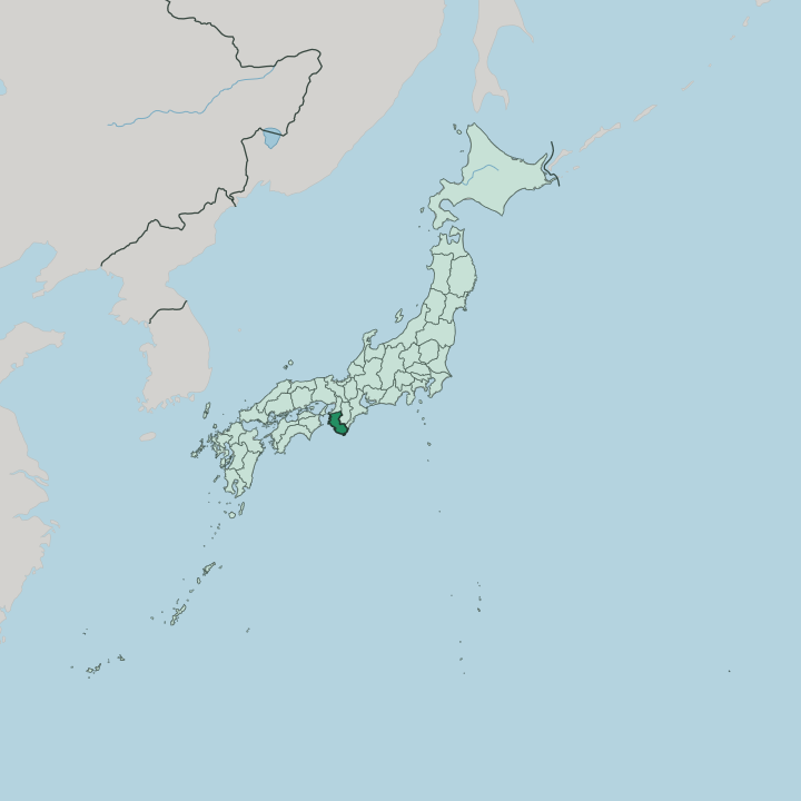


Towns & cities in Wakayama
Pick a town or city — each links to where to stay.
Four bases divide the prefecture. Wakayama, the capital, sits at the mouth of the Kinokawa on the Kii Channel, Wakayama Castle on the hill above and its trains reaching Osaka in little more than an hour, so it suits a first night before you head south. Mount Kōya trades hotels for temple lodging, a night on tatami among the Shingon monasteries.
Shirahama answers with beaches and open-air onsen. Down on the Kumano coast, the onsen inns around Katsuura sit closest to Nachi Falls and the shrines at the pilgrimage's end.
About Wakayama
Faith put Wakayama on the map.
What is Wakayama known for?
Mount Kōya, the mountaintop monastic complex where the monk Kūkai established Shingon Buddhism in 816, remains one of Japan's most sacred sites and shares a UNESCO listing with the Kumano shrines. Those shrines, the Kumano Sanzan, sit at the end of the Kumano Kodō pilgrimage trails. Nearby, Nachi Falls plunges beside the Kumano Nachi Taisha as the tallest single-drop waterfall in the country.
The coast adds hot springs at Shirahama and a tuna harbour at Katsuura, while the inland orchards grow the Kishū mikan oranges and ume plums the region sends to kitchens across Japan.
Where is Wakayama?
Wakayama occupies the southern and western flanks of the Kii Peninsula, the broad headland that juts from Honshū into the Pacific. It belongs to the Kansai region. Osaka lies over the northern border, with Nara and Mie to the northeast, and everything else is water.
The Kii Channel washes the western shore, dividing the peninsula from Shikoku, while the open Pacific Ocean runs along the south. Mountains fill almost everything. The forested ranges of the Kii Mountains rise steeply from the coast and cover the bulk of the interior, leaving only a narrow rim of flat land at the edges.
The one real plain lies in the northwest, where the Kinokawa reaches the sea and the capital sits at its mouth. South of there the coastline frays into coves and headlands. At Kushimoto the land runs out at Cape Shiono-misaki, the southernmost point of Honshū.
Rivers cut down through the ranges to both coasts. The Kinokawa drains the north toward the Kii Channel, while the Kumano River marks the eastern boundary with Mie before emptying into the Pacific near the great shrines. Little of the prefecture sits far from either the mountains or the sea.
What is Wakayama like?
Faith shapes daily life here. For more than a thousand years, pilgrims have walked the Kumano Kodō through the cedar forests to the three grand shrines, and monks have kept the halls of Mount Kōya lit above the valleys. The whole peninsula reads as a sacred landscape, its forests and waterfalls treated as gods long before the temples came.
Visitors still sleep in the temples as shukubo guests, sharing the monks' vegetarian meals and morning prayers. That devotion is old and unbroken. Away from the shrines, the culture turns to hot water and food.
Shirahama's springs count among the oldest in Japan, named in the eighth-century chronicles as one of the country's first hot springs. The kitchens lean on what the land and sea give. Kishū mikan oranges and Minabe's ume plums come off the hillsides, the fishing boats at Katsuura land some of the country's finest tuna, and Wakayama's own soy-and-pork ramen fills the bowls in the capital.
Beyond the pilgrim towns the pace is rural and slow, a countryside of orchard terraces, fishing ports, and quiet valleys. The common tongue is Japanese. Craft runs deep too, in the red Negoro lacquerware first made at the mountain temple of Negoro-ji.
What is the history of Wakayama?
The land is old Kii Province. Kūkai founded the monastery on Mount Kōya in 816, and by the Heian period retired emperors were making the long pilgrimage to the Kumano shrines through the same mountains. Power came later.
In 1619 the shogun's son Tokugawa Yorinobu took the province and rebuilt Wakayama Castle as the seat of the Kishū Domain, one of the three senior branches of the ruling Tokugawa house. When the domains were dissolved, Kishū became the modern prefecture.
What is the climate of Wakayama?
Wakayama sits in the warm, wet south. Its climate is humid subtropical, with hot, sticky summers and mild winters that rarely see snow along the coast. Rain defines the year.
The Kii Mountains wring heavy rainfall from the Pacific weather, and the late-summer typhoons that sweep the peninsula make September the wettest stretch, feeding the waterfalls that pour off the ranges. Up on Mount Kōya the air stays cooler year round, and winter can bring snow to the temple roofs.
How do you get to Wakayama?
Most travellers come through Osaka. Kansai International Airport sits just to the north, and from Shin-Osaka the JR limited express Kuroshio runs down the coast to Wakayama, Shirahama, and Kii-Katsuura. The Nankai railway offers the other way in.
Its Main Line reaches Wakayama from Namba, while the Kōya Line climbs the mountains to Gokurakubashi, where a cable car finishes the ascent to Mount Kōya. Beyond the trains, roads thread the coast and a small airport at Shirahama links the far south to Tokyo.
Good for
Updated July 2026