Japan
Nara-ken, Japan — Towns & Travel Guide


Nara Prefecture is Japan's ancient heartland: a landlocked stretch of Honshu holding the earliest capitals, the Great Buddha, and Mount Yoshino.
About Nara-ken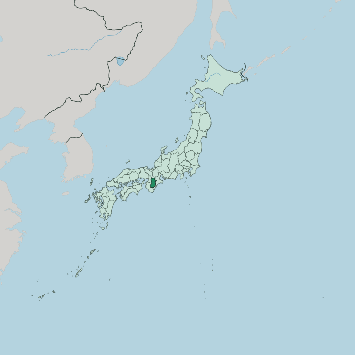


Towns & cities in Nara-ken
Pick a town or city — each links to where to stay.
Most visitors base themselves in Nara itself. The lanes around Kintetsu Nara Station lead straight into Nara Park, so the Great Buddha, Kōfuku-ji, and the deer are a walk from breakfast, and this is the easy choice for a first stay. Naramachi, the old merchant quarter just south, swaps the crowds for latticed townhouses turned into guesthouses.
Further south, Kashihara makes a practical base for the Asuka plain and the central basin. Yoshino is different again: ridge inns and pilgrim lodgings scattered through the cherry slopes, though beds there thin outside blossom season.
About Nara-ken
Temples and deer define it.
What is Nara-ken known for?
Tōdai-ji shelters the Great Buddha, a bronze colossus dedicated in the year 752 inside one of the largest wooden halls ever built, and the tame deer of Nara Park wander the lawns and paths around it. Kōfuku-ji raises its five-storey pagoda nearby, while Kasuga-taisha lines its wooded approach with stone and bronze lanterns. South of the city stands Hōryū-ji, whose timber halls rank among the oldest surviving wooden buildings anywhere in the world.
Come spring, the cherry trees of Mount Yoshino draw crowds of their own.
Where is Nara-ken?
Nara Prefecture sits inland in the Kansai region of Honshu, one of just two Kansai prefectures with no coast at all. Kyoto Prefecture lies to the north, Osaka Prefecture to the northwest across the Ikoma range, Wakayama Prefecture to the southwest, and Mie Prefecture to the east. Most of the life of the place gathers in the north. There the flat Nara Basin spreads out, a lowland ringed by hills where the cities of Nara, Kashihara, and Tenri stand and where the Yamato River gathers the basin's streams and carries them west toward Osaka Bay.
The rest is mountains. Those mountains fill the southern two-thirds of the prefecture. The Kii Mountains cover the greater part of its land, rising through cedar forest to Mount Hakkyō, the highest peak in the Kansai region.
The Yoshino River cuts the range from east to west along a great fault, the Median Tectonic Line, splitting the gentle basin country from the steep interior. Rain falls hard here. On the Mie border, Mount Ōdaigahara catches some of the heaviest rain anywhere in Japan, and forest covers the slopes almost without a break to the borders of Wakayama and Mie.
What is Nara-ken like?
Nara Prefecture holds the ground where the Japanese state took shape. The old Yamato court ruled from these plains, and the poems of the Man'yōshū, the oldest collection of Japanese verse, name its hills and rivers again and again. Faith is woven through the land.
Mount Miwa, wooded and unclimbed except by pilgrims, is itself the object of worship at Ōmiwa Shrine, one of the oldest shrines in the country. In the southern mountains the ascetics of Shugendō still walk the Ōmine ridges, and the city of Tenri grew up around the headquarters of the Tenrikyo religion. The craftsmanship of Nara reaches back every bit as far.
Nara workshops press most of Japan's sumi ink, kneading lampblack and glue into inksticks for calligraphers, and cut writing brushes and disposable chopsticks from the prized cedar of Yoshino. The prefecture calls itself a birthplace of refined sake; monks at Shōryaku-ji brewed clear rice wine here centuries ago, and the brewers around Ōmiwa Shrine still hang cedar globes above their doors. Food keeps the same long memory.
The thin somen noodles of Miwa, hand-stretched and dried in winter wind, trace their line back through the temples of Sakurai.
What is the history of Nara-ken?
This was the cradle of Japan's state. Through the Asuka and Kofun periods the court moved from palace to palace across the southern basin, at Asuka and Kashihara, raising great burial mounds for its rulers. In the year 694 the first Chinese-style capital rose at Fujiwara-kyō, and in 710 the court moved north to Heijō-kyō, on the site of the city of Nara.
For most of the century that followed, until the court left in 784 and settled at last in Kyoto, this was the centre of the realm, and the province of Yamato kept that memory long after the emperors had gone.
What is the climate of Nara-ken?
The Nara Basin has a warm inland climate, sheltered by hills on every side. Summers turn hot and sticky, thunderheads building over the plain through July and August, and winters run cold for so southern a place, with frost on the paddies and the odd fall of snow. The mountains keep their own weather.
Up on the Mie border, Mount Ōdaigahara draws some of the heaviest rain in Japan, and the Yoshino peaks stay wetter and cooler than the towns below all year.
How do you get to Nara-ken?
Most travellers reach Nara from Osaka or Kyoto, both barely half an hour out by train. Two railways run in: the private Kintetsu line from Osaka Namba and Kyoto to Kintetsu Nara Station, and the JR line into JR Nara Station beside it. No bullet train stops in the prefecture.
Kansai International Airport, out on Osaka Bay, is the usual way in from abroad, with a bus or a change of trains onward to Nara. Once here, the Kintetsu network threads on south toward Kashihara and Yoshino.
Good for
Updated July 2026