Japan
Ibaraki, Japan — Towns & Travel Guide


Ibaraki fills the north-eastern Kantō region, a Pacific-facing prefecture of plains, the twin peaks of Mount Tsukuba, and Mito's plum gardens.
About Ibaraki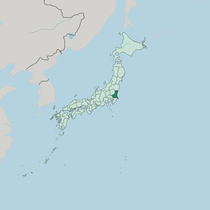


Towns & cities in Ibaraki
Pick a town or city — each links to where to stay.
Mito makes the natural first base, capital and largest city, a short walk from Kairaku-en and stocked with the widest choice of rooms. Tsukuba suits a different trip. The planned science city sits at the end of the Tsukuba Express, under the twin peaks, close to the university and the ropeway.
For the coast, stay near Hitachi Seaside Park on the Hitachinaka shore, or south at Ōarai, where the shrine gate stands out in the surf. Choose Mito for gardens and trains, the shore for flowers and sea air.
About Ibaraki
Its reputation grows from flowers, water, and old faith.
What is Ibaraki known for?
Mito, the prefectural capital, holds Kairaku-en, one of the Three Great Gardens of Japan, where some three thousand plum trees open in late winter. Mount Tsukuba lifts its twin peaks over the plain to the west, a shape climbers have followed for centuries. On the Pacific shore, Hitachi Seaside Park turns whole hills blue with nemophila in spring.
Kashima Shrine, one of the oldest in the Kantō region, guards the coast to the south. Mito's nattō is famous nationwide.
Where is Ibaraki?
Ibaraki occupies the north-eastern corner of the Kantō region, on the Pacific side of the main island of Honshu, north-east of Tokyo. Its whole eastern edge is coast. The Pacific Ocean runs down that side for roughly 190 kilometres, from the cliffs below the northern hills to the long sandbars near the mouth of the Tone River.
Most of the land behind it is flat, the north-eastern rim of the broad Kantō Plain, ground that has been farmed for centuries. Fukushima Prefecture lies to the north, Tochigi Prefecture to the west, and Chiba Prefecture across the river to the south. The relief gathers in the north-west. There the Yamizo Mountains climb toward the border with Tochigi Prefecture, and the lone mass of Mount Tsukuba rises from the plain, its twin summits visible for miles.
Beyond the northern hills, water takes over Ibaraki: Lake Kasumigaura floods the south and the Tone River traces the whole southern boundary. Lake Kasumigaura, the second-largest lake in Japan, spreads its shallow arms across the south, while the Tone River, among the longest in the country, draws the whole southern boundary with Chiba Prefecture before emptying into the Pacific. Between lake, river, and sea, the southern half of Ibaraki is a low, watery plain.
The coastline never lies far off.
What is Ibaraki like?
Two things carry Ibaraki's name across Japan: plum blossom and nattō. Kairaku-en, laid out in Mito in 1842 by the daimyō Tokugawa Nariaki, was built for townsfolk as much as samurai, and its plum trees still draw crowds when they flower in late winter. The sticky fermented soybeans called nattō are tied to Mito as firmly as the garden is.
Learning runs deep here too. The Mito domain gave rise to Mitogaku, a school of history and political thought, and it was Tokugawa Mitsukuni who set scholars to compile the Dai Nihonshi, a vast history of Japan. Faith and science sit side by side.
Kashima Shrine, sacred to the martial deity Takemikazuchi, has drawn pilgrims and swordsmen for many centuries, while at the coast the great torii of Ōarai Isosaki Shrine stands among the waves. West of it, the bronze figure of the Ushiku Daibutsu towers over the plain, one of the tallest statues anywhere. Modern Ibaraki added a very different landmark.
Tsukuba was laid out as a planned science city, and its university and research institutes, including the space campus at Tsukuba, made the prefecture a centre of Japanese research. The everyday speech, the broad Ibaraki dialect, is Japanese with a country lilt.
What is the history of Ibaraki?
For most of its recorded past this was Hitachi Province, one of the provinces set up under the ancient state in the 7th century, with its seat of government near modern Ishioka. Under the Tokugawa shōguns the Mito Domain governed the land, held by a branch of the ruling family ranked among the Gosanke. The modern prefecture came later.
The province took the name Ibaraki in 1871, and by 1875 it reached its present shape, gaining districts from the old Shimōsa Province in the south.
What is the climate of Ibaraki?
Ibaraki has a humid, temperate climate, milder along the coast than up in the hills. Summers are warm and sticky, with heavy rain in the wet months and the odd typhoon sweeping in off the Pacific Ocean in late summer. Winters on the Kantō Plain stay dry and often clear, the cold blunted by the sea.
Snow is rare on the flatland. It falls more readily in the Yamizo Mountains of the north, where the ground climbs and the air cools.
How do you get to Ibaraki?
Ibaraki lies just north-east of Tokyo, an easy run by rail. The Tsukuba Express carries passengers from Akihabara to Tsukuba in about 45 minutes, while the JR Jōban Line runs up the coast to Mito and Hitachi. Ibaraki Airport, out at Omitama, handles a handful of flights.
From the port at Ōarai, a long-distance ferry crosses to Hokkaido. No bullet train reaches the prefecture.
Good for
Updated July 2026