Japan
Chiba-ken, Japan — Towns & Travel Guide


Chiba Prefecture wraps the east side of Tokyo Bay on the Bōsō Peninsula, just east of Tokyo, holding Narita Airport and Tokyo Disney Resort.
About Chiba-ken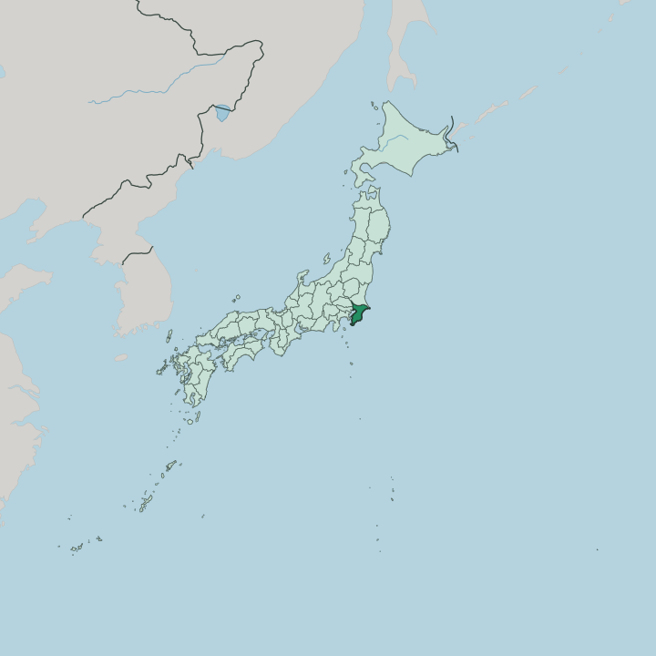


Towns & cities in Chiba-ken
Pick a town or city — each links to where to stay.
It depends what you came for. Chiba city and neighbouring Makuhari suit business travellers, ranged along Tokyo Bay with the convention halls of Makuhari Messe and the reclaimed towers of Kaihinmakuhari at their centre. Narita puts you beside the airport and its great temple.
For the parks, stay in Urayasu. The southern Bōsō towns of Tateyama and Kamogawa trade the city for warm beaches and seafood, while Chōshi guards the Pacific edge.
About Chiba-ken
Two names carry Chiba abroad.
What is Chiba-ken known for?
Narita International Airport sits at its northern edge as the main international airport for the Tokyo area, while Tokyo Disney Resort draws crowds to Urayasu on the shore of Tokyo Bay. Makuhari Messe hosts the region's largest trade fairs and concerts in Chiba city. Beyond them lies the rural Bōsō Peninsula.
Its Pacific-facing Kujūkuri coast is a long ribbon of surf beaches within easy reach of the capital.
Where is Chiba-ken?
Chiba sits directly east of Tokyo. It occupies most of the Bōsō Peninsula, the broad arm of land in the Kantō region of Honshu that encloses the eastern side of Tokyo Bay and holds that sheltered water apart from the open Pacific Ocean. Land borders are few. Ibaraki Prefecture lies to the north, Saitama Prefecture to the northwest, and Tokyo itself to the west.
The peninsula gives the prefecture more coastline than land frontier. Chiba city stands on the bay's northeastern curve, where the built-up Tokyo fringe gives way to farmland and coast. Along much of the northern edge, the Tone River draws the line between Chiba and Ibaraki before it reaches the sea.
The eastern shore runs down the flat Kujūkuri Plain, a long straight beach open to Pacific surf, while the southern tip narrows to the warm bays around Tateyama. Rice paddies and market gardens fill the low interior behind the dunes. Chōshi marks the easternmost point, with Inubōsaki Lighthouse raised above the river mouth.
Nowhere here sits far from water. The Tokyo Bay Aqua-Line tunnels and bridges across the bay to tie the peninsula to Kanagawa on the far shore.
What is Chiba-ken like?
Chiba feeds Tokyo. The flat inland fields grow more peanuts than anywhere else in the country, alongside daikon, spring onions, and the pears that ripen across the northern plain. Its ports pull in the sea's share.
Chōshi lands one of the heaviest catches of any harbour in Japan, and the fishing towns of Katsuura and Tateyama send tuna, sardines, and clams up to the capital's markets. Soy sauce made the prefecture's name. Noda and Chōshi have brewed shōyu beside the rivers for centuries, shipping it downstream to Edo when Tokyo still went by that name.
Faith and craft run alongside the food. Naritasan Shinshō-ji draws millions of pilgrims to Narita for the New Year, ranking among the busiest temples anywhere in the Kantō region. The old canal town of Sawara keeps its Edo-era warehouses along the water in Katori.
Sawara's Inō Tadataka walked the coasts to draw the first accurate map of the country. Surfers own the Pacific side. The long beach at Kujūkuri ranks among the country's main surf coasts, busy with boards whenever the swell rolls in off the ocean.
Japanese is the language, as across the country.
What is the history of Chiba-ken?
Chiba is young as a prefecture, old as a land. It was drawn together in 1873, when the Meiji government merged the short-lived Kisarazu and Inba prefectures into a single unit named for the Chiba clan. The land itself is far older.
Its territory was once the three provinces of Kazusa, Shimōsa, and Awa, ruled from castle towns long before Tokyo grew across the bay. The Chiba clan gave the place its name.
What is the climate of Chiba-ken?
Warm seas set the tone. The Kuroshio Current sweeps warm water up the Pacific side of the Bōsō Peninsula, holding off frost and keeping the southern tip mild enough to grow flowers through the winter. Summers turn hot and sticky.
Rain comes heaviest in the plum-rain weeks of early summer and again when autumn typhoons track up the coast from the Pacific. At Chōshi the wind off the sea keeps the easternmost cape a few degrees cooler than inland.
How do you get to Chiba-ken?
Many visitors land in Chiba first. Narita International Airport, the main long-haul airport for the Tokyo area, stands on the plateau above the town of Narita in the north of the prefecture. Trains do the rest.
Frequent lines run west into Tokyo along the shore of Tokyo Bay and out to the Pacific coast, while the Tokyo Bay Aqua-Line carries road traffic straight across the water to Kanagawa. Chiba city lies under an hour from central Tokyo.
Good for
Updated July 2026