Japan
Hiroshima-ken, Japan — Towns & Travel Guide


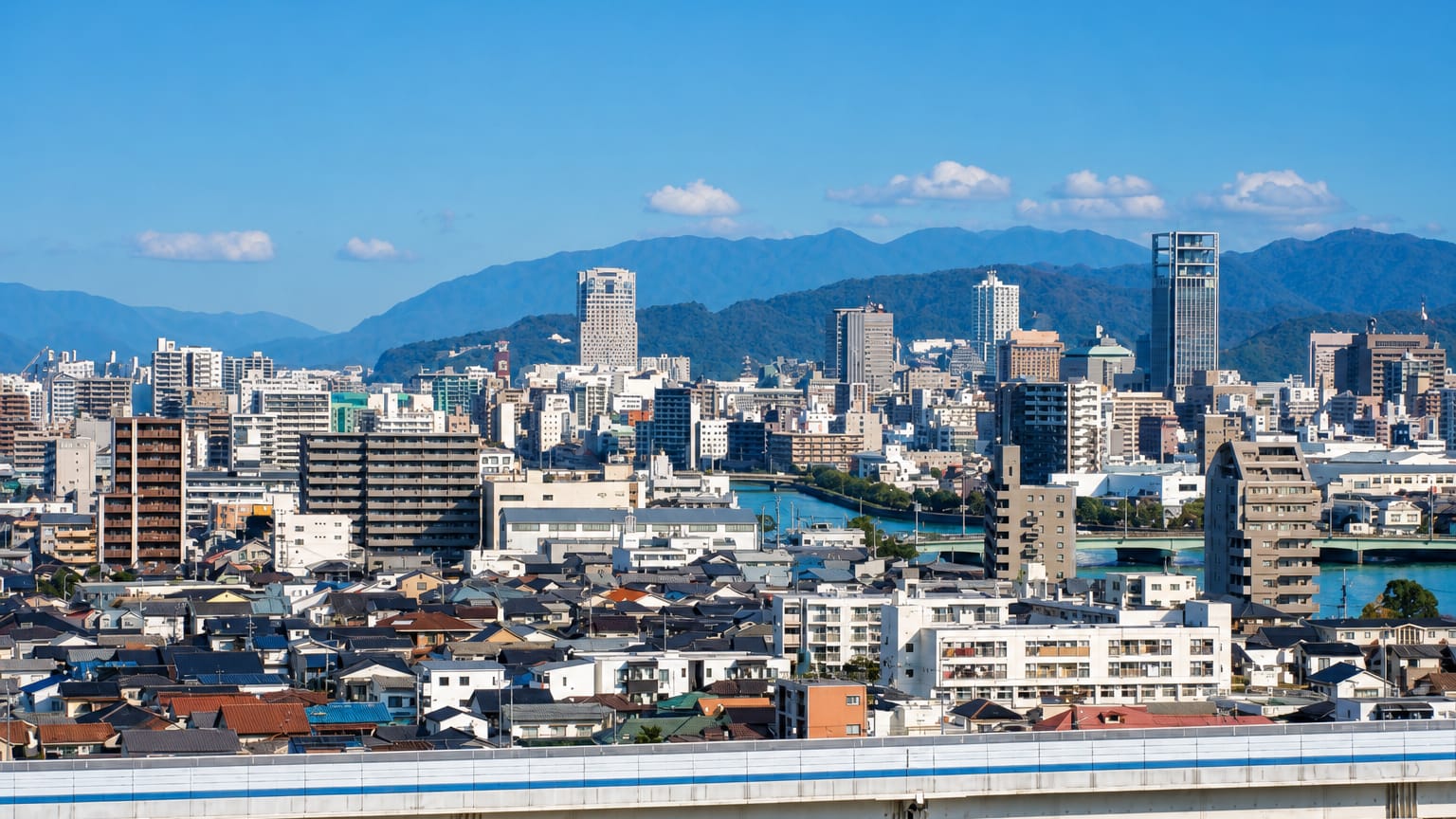
Hiroshima Prefecture faces the island-studded Seto Inland Sea in western Honshu, from the A-Bomb Dome to the floating torii of Miyajima.
Find your area →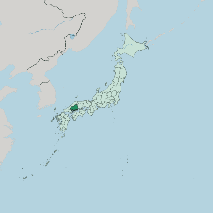


Towns & cities in Hiroshima-ken
Pick a town or city — each links to where to stay.
 Japan
Japan
Hiroshima
Wide boulevards cross the river delta at Hiroshima, a city on the Seto Inland Sea in the Chugoku region of Honshu, known for the Hiroshima Peace Memorial…Where to stay →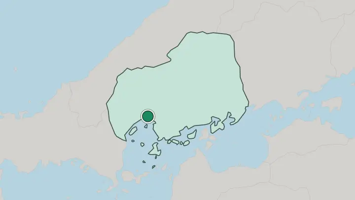
About Hiroshima-ken
Two World Heritage sites define the prefecture.
What is Hiroshima-ken known for?
One is the skeletal A-Bomb Dome in Hiroshima, left standing beneath the point where the atomic bomb detonated in 1945, now the centre of the Peace Memorial Park. The other floats offshore on Miyajima, where the vermilion torii gate of Itsukushima Shrine stands in the tidal shallows of the Seto Inland Sea. Food carries equal weight.
The calm bays farm most of Japan's oysters, and Hiroshima-style okonomiyaki layers cabbage, batter and yakisoba noodles on a hot griddle. Sake flows from the brewery town of Saijō inland.
Where is Hiroshima-ken?
Hiroshima Prefecture occupies the southern flank of the Chūgoku region, on the western stretch of Honshu. Its whole southern edge is coastline. That coast fronts the Seto Inland Sea, the sheltered band of water that separates Honshu from the island of Shikoku, and the sea here breaks into scores of small islands, bays and channels.
Behind the shore the land climbs fast. The Chūgoku Mountains run along the northern interior, and most of the prefecture is upland forest cut by rivers that drain south toward the coast. Those rivers matter.
Where the largest of them, the Ōta River, splits into six channels across a low delta, the city of Hiroshima spreads over the flat ground between the water. Four prefectures ring it on land. Okayama lies to the east, Tottori to the northeast, Shimane along the north, and Yamaguchi to the southwest. There is a fifth border almost too small to draw: a 74-metre boundary with Ehime, on the tiny island of Hyōtanjima out in the Inland Sea.
The pattern holds from end to end. Mountains keep the north, water keeps the south, and the flat, workable land sits in the river plains and around the harbours in between. Nowhere in the prefecture is far from either the ridges or the sea.
What is Hiroshima-ken like?
Culture here is bound up with memory and with the sea. Every August the city of Hiroshima marks the atomic bombing with lantern-floating on the rivers of the delta, and the Peace Memorial ceremony draws the whole country's attention. Faith runs older than that grief.
On Miyajima, worshippers have approached Itsukushima Shrine across the water for centuries, timing the crossing to the tide beneath its standing gate. The table is its own tradition. Cooks build Hiroshima-style okonomiyaki in layers on the griddle, folding in a nest of yakisoba noodles, and the oyster rafts in the Seto Inland Sea supply kitchens across Japan through the cold months.
Drink follows suit. The white-walled breweries of Saijō, in Higashihiroshima, draw on soft local water and rank among the country's foremost sake towns. Craft persists inland too.
The workshops of Kumano turn out the fine calligraphy and cosmetic brushes that Japanese painters and artists have relied on for generations, and in the northern mountain valleys villages still stage kagura, the masked night dances that act out old myths of gods and serpents. Two older identities sit under all of it, the westward lands of Aki and the eastern country of Bingo, each with its own dialect and temper.
What is the history of Hiroshima-ken?
The prefecture was stitched together from two old provinces, Aki in the west and Bingo in the east. Hiroshima itself began as a castle. The warlord Mōri Terumoto raised Hiroshima Castle on the Ōta delta in 1589 and named the new town after it.
Fukuyama grew the same way, a castle seat laid out in the Bingo lands in 1619. The modern boundaries were fixed in 1876. Then came 1945.
The first atomic bomb used in war destroyed the centre of Hiroshima in a moment, and the rebuilt city grew back around the preserved ruin of the A-Bomb Dome.
What is the climate of Hiroshima-ken?
Hiroshima sits in the Setouchi climate zone, and the setting does the work. The Chūgoku Mountains block the northern winds while Shikoku shields the coast from the south, leaving the Seto Inland Sea shore mild, sunny and unusually dry for Japan. Rain is modest and comes mostly with the summer rainy season and the odd typhoon.
Winters on the coast are gentle. Inland the story changes, and the northern uplands near the Shimane border catch real snow through the cold months.
How do you get to Hiroshima-ken?
For most, the way into Hiroshima Prefecture is by rail. The Sanyō Shinkansen runs straight through Hiroshima Station, putting the city within about ninety minutes of Osaka and a few hours of Tokyo. Flights land at Hiroshima Airport, out in the hills near Mihara, with a bus down to the city.
From the waterfront at Miyajimaguchi, short ferries cross to Miyajima and the other islands of the Seto Inland Sea. There is a slower way in. Cyclists ride the Shimanami Kaidō from Onomichi, bridging island to island all the way over to Shikoku.
Common questions
What is the best area to stay in Hiroshima-ken?
Hiroshima: a first visit to the prefecture.
Good for
Updated July 2026