Kenya
Turkana, Kenya — Towns & Travel Guide


Turkana is Kenya's largest county, a hot, arid expanse wrapped around Lake Turkana in the country's far north-west.
About Turkana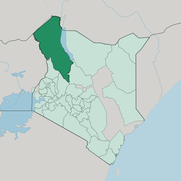


Towns & cities in Turkana
Pick a town or city — each links to where to stay.
Turkana is vast. Lodwar, the county capital on the Turkwel River, holds the airport and nearly every proper hotel, so most trips start there. For the lake itself, Eliye Springs offers palm-shaded rondavels on a sandy western shore an hour's drive away.
Anglers head instead for Ferguson's Gulf, the shallow inlet reached through Kalokol, where boats set out for Central Island and its crater lakes. The far eastern shore, around Sibiloi National Park and the Koobi Fora fossil beds where early hominins came to light, means rough camping and a long haul by four-wheel drive. Pick Lodwar first; go to the water when you want the Jade Sea up close.
About Turkana
What is Turkana known for?
Two things carry Turkana's name to the world: a lake and a fossil record. Lake Turkana, the jade-green soda lake that fills the county's eastern edge, is the largest permanent desert lake on Earth. Its shores are also one of the richest fossil grounds anywhere.
The banks near the Nariokotome gave up the Turkana Boy, a near-complete Homo erectus skeleton, while Koobi Fora on the eastern shore yielded other hominins, and the county is often called a cradle of humankind. Between the two lies the land of the Turkana people, camel and cattle herders of the northern plains. Lodwar ties it all together.
Where is Turkana?
Turkana fills the far north-west corner of Kenya, the largest of the country's counties by land. It sits in the northern reach of the Great Rift Valley, where the East African Rift pulls the land apart into low plains and broken mountain ranges. Three countries press on its borders. Uganda lies to the west, South Sudan across the north-west, and Ethiopia along the north-east.
To the east the ground drops to Lake Turkana, and beyond the water lie the drier counties of Kenya's north. Little of it is gentle. The plains run hot and thorn-scrubbed between ridges that climb toward the Ugandan escarpment.
Lake Turkana is the reason the county has a shape. It is the largest permanent desert lake on the planet, and the largest of the world's alkaline lakes, its water tinted the jade green that gives the Jade Sea its name. Three rivers feed it and none drains it.
The Omo River enters from Ethiopia and supplies most of the inflow; the Turkwel and Kerio rivers reach it from the Kenyan side, running only after rain. Rising from the middle of the lake, Central Island is an active volcano whose craters hold three small lakes and the world's largest gathering of Nile crocodiles. Evaporation alone carries the water away, and that steady loss keeps the lake salty.
What is Turkana like?
The county takes its name from the Turkana, a Nilotic people who have herded these plains for centuries. Livestock is the measure of a household here. Camels, cattle, goats, and donkeys are wealth, food, and bridewealth all at once, and families drive them across the plains after grass and water.
Men belong to age-sets that order authority and ritual through life. Women wear stacked bead collars by the dozen, a mark of age and standing. The language, also called Turkana, belongs to the Eastern Nilotic branch and reaches across the whole county and into the lands beyond its borders.
Turkana has become one of Kenya's most mixed corners, and the reason is Kakuma. The camp on the county's western plains has taken in refugees from South Sudan, Somalia, and the wider region for decades, layering their languages and markets over the older pastoral world. Lodwar shows the same blend on a smaller scale.
Elsewhere the pattern of life still follows the herds and the seasons. Song, storytelling, and dance carry Turkana history, since almost none of it was ever written down. Cattle still speak loudest here.
What is the history of Turkana?
Few places on Earth hold a longer human record. On the western shore at Lomekwi, archaeologists found stone tools cut roughly 3.3 million years ago, older than any others known. Along the same lake, Richard Leakey's team began digging Koobi Fora in 1968, and in 1984 they lifted the Turkana Boy, a near-whole Homo erectus skeleton, from the ground near the Nariokotome.
That work fixed the basin's place in the story of human origins. The modern county is young by comparison. Turkana became one of Kenya's counties in 2013, when the country handed real power to its regions.
What is the climate of Turkana?
Turkana runs hot and dry through the year. It is one of the most arid parts of Kenya, a place of thorn scrub and bare rock where rain is the exception rather than the rule. What little falls comes mostly between April and June, with a lighter spell around November, and much of it drains away in flash floods before it soaks in.
Strong winds sweep off Lake Turkana, kicked up from the south-east across the open water almost daily. Shade is the only relief. Drought is a recurring hardship, and herders read the sky closely for the first grazing rains.
How do you get to Turkana?
Nearly every visitor comes through Lodwar. Lodwar Airport sits on the edge of the county capital, and light aircraft link it with Nairobi and Eldoret in under two hours. The overland route is the other way in: a single tarmac highway climbs north from Kitale through Kapenguria and the oil town of Lokichar before dropping into Lodwar, then running on to Kakuma and the South Sudan border at Lokichogio.
It is a long day's drive from the highlands. From Lodwar, rough tracks and boat trips cover the last stretch to the lake, out to Kalokol and the beach at Eliye Springs. The eastern shore stays hardest of all to reach.
Good for
Updated July 2026