South Korea
Jeju-do, South Korea — Towns & Travel Guide


Jeju-do is South Korea's volcanic island province, a subtropical world built around Hallasan and ringed by the Korea Strait.
About Jeju-do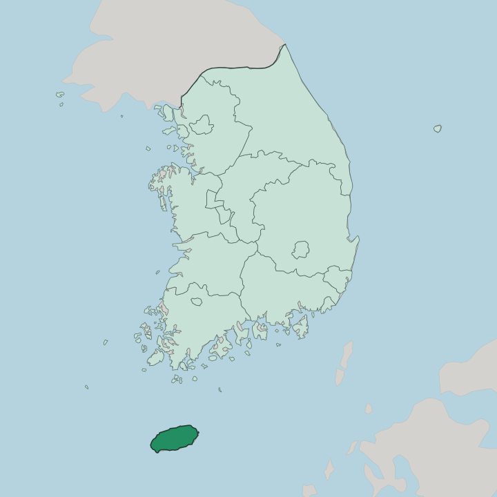
Towns & cities in Jeju-do
Pick a town or city — each links to where to stay.
Two cities, one north, one south. Jeju City holds the airport and the ferry terminal on the northern shore, so most trips begin there, close to the Gwaneumsa trail up Hallasan. Seogwipo faces the Korea Strait on the warmer southern coast, sheltered by the mountain and set beside the Jeongbang and Cheonjiyeon waterfalls.
Choose Jeju City for arriving and for the shortest hop from the plane; choose Seogwipo when you want the mildest winters on the island and the southern falls at your door.
About Jeju-do
One word covers it: volcano.
What is Jeju-do known for?
Jeju-do is famous first for Hallasan, the shield volcano whose 1,947-metre summit is the highest ground in South Korea and the maker of everything around it. Roughly 360 oreum, the smaller parasitic cones, freckle the slopes below. Lava that once poured off that peak left tunnels underground, and Manjanggul is the tube visitors walk through.
The haenyeo, the island's free-diving women who harvest abalone and sea urchin without air tanks, are its living emblem. Seongsan Ilchulbong rises straight from the sea, a crater lit at sunrise.
Where is Jeju-do?
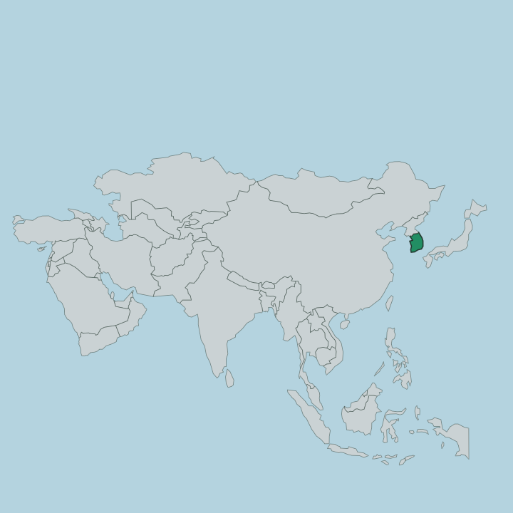
Jeju-do sits alone in the Korea Strait, south of the Korean Peninsula and north of the wider water toward Japan. It is the largest island in South Korea and, by land, the smallest of its provinces. The shape is a blunt oval, wider east to west than north to south, and everything tilts up toward the middle.
Hallasan stands at that centre, a shield volcano whose long, gentle slopes are the island itself rather than a peak set upon it. An old saying holds that Jeju is Hallasan and Hallasan is Jeju. The coast is where people live.
Jeju City spreads along the northern shore facing the peninsula, and Seogwipo lines the southern coast that looks out over the strait. Between them the ground climbs through farmland and grazing into the cones the locals call oreum, roughly 360 of them scattered across the flanks. Basalt is everywhere underfoot, black and porous, stacked into the low field walls that divide the plots.
Lava tubes thread the rock below. The sea is never far, because no part of the island lies deep inland.
What is Jeju-do like?
The haenyeo define how Jeju sees itself. These are the island's women who dive without tanks, holding one breath to gather abalone and sea urchin off the rocks, many of them working into their seventies and eighties. Their whistling exhale as they surface has its own name, and UNESCO listed their culture as intangible heritage in 2016.
The tradition tilted female over generations, as diving passed from men to women and became the household living. It carries a matriarchal streak found almost nowhere else in Korea. Stone, wind, and the sea shape the rest.
Jeju's dialect drifts far from mainland Korean, distinct enough that outsiders struggle to follow it. Squat grandfather statues of porous basalt, the dol hareubang, guard old village gates. The food leans on what the coast and the volcanic soil give up, from black pork to fresh-caught seafood and hand-cut buckwheat.
Shamanic rites tied to the sea still hold in the fishing villages. Little of this reads as an import from Seoul.
What is the history of Jeju-do?
Jeju began as Tamna. Legend traces its people to three demigods who rose from holes in the ground and founded the line that ruled the island kingdom for centuries. Tamna traded horses, dried fish, and abalone with China and Japan while keeping its own kings.
It fell into a vassal's role under the Goryeo dynasty in 938, kept a measure of self-rule for generations after, and was finally absorbed outright into Joseon Korea in 1404. From an independent maritime state it became the country's southernmost province.
What is the climate of Jeju-do?
Jeju runs warmer than anywhere on the Korean mainland. The climate is humid subtropical, mild through a winter that rarely drops below freezing and hot, sticky, and heavy with rain in the deep summer. Hallasan splits the island's weather in two: it blocks the cold continental winds, so Seogwipo on the sheltered south stays the warmest corner of South Korea while Jeju City on the exposed north feels the bite.
Rain falls across the whole year rather than in one wet season. Wind off the strait is the constant.
How do you get to Jeju-do?
Nearly everyone flies. Jeju City holds the island's international airport, and the short hop from Seoul is one of the busiest air routes anywhere, feeding a steady stream of arrivals onto the northern shore. Ferries offer the slower way in, sailing from mainland ports such as Mokpo and Wando across the Korea Strait to the same city.
Once on the ground, buses and the coastal ring road carry travellers between Jeju City and Seogwipo and out to the trailheads and the coast.
Good for
Updated July 2026