Mexico
Estado de Oaxaca, Mexico — Towns & Travel Guide


Oaxaca is a state of southern Mexico, Zapotec and Mixtec country, Monte Albán, mezcal, and a Pacific surf coast at Puerto Escondido.
About Estado de Oaxaca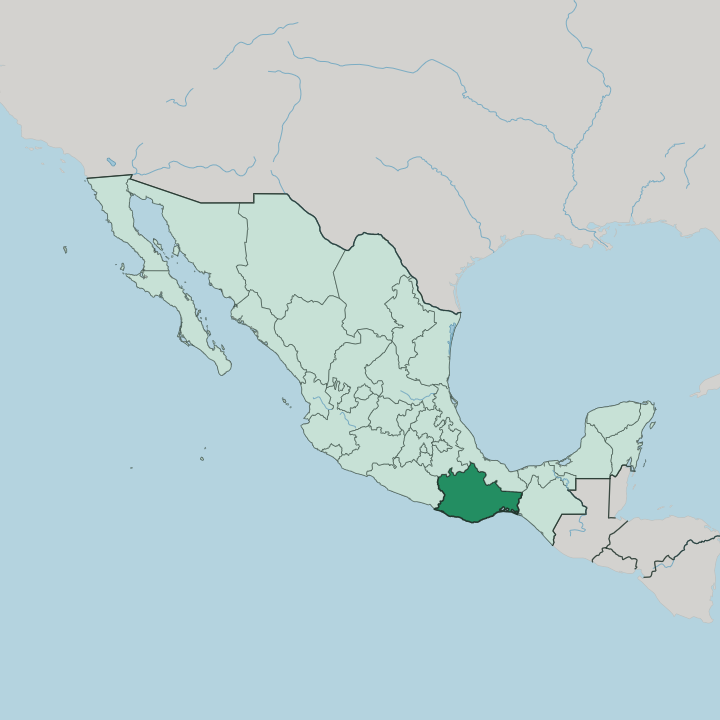


Towns & cities in Estado de Oaxaca
Pick a town or city — each links to where to stay.
 Mexico
Oaxaca
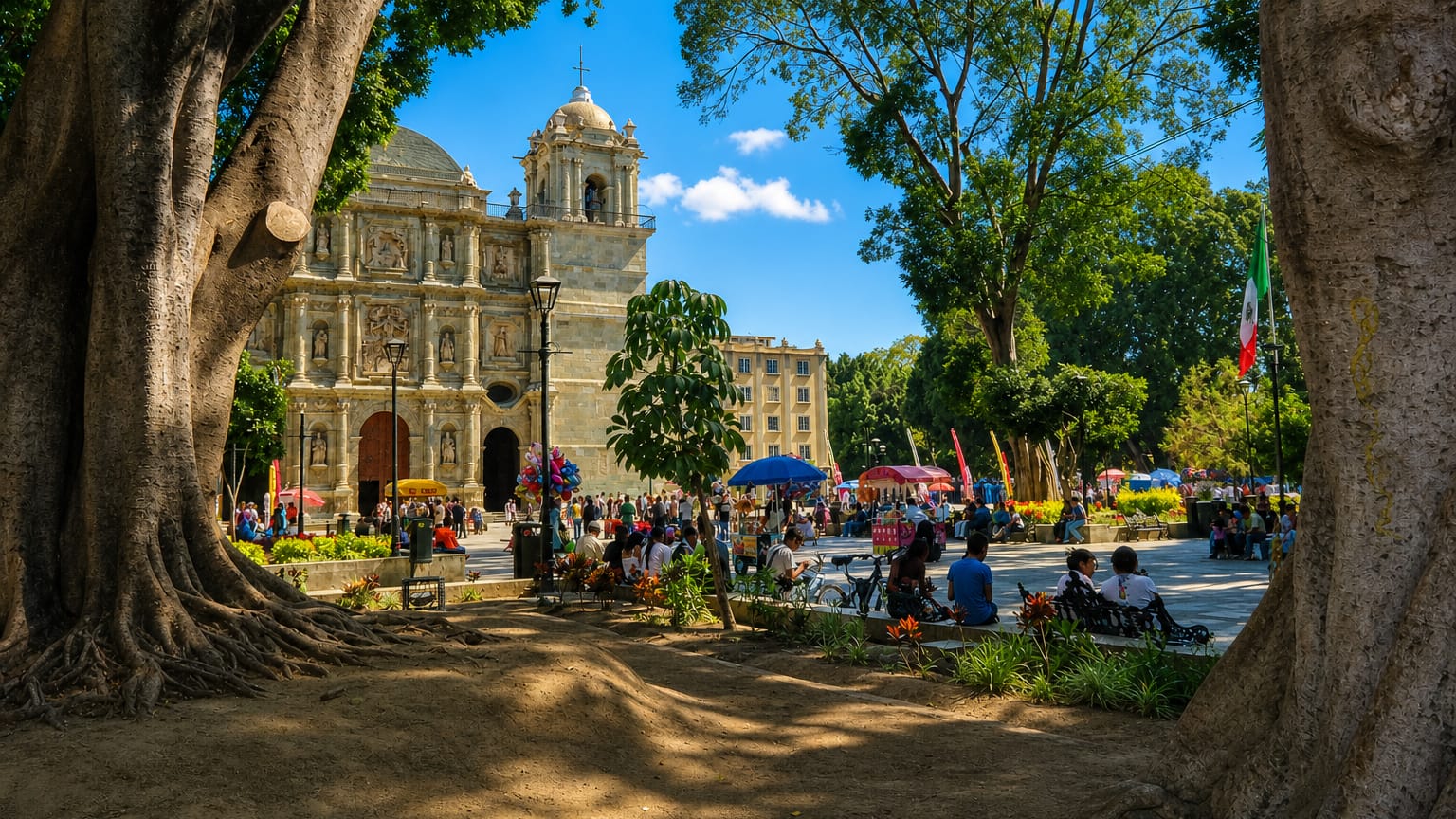
Stone churches line the old streets of Oaxaca, a colonial city in Estado de Oaxaca known for the Church of Santo Domingo de Guzmán.Where to stay →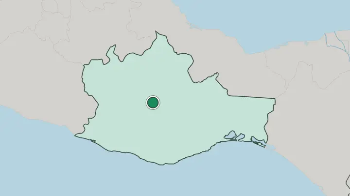
About Estado de Oaxaca
Few states carry more indigenous weight.
What is Estado de Oaxaca known for?
Oaxaca is Zapotec and Mixtec country, and its Central Valleys hold Monte Albán, the mountaintop city the Zapotec ruled for more than a thousand years before the Mixtec pressed in. The state pours most of Mexico's mezcal, distilled from wild and cultivated agave in the villages around Santiago Matatlán. Its kitchens gave the country its moles and the tlayuda.
Every July the capital fills for the Guelaguetza, when delegations from the state's regions dance in their own costumes and dialects.
Where is Estado de Oaxaca?
Oaxaca sits in the south of Mexico, where the land crumples into mountains before it reaches the sea. Guerrero lies to the west, Puebla and Veracruz to the north, and Chiapas to the east, while the Pacific Ocean closes the whole southern edge. The Sierra Madre del Sur fills most of the interior, taking up roughly two-thirds of the state across its west, centre, and south in a maze of ridges and canyons, and its high point, Cerro Nube, clears the clouds in the south. A second range, the Sierra Madre de Oaxaca, walls off the north toward Puebla and Veracruz.
Between the ranges sit the Central Valleys. Oaxaca de Juárez stands on that valley floor, on a plateau high above the coast, ringed by hills. The coast and the isthmus are another country.
In the far east the land pinches to the Isthmus of Tehuantepec, the narrowest neck of Mexico, where only a low ridge separates the Pacific from the Gulf side. Rivers drain the state both ways. The Papaloapan gathers the northern sierra's rain and runs down into Veracruz toward the Gulf, while the Atoyac and the Río Verde carry the Central Valleys' water south to the Pacific.
Down on the shore, a thin coastal plain runs behind long surf beaches and lagoons. The state counts 570 municipalities, more than any other in Mexico, most of them mountain towns reached by a single winding road.
What is Estado de Oaxaca like?
Oaxaca is the most indigenous state in Mexico. Sixteen recognised peoples live within its borders, the Zapotec and Mixtec the largest, alongside Mazatec, Mixe, Chinantec, Triqui, and others who each keep their own tongue. That plurality is written into how the state governs itself.
Of its municipalities, 418 run not by party ballots but by usos y costumbres, the customary law of assemblies and unpaid civic duty. Spanish is the common language, but it shares the ground with dozens of indigenous ones. Benito Juárez, the Zapotec shepherd boy who became president of Mexico, was born in the northern sierra village of Guelatao.
Its past is stacked in stone. Monte Albán, the Zapotec capital cut into a flattened hilltop above the valley, ruled here for more than a thousand years, and the Mixtec later left their fretted mosaics at Mitla. The living culture is just as dense.
Oaxaca is the mezcal heartland, and its kitchens are counted among Mexico's finest, from the seven moles and the huge tlayuda to fried chapulines and stringy quesillo cheese. Craft runs through the valley villages. Teotitlán del Valle weaves wool rugs, San Bartolo Coyotepec fires black pottery, and Arrazola carves the painted alebrije figures.
Every summer the Guelaguetza gathers dancers from all eight regions. Come autumn, the cemeteries glow for Day of the Dead.
What is the history of Estado de Oaxaca?
Oaxaca's story starts on a hilltop. The Zapotec levelled the summit of Monte Albán around 500 BCE and ruled the valley from it for over a thousand years, until Mixtec lords gained the upper hand by the 13th century. Spanish forces under Hernán Cortés took the region in 1521, and Cortés kept the valley as his personal marquisate.
Oaxaca became a free and sovereign state of Mexico in 1824. The honorific de Juárez came later, for Benito Juárez, the Zapotec lawyer from the sierra who rose to Mexico's presidency.
What is the climate of Estado de Oaxaca?
Height decides the weather. Up in the Central Valleys, Oaxaca de Juárez sits high enough for warm days and cool, clear nights through most of the year, spared the heat below. The Pacific coast around Puerto Escondido and Huatulco runs hot and humid the year round, cooled only by the sea breeze.
One season splits the calendar. Rain sweeps in from about June to October, when afternoon storms drench the sierra and the valleys, then the skies dry out for a long, bright winter.
How do you get to Estado de Oaxaca?
Arrivals divide by altitude. The state's own airport, Xoxocotlán International Airport, sits just south of Oaxaca de Juárez and runs mainly on flights from Mexico City. Travellers bound for the sand skip the capital and land on the coast instead, at Puerto Escondido or at Bahías de Huatulco International Airport, which draws direct flights from the United States and Canada.
The Barranca Larga-Ventanilla toll road climbs over the Sierra Madre del Sur to link the coast to the city in about three hours. Buses run the same mountain passes.
Good for
Updated July 2026