Mexico
Estado de Michoacán de Ocampo, Mexico — Towns & Travel Guide


Michoacán is a state of western Mexico, rising from the Pacific coast to volcanic highlands, its capital Morelia at the heart of old Purépecha country.
About Estado de Michoacán de Ocampo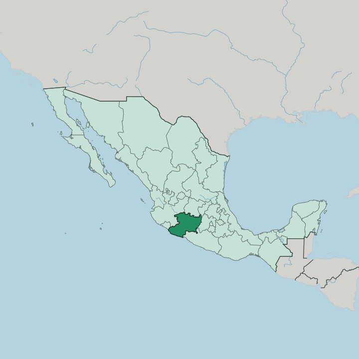


Towns & cities in Estado de Michoacán de Ocampo
Pick a town or city — each links to where to stay.
Morelia makes the natural base, its cantera-stone old town holding the widest choice of rooms in the state. Pátzcuaro is the other hub. The lakeside town fills for the Day of the Dead vigils on Janitzio, so beds there go early.
Uruapan sits deeper in the avocado country to the west, a working city beside the Cupatitzio river and the usual jump-off for Parícutin. The Pacific coast around Lázaro Cárdenas is industrial more than restful. Choose Morelia for colonial streets, Pátzcuaro for the lake and its islands.
About Estado de Michoacán de Ocampo
What is Estado de Michoacán de Ocampo known for?
Michoacán is known for Morelia, its capital, whose pink-stone colonial centre is a World Heritage Site. Purépecha country fills the highlands around Lake Pátzcuaro, where the lakeside town of Pátzcuaro anchors Mexico's most famous Day of the Dead vigils. Volcanoes shape the land.
Parícutin rose from a cornfield in 1943 and buried the villages around it in black lava. Uruapan sits in the avocado belt to the west, and every winter the fir forests near the eastern border fill with monarch butterflies. The mix runs from copper towns to a working Pacific port.
Where is Estado de Michoacán de Ocampo?
Michoacán lies in western Mexico, wrapping from the Pacific Ocean up into the highlands of the interior. Its southern shore is a hot, narrow coastal plain along the Pacific, backed by the Sierra Madre del Sur, whose ridges climb sharply from the sea. Inland the land rises again into the Trans-Mexican Volcanic Belt, a chain of cones and lava fields that crosses the north of the state and gave Parícutin to the world in 1943.
Morelia sits up in that volcanic country. Jalisco and Colima flank the state to the west, Guanajuato lies to the north with Querétaro at the north-east, the State of Mexico to the east, and Guerrero along the south. Six states ring it. Water defines the middle of Michoacán.
The Balsas river and its Tepalcatepec tributary drain the hot depression along the southern border, while the Lerma river marks part of the northern edge and runs west toward Lake Chapala. Between the volcanoes lie the lakes. Lake Pátzcuaro, ringed by Purépecha villages, and the broad, shallow Lake Cuitzeo to the north are the largest, both remnants of a wetter volcanic basin.
Elevation does most of the work here, splitting the state between a sweltering coast and a temperate upland where most of the towns and people sit.
What is Estado de Michoacán de Ocampo like?
Michoacán is the Purépecha heartland, and their culture still shapes the state. Spanish is the common language, but Purépecha is spoken in the villages around Lake Pátzcuaro and the western sierra, one of the few Mexican tongues that has no known relatives. The Night of the Dead here is famous across the country.
Families carry candles and marigolds out to the island cemeteries of Janitzio and the lakeshore towns, keeping an overnight vigil that draws visitors from far off. Craft runs town by town. Santa Clara del Cobre still beats copper by hand as it has since colonial days, Paracho turns out the guitars that supply mariachi bands nationwide, and the old Purépecha capital at Tzintzuntzan sells straw figures and pottery below its stone pyramids.
Food is the other pillar. Michoacán claims carnitas, the slow-fried pork of Quiroga and the Sunday markets, along with corundas, uchepos, and the sweet ates of Morelia. Bishop Vasco de Quiroga set many of these craft trades in the sixteenth century, giving each lake town its own specialty, and that pattern holds.
Morelia carries the high culture. The cantera-stone capital keeps a serious music and film life, and the monumental organ in its cathedral anchors an international music festival each year.
What is the history of Estado de Michoacán de Ocampo?
The Purépecha ruled here first. Their empire was the one power the Aztecs of the central valley never managed to conquer, held from Tzintzuntzan on the shore of Lake Pátzcuaro. Spanish forces took the kingdom in the 1520s, and Bishop Vasco de Quiroga rebuilt the shattered lake communities around the trades and towns that still survive by name.
The colonial capital, Valladolid, was renamed Morelia in 1828 for José María Morelos, the independence priest born there. The state joined the Mexican federation in 1823, and later took the name of Melchor Ocampo, a liberal reformer shot in the Reform War.
What is the climate of Estado de Michoacán de Ocampo?
Michoacán's climate follows its elevation more than its seasons. The Pacific coast and the Balsas depression stay hot and humid the year round, while Morelia and the volcanic highlands keep mild, spring-like days and cool nights. Rain comes in summer.
Storms roll off the Sierra Madre del Sur from about June to September and green the whole state, leaving the winter dry. Cold and moisture settle on the high fir forests toward the eastern border, and those oyamel groves of the Monarch Butterfly Biosphere Reserve draw the overwintering monarchs each winter.
How do you get to Estado de Michoacán de Ocampo?
Most visitors reach Michoacán by air into Morelia, whose airport carries flights from Mexico City and several US cities with large migrant communities. Uruapan has a smaller airport of its own for the avocado trade and the western towns. Roads matter more here.
Toll highways climb in from Mexico City and Guadalajara, winding up through the Trans-Mexican Volcanic Belt to Morelia and Pátzcuaro. Freight takes the coast. Lázaro Cárdenas is one of the country's busiest container ports, though it moves cargo rather than tourists.
Good for
Updated July 2026