Mexico
Estado de México, Mexico — Towns & Travel Guide


Estado de México wraps around Mexico City on three sides, from Teotihuacán's pyramids to the Nevado de Toluca and the lake at Valle de Bravo.
About Estado de México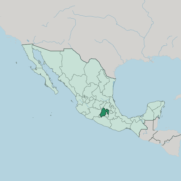


Towns & cities in Estado de México
Pick a town or city — each links to where to stay.
Few travellers sleep in the state itself, and most base in Mexico City and cross the boundary on day trips, since it holds no single tourist centre. Pick a base by interest. Toluca, the capital, sits below the Nevado de Toluca and works for the western valley and the volcano.
Valle de Bravo, two hours west on Lake Avándaro, is the weekend country of Mexico City and the place to stay for the water. For the Pyramids of the Sun and Moon, the small town beside the Teotihuacán ruins puts the dawn climb within easy reach. Choose Ixtapan de la Sal for its thermal springs in the warm south.
About Estado de México
Three landmarks define the state.
What is Estado de México known for?
Teotihuacán, the pre-Aztec city of the Pyramids of the Sun and Moon, spreads across the northern plain, its Pyramid of the Sun among the largest in the ancient world. West of the capital, Valle de Bravo overlooks Lake Avándaro, a pine-ringed weekend refuge for paragliders and sailors. South of Toluca, the Nevado de Toluca holds two lakes in its broken crater.
Everywhere else, the suburbs of Ecatepec and Naucalpan press against Mexico City.
Where is Estado de México?
Estado de México sits in the middle of the country, on the high plateau the Aztecs called Anáhuac. It curls around Mexico City on three sides, leaving the capital almost an island inside the state. Querétaro and Hidalgo lie along the northern edge.
To the east are Tlaxcala and Puebla; to the south, Morelos and Guerrero; to the west, Michoacán. The land is high and folded. This is the heart of the Trans-Mexican Volcanic Belt, where the great cones of central Mexico stand.
Two ranges of volcanoes frame the state. On the eastern rim, toward Puebla and Morelos, rise Popocatépetl and Iztaccíhuatl, the second and third highest mountains in Mexico, one of them still smoking. West of Toluca stands the extinct Nevado de Toluca, whose broken crater cradles two small lakes.
Between the volcanoes open the two great basins: the Valley of Mexico in the east, drained toward the capital, and the Toluca Valley in the west, higher and colder. The Lerma River begins here, in marshes near Toluca, and flows west on its long run to the Pacific. Little of the state lies low.
Only the far south-west, dropping toward the Balsas depression and Guerrero, turns to warm country.
What is Estado de México like?
The state carries some of the deepest indigenous roots in central Mexico. This was the western flank of the Aztec world, and its towns paid tribute to Tenochtitlan. Five native peoples still hold their languages here: the Mazahua and Otomí in the western hills, the Nahua descendants of the Aztecs across the centre, and the Matlatzinca and Tlahuica in smaller pockets.
Nahuatl is still spoken in villages near the volcanoes. Spanish is the common tongue. But the old place-names, foods and festivals are Mesoamerican to the core.
Craft towns give the state its character. Metepec, beside Toluca, is famous for its clay Trees of Life, brightly painted sculptures crowded with figures from Eden and folk legend. Tultepec lives by fireworks, and builds towering paper bulls packed with rockets for its March festival.
In Toluca itself, the Cosmovitral wraps a botanical garden in a wall of stained glass, its Sun Man burning at the centre. The city's kitchens gave Mexico its green chorizo, a sausage tinted green with herbs and chillies. Faith runs strong too.
The mountain sanctuary of Chalma, reached on foot by pilgrims for centuries, ranks second only to Guadalupe among the country's shrines.
What is the history of Estado de México?
The past here is older than the Aztecs. Teotihuacán, whose Pyramids of the Sun and Moon went up around the start of the first millennium, was the largest city in the Americas long before Tenochtitlan rose. The Mexica later ruled the valley from that lake capital, on land the state still surrounds.
Statehood came in 1824, when the new republic carved out the vast State of Mexico, then lost Mexico City to the federal district it had to host. The government wandered before settling at Toluca in 1830. Cities did the rest.
What is the climate of Estado de México?
Altitude sets the weather, not the tropics. Most of the state lies high on the plateau, so days are mild and nights cool the year round, even though it sits at a tropical remove from the equator. The rains come in summer, heavy from June to September, and the winter months stay dry.
Up on the Nevado de Toluca the crater lakes freeze, and snow dusts the high cones. The far south-west is the exception. Dropping toward the Balsas, it turns genuinely hot.
How do you get to Estado de México?
Almost everyone arrives through Mexico City. Because the state wraps the capital, the Mexico City International Airport is the practical way in, and the ruins of Teotihuacán lie less than an hour north of its runways. Toluca keeps its own airport in the western valley, a quieter alternative used mainly for domestic flights.
From either, roads climb the passes between the volcanoes to Valle de Bravo and the Nevado de Toluca. An interurban train links Toluca with the capital. Wrapping the capital as it does, the State of Mexico keeps everything within an easy reach.
Good for
Updated July 2026