Nigeria
Ondo State, Nigeria — Towns & Travel Guide


Ondo State runs from the Idanre hills down to the Atlantic coast in south-western Nigeria, the cocoa-rich Sunshine State.
About Ondo State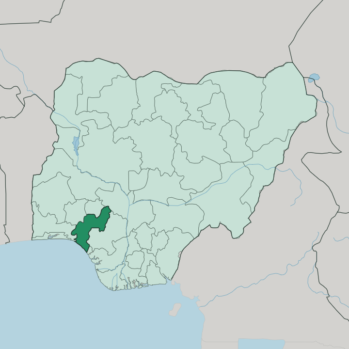
Towns & cities in Ondo State
Pick a town or city — each links to where to stay.
Akure is the obvious base. The capital holds most of the state's hotels and the only airport, set in the Yoruba Hills with roads running out to Owo, Ondo and Ado-Ekiti. Idanre suits travellers who come for the granite hills and cocoa farms, though beds thin out fast.
Ondo town works as a stop toward the coast. Down on the Ilaje shore near Igbokoda, reached through mangrove creeks, accommodation is sparse and most arrivals go by boat. Choose Akure first, and treat the hills and the coast as day trips or short stays.
About Ondo State
Cocoa built this state.
What is Ondo State known for?
Ondo grows a large share of Nigeria's crop, and the plantations around Idanre are the country's biggest single producing area. Above those farms rise the Idanre hills, over 1,000 metres of granite that mark the highest ground in the western half of Nigeria and carry 682 steps to an old hilltop town. Southward the land drops through rainforest and mangrove to an 80 km strip of Atlantic coast where the Ilaje people fish.
Akure, the capital, ties it together.
Where is Ondo State?
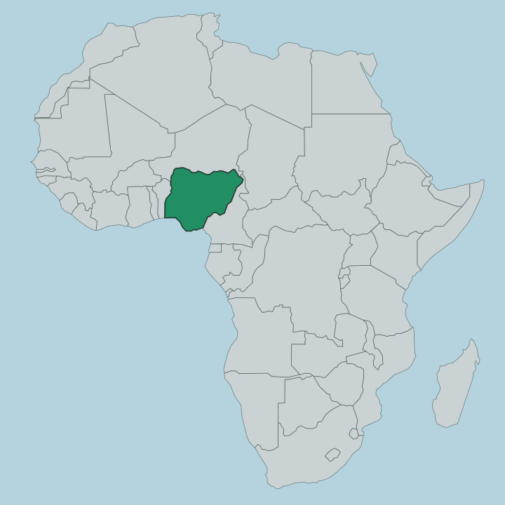
Ondo State sits in south-western Nigeria, one of the Yoruba states, and it reaches all the way from the interior hills to the sea. Ekiti State lies to the north. Kogi State touches its north-east and Edo State its east, Delta State meets it in the south-east, Ogun State runs along the south-west, and Osun State closes the north-west. To the south there is only water, the Atlantic Ocean along the Bight of Benin.
That is a long span for one state. Inland the ground is high and forested, climbing to the Idanre hills, a mass of bare granite that tops 1,000 metres and stands as the highest point in the western half of the country. From there the land falls away southward through dense tropical rainforest, then into a belt of forest and freshwater swamp, and finally to the mangrove and the tidal creeks of the coast.
Rivers such as the Owena drain the interior toward the lagoons behind the shore. The coastline itself runs roughly north-west to south-east for about 80 km, low and broken by creeks rather than cliffs. Akure, the capital, sits inland in the forested Yoruba Hills, at the crossing of roads out to Owo, Ondo, Idanre and the Ekiti border.
Few Nigerian states change so completely from one end to the other.
What is Ondo State like?
This is Yoruba country. The state gathers several Yoruba subgroups under one map, each with its own towns and traditions, and the differences between them run deep. Akure and Owo people hold the forested centre and east.
Down in the southern hills sit the Ondo and Idanre communities, while the Ikale and Ilaje spread toward the water. Each answers to its own kings. Akure looks to the Deji of Akure, a line of rulers whose old kingdom traded between the Benin Kingdom to the east and Ile-Ife to the west, and that Benin influence still shows in the town's history and regalia.
The Ilaje are the odd ones out. A migratory coastal people, they built their lives on the creeks and the open Atlantic, and their villages depend on fishing rather than farming the way the inland towns do. Cocoa is the thread that ties the interior together, moving from farm to market town across the whole plateau.
Yoruba is the shared language throughout. Palace festivals, drumming and masquerade still mark the year in the older towns, and the hilltop shrines around Idanre draw pilgrims as much as sightseers.
What is the history of Ondo State?
The state is young. Ondo State was carved out of the former Western State in 1976, when Nigeria's military government split the west into three. Its towns long predate that line on the map.
Akure, Owo and Ondo were established Yoruba kingdoms centuries before the state existed, and Akure's rulers traded between Benin and Ile-Ife in the era of those older powers. The state kept its first shape for twenty years. In 1996 the northern districts were separated to form Ekiti State, leaving Ondo with the borders it holds now.
What is the climate of Ondo State?
Ondo State is hot and wet, a tropical climate that feeds the cocoa. The south sees the heaviest rain, which keeps the coastal creeks and the rainforest around Idanre green through most of the year. A drier, dusty spell arrives when the harmattan wind blows down from the north.
Toward the northern edge the forest gives way to patches of savannah, and the rains ease there compared with the soaking coast. Warmth is the constant.
How do you get to Ondo State?
Most visitors reach Ondo State by road. Akure has its own airport, commissioned in 1986, with flights linking the capital to Lagos and Abuja for those who fly. Tarred roads fan out from there.
They run to Owo in the east, to Ondo and Okitipupa toward the coast, and north to the Ekiti border. The Ilaje shore is the harder half to reach, since the creek villages around Igbokoda are gained by boat rather than car. Overland from Lagos, the drive comes up through Ogun State.
Updated July 2026