Nigeria
Taraba State, Nigeria — Towns & Travel Guide


Taraba State fills a green corner of north-eastern Nigeria, where the Mambilla Plateau climbs toward Chappal Waddi, the country's highest peak.
About Taraba State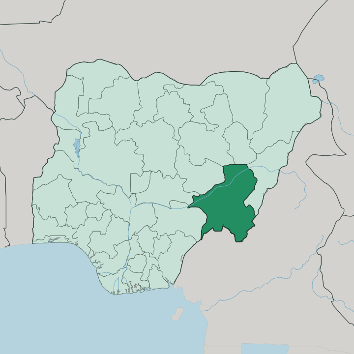
Towns & cities in Taraba State
Pick a town or city — each links to where to stay.
Jalingo, the capital in the north of the state, holds most of the beds and is where an air arrival lands. It suits you for the practical side. Gembu, the main town on the Mambilla Plateau, is the cool-climate base for the highlands and the tea estates that spread across the grass.
Wukari sits south of the Benue, the old seat of the Jukun kingdom and its Aku Uka ruler. For the wildlife, Serti is the road-end settlement before Gashaka-Gumti National Park, where lodging is basic and arranged through the park itself. Pick Jalingo first.
Then climb to Gembu for the mountains.
About Taraba State
What is Taraba State known for?
Taraba calls itself Nature's Gift to the Nation, and the highlands earn the boast. In its far south the Mambilla Plateau rises well over a kilometre, cool and grassy where cattle graze the high pasture through the year. Chappal Waddi lifts higher still, the tallest mountain in Nigeria and West Africa.
Around it spreads Gashaka-Gumti National Park, the largest in the country, home to chimpanzees and forest elephants. Jalingo is the state capital. The rivers do the rest.
Where is Taraba State?
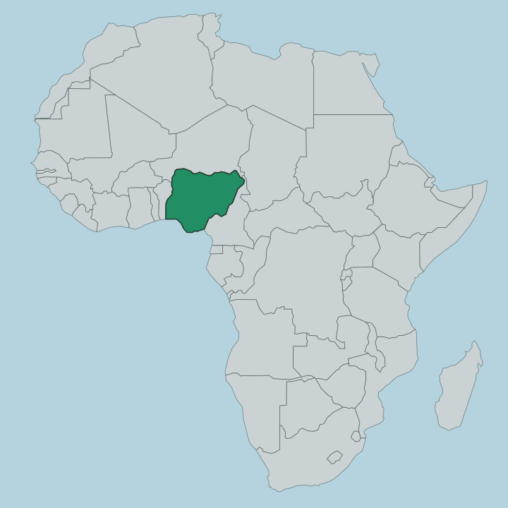
Taraba stretches across north-eastern Nigeria, a long block of country that tilts from lowland valleys in the north to high mountains in the south. It takes its name from the Taraba River, which drains the southern reaches on its way to join the Benue. The Benue is Nigeria's second-longest river, and it crosses the middle of the state from east to west, splitting the map into a northern half around Jalingo and a southern half around Wukari and the plateau.
Undulating savanna covers most of the ground. The south is different. There the land climbs into the Mambilla Plateau, a broad grassland lifted more than a kilometre up and holding a temperate, misty climate rare in this part of Africa.
Chappal Waddi crowns the southern edge as the highest point in the country, near where the border runs up against Cameroon. The Donga River threads down from the same hills. Cameroon lies to the east and south-east; within Nigeria, Taraba touches Adamawa, Gombe, Bauchi, Plateau, Nasarawa and Benue states.
The main rivers all rise in the Cameroonian mountains and pour westward, and that flow of water off the highlands has shaped the whole state.
What is Taraba State like?
Few Nigerian states pack in as many peoples as Taraba. Something like eighty distinct ethnic groups share the ground here, and no single one commands the whole. The Jukun anchor the south around Wukari, where the Aku Uka reigns as one of the oldest traditional rulers in the region and the Puje harvest festival still gathers the town.
Fulani herders hold the Muri country of the north and much of the Mambilla Plateau, driving cattle across the high grass. Between them live Mumuye, Kuteb, Chamba, Tiv, Mambilla and Ichen communities, each with its own tongue. That mix drives the calendar.
Fishing festivals crowd the Benue at Ibi, Kuteb dances mark the year at Takum and Ussa, and Mambilla ceremonies play out on the plateau. The plateau itself carries a farming culture built on tea and cattle, unlike anywhere else in Nigeria. Cattle wealth runs deep in the north and the highlands alike.
English serves as the common language across all of it, the bridge between eighty mother tongues. Markets, music and cattle knit the state together more than any capital does.
What is the history of Taraba State?
The state itself is young. It was carved out of the old Gongola State on 27 August 1991, under the military government of Ibrahim Babangida, and named for the Taraba River. But the land is far older than its borders.
Taraba was stitched together from three historic divisions, Wukari, Muri and Mambilla, each with its own past. At Wukari the Jukun kingdom of Kwararafa once held sway as a power on the middle Benue, and its Aku Uka still presides over the town. The modern state simply drew a line around that older world.
What is the climate of Taraba State?
Taraba runs on two seasons. The wet months stretch from April to October, when rain sweeps in and the savanna greens, heaviest in the far south around Serti and Takum. Dry season follows from November to March, the driest stretch falling over December and January when the humidity drops hard and the harmattan haze drifts down from the north.
Heat rules the lowland valleys around Jalingo and the Benue. The Mambilla Plateau breaks that pattern completely, holding a cool, temperate climate through the year that draws its tea and cattle from the mild air.
How do you get to Taraba State?
Most travellers reach Taraba overland. The state lies deep in north-eastern Nigeria, well off the main coastal corridors, so the usual approach is a long road journey up from Jalingo's neighbouring states. Jalingo does have its own airport, opened to link the capital by air, though flights are limited.
From Jalingo, roads run south across the Benue toward Wukari and climb the steep switchbacks onto the Mambilla Plateau at Gembu. Reaching Gashaka-Gumti National Park means a further drive to Serti and a guide from there.
Good for
Updated July 2026