Peru
Departamento de Ayacucho, Peru — Towns & Travel Guide


Ayacucho fills the south-central Andes of Peru, a region of colonial churches, Quechua craft towns and the battlefield that sealed the country's independence.
About Departamento de Ayacucho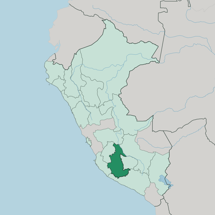
Towns & cities in Departamento de Ayacucho
Pick a town or city — each links to where to stay.
The city of Ayacucho is the obvious base. Its Plaza Mayor is walled by colonial churches, and the retablo workshops sit a few streets off it. Quinua and Huanta suit a night out of town, the first on the independence battlefield above the city and the second down in a warmer valley of orchards and pisco.
Far to the south, Puquio opens the road into Lucanas and the vicuña herds of Pampa Galeras. Choose your base. Stay in the capital for churches and Semana Santa; head to Puquio or Huanta if you want the region's wilder edges.
About Departamento de Ayacucho
What is Departamento de Ayacucho known for?
Ayacucho is a region of churches and craftwork high in the Peruvian Andes. Its capital, the city of Ayacucho, holds more than thirty colonial temples and stages Peru's largest Holy Week. The plains above Quinua carry a heavier weight, for the Battle of Ayacucho ended Spanish rule across South America there in 1824.
Faith and craft define it. Retablo altar-boxes, Quinua clay churches and the ruins of the Wari capital fill out the rest.
Where is Departamento de Ayacucho?
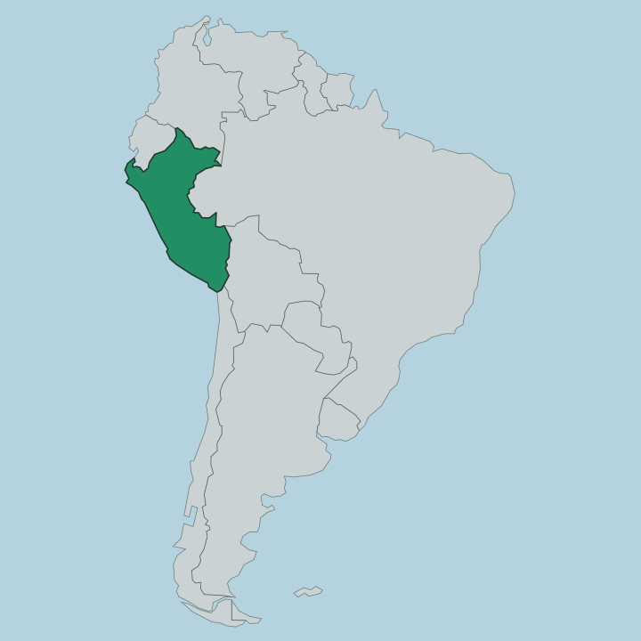
Ayacucho sits in the south-central Andes of Peru, a wedge of highland country between the coast and the deep Amazonian valleys to the east. The land climbs hard. Warm ravines along the Apurímac drop below 1,000 metres, while the Sara Sara volcano in the far south rises past 5,500 metres, so a single region holds cactus gorges and glacier-fringed puna at once.
The Apurímac itself runs down the eastern flank, one of the headwater rivers of the Amazon, and the Pampas River traces the boundary with Huancavelica to the west. Most of the department is steep sierra. Only a fringe of hot, humid jungle spills over the eastern rim toward the lowlands.
The regional capital, the city of Ayacucho, stands in a dry valley on the western side at around 2,760 metres, sheltered from the worst of the rains. South of it the country opens into the wide plateaus of Lucanas and Parinacochas, where Lake Parinacochas lies below the volcanoes and vicuña graze the Pampa Galeras grasslands. Nearly nine parts in ten of the land is mountain.
That vertical spread, from river gorge to volcano, is the single fact that shapes travel here.
What is Departamento de Ayacucho like?
Ayacucho keeps its old name of Huamanga in daily speech, and the region wears its history on its facades. Quechua is the first language of most people here, the Chanka variety carried down from before the Spanish arrived, and Spanish shares the streets with it. The city earned the tag City of Churches for a reason.
More than thirty colonial temples in Renaissance and Baroque stone crowd its centre, their carved portals paid for by silver that once passed through Huamanga. The craft tradition of Ayacucho reaches back just as far as its churches. Ayacucho is the home of the retablo.
The master Joaquín López Antay raised this portable wooden altar-box, packed with tiny painted figures, into a recognised art. Up the road at Quinua, potters shape red clay into miniature churches for the roofs of highland houses. All of it comes to a head at Semana Santa.
Holy Week here is the grandest in Peru, ten days of night processions over carpets of flower petals laid across the cobbles. The devotion is old and the crowds are large. Away from the churches, the culture lives in weaving, in carved Huamanga alabaster, and in the Quechua spoken in the market stalls.
What is the history of Departamento de Ayacucho?
Long before the Inca, the Wari built their capital on the hills near the modern city, ruling much of the Andes from Ayacucho through the Middle Horizon. The Spanish founded Huamanga in 1539. Its greatest day came on the pampa above Quinua in 1824, when the Battle of Ayacucho broke the Spanish army and sealed independence for Peru and much of South America, after which the victors renamed the city for the fight.
Ayacucho carries a darker chapter too, as the region where the Shining Path insurgency began in 1980 and where the following war fell hardest.
What is the climate of Departamento de Ayacucho?
Altitude, not season, sets the temperature across Ayacucho. The capital's dry valley stays mild by day and cold after dark most of the year, sunny even when the coast is grey. What changes is the rain.
A dry spell from May to September brings clear skies over the Andes and the best walking on the high plateaus, while the wet months from December to March green the hills and swell the Apurímac. Nights are cold up here. The eastern jungle rim stays warmer and far damper than the sierra.
How do you get to Departamento de Ayacucho?
Flying is the quick way in. Coronel FAP Alfredo Mendívil Duarte airport, on the edge of the city of Ayacucho, runs short daily hops to Lima and little else. The overland route climbs the Los Libertadores highway up from the Pacific coast near Pisco, a long day of switchbacks over the Andes that most travellers break along the way.
Buses grind in from Lima, Cusco and the Mantaro valley to the north. Once here, the region's towns are linked by winding mountain roads.
Good for
Updated July 2026