Thailand
Changwat Amnat Charoen, Thailand — Towns & Travel Guide


Amnat Charoen is one of Thailand's youngest provinces, a farming pocket of the Isan northeast along the Mekong River border with Laos.
Find your area →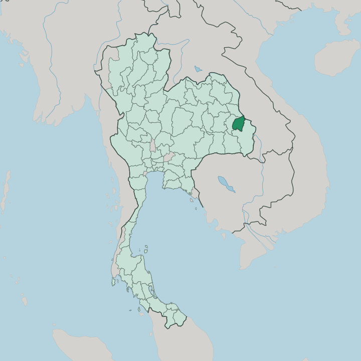


Towns & cities in Changwat Amnat Charoen
Pick a town or city — each links to where to stay.
Amnat Charoen is not a hotel town. Most beds cluster in the provincial capital, Mueang Amnat Charoen, an easy base for the Big Buddha at Phra Mongkhon Ming Mueang and the temples around it. Out in the countryside the choice thins quickly.
Chanuman sits on the Mekong, where dry-season rapids surface and Phu Thai weavers still work the looms; Lue Amnat is the other weaving district. For flights, rail and a fuller run of hotels you are better off an hour south in Ubon Ratchathani.
About Changwat Amnat Charoen
Amnat Charoen is farm country.
What is Changwat Amnat Charoen known for?
Its name joins the Thai words for power and prosperity, and jasmine rice and sugarcane fill the plains that run east toward the Mekong River. The province split from Ubon Ratchathani in 1993, one of the youngest in Thailand. Above the capital rises Phra Mongkhon Ming Mueang, a seated Buddha of roughly 20 metres that appears on the provincial seal.
Weavers here are known for silk and for khit cloth, a geometric brocade carried down from Phu Thai settlers who crossed the river from Laos.
Where is Changwat Amnat Charoen?
Amnat Charoen lies in the Isan region, the plateau country of northeastern Thailand. It is small by Thai standards. The province sits about 590 km east-northeast of Bangkok, far up the Mekong valley near the frontier with Laos.
Three Thai provinces wrap around it: Ubon Ratchathani to the south, Yasothon to the west, and Mukdahan to the north. Its eastern edge is water. For roughly 38 kilometres the Mekong River runs along that side, dividing Amnat Charoen from Savannakhet Province on the Laotian bank.
Most of the land is flat. The province spreads across the Mekong plain, rising into low hills only in the north, where Phu Sa Dok Bua National Park protects a belt of forest and sandstone. Two tributaries, the Lam Sae Bai and the Lam Sae Bok, drain the interior toward the great river.
When the dry season pulls the Mekong down between February and May, reefs and sandbars break the surface, and rocky rapids such as Kaeng Tanglang appear near the district of Chanuman. Forest still covers only a small fraction of the province. The rest is rice.
What is Changwat Amnat Charoen like?
Life here is Isan through and through. The everyday language is the Lao-rooted Isan speech of the northeast, not the central Thai of Bangkok, and the food leans to sticky rice, grilled river fish and fierce som tam. Faith runs deep.
Most people follow Theravada Buddhism, layered over older animist customs, and Chanuman's Phu Thai families keep a set of fourteen moral precepts that shape daily manners. Households bathe their feet before entering a home. No one steps on a monk's shadow.
Merit-making orders the week, with alms given to monks at dawn and flowers and candles set before the Buddha. Craft is the province's calling card. Weavers around Lue Amnat and the Phu Thai villages produce khit, a supplementary-weft brocade whose geometric bands sometimes resolve into fish, elephants or turtles, while silk hamlets add their own bolts of cloth.
The calendar turns on Buddhist festivals. At the start of the wet season comes Bun Bang Fai, the rocket festival, when home-made bamboo rockets are fired skyward to beg the rains; later come the end of Buddhist Lent, Songkran and Loy Krathong. These are working traditions, not shows for visitors.
What is the history of Changwat Amnat Charoen?
The name is older than the province. Long a small Lao meuang on the middle Mekong, the district was governed first from Khemarat and later from Ubon Ratchathani, and it took the name Amnat Charoen, meaning roughly 'prosperous power', in 1939. Full provincehood came late.
On 12 January 1993 the government carved seven districts out of Ubon Ratchathani to create Amnat Charoen, one of several new provinces drawn that year.
What is the climate of Changwat Amnat Charoen?
Three seasons order the year. Amnat Charoen has a tropical savanna climate, and the southwest monsoon brings the rains from May into October, with the heaviest downpours in the storms of August and September. Cool, drier weather follows.
Then March through May turns hot and hazy over the Mekong plain. The river itself marks the calendar: as it falls between February and May, sandbars and rapids that the flood had swallowed rise back into the light.
How do you get to Changwat Amnat Charoen?
Amnat Charoen has no runway of its own. Most travellers fly or take the overnight train to Ubon Ratchathani, the regional hub about an hour to the south, then finish the trip by road. Long-distance buses grind up from Bangkok in eight or nine hours, following the highways through Nakhon Ratchasima.
Local minibuses thread the province too, running the route between Ubon Ratchathani and Mukdahan. A private car opens the riverside districts.
Common questions
What is the best area to stay in Changwat Amnat Charoen?
Ubon Ratchathani: flights and a wider choice of hotels.
Updated July 2026