Thailand
Changwat Chumphon, Thailand — Towns & Travel Guide


Chumphon sits on the Isthmus of Kra, the slim neck of peninsular Thailand, and its coast is the mainland jumping-off point for Ko Tao.
About Changwat Chumphon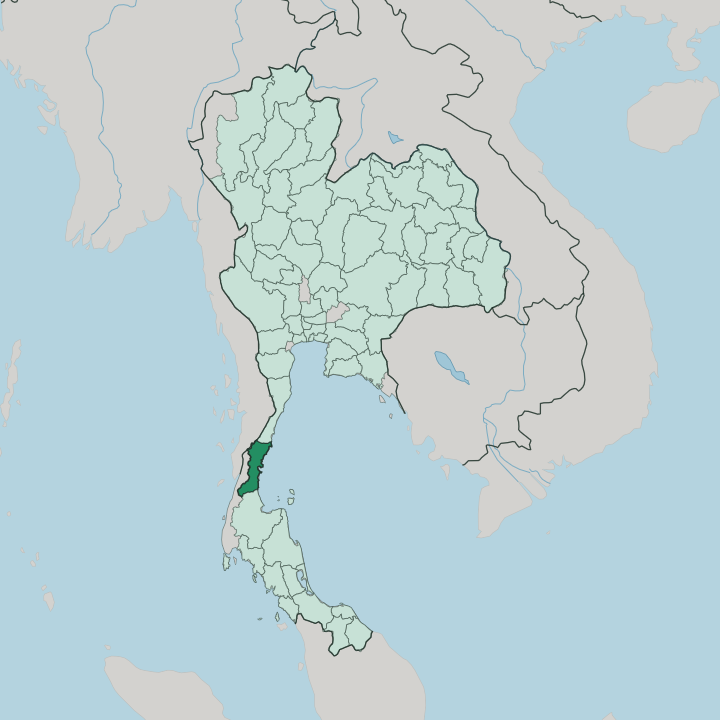


Towns & cities in Changwat Chumphon
Pick a town or city — each links to where to stay.
Chumphon town is the practical base. It is the rail terminus where the night train from Bangkok hands travellers to the dawn ferries for Ko Tao, a few streets from the piers. For sand, most people head north to Hat Thung Wua Laen in Pathio, the province's main beach.
South along the Southern Line lies Lang Suan, an old town on its river amid durian and langsat orchards. Divers cross to the islets of Mu Ko Chumphon. Choose the town for transit, the coast to linger.
About Changwat Chumphon
What is Changwat Chumphon known for?
Most travellers know Chumphon as the crossing point where the long tail of southern Thailand begins. Boats leave its piers for Ko Tao, the diving island out in the Gulf of Thailand, and many people pause only long enough to catch one. That undersells the place.
The province grows much of the country's robusta coffee, keeps a quiet run of coast at Hat Thung Wua Laen, and guards the reef-fringed islets of Mu Ko Chumphon National Park. Divers and coffee both come from here.
Where is Changwat Chumphon?
Chumphon opens the long peninsula that trails south from the bulk of Thailand toward Malaysia. It lies in the upper part of southern Thailand, the first province reached as the country narrows. Here the land is narrow.
The Gulf of Thailand presses against its eastern shore while the Tenasserim Hills rise along the west, and beyond that ridge lies Myanmar. Chumphon holds the mainland side of the Isthmus of Kra, the slender waist of the whole Malay Peninsula, where only a short stretch of hills separates the Gulf from the Andaman side. Its coastline runs for 222 kilometres down the Gulf, broken by river mouths, mangrove, and a scatter of 44 islands offshore.
Three provinces ring the land. Prachuap Khiri Khan lies to the north, Ranong sits across the hills to the west, and Surat Thani carries on to the south. The Lang Suan River drains the wet southern districts before reaching the sea. Rubber and orchard fruit fill the inland valleys.
Beaches and quiet islets line the shore. Little of Chumphon sits far from either the hills or the water.
What is Changwat Chumphon like?
Chumphon feels like farm and sea more than town. The hills inland are coffee country, planted with much of the robusta that Thailand roasts, and the valleys carry durian, lady-finger bananas, and the sweet langsat the south is known for. Sawi grows pineapple.
Roadside stalls pour iced robusta thick and dark, a habit as local as the fruit. Down on the coast the rhythm is fishing, with squid boats working the Gulf and morning markets stacked high with the night's catch. Southern Thai cooking here leans hot and sour, cooled a little by all that orchard fruit.
One figure stands above the rest. Prince Abhakara Kiartivongse, remembered as the father of the Royal Thai Navy, is honoured at a shrine on Hat Sai Ri where the retired torpedo boat HTMS Chumphon rests on land, and sailors and fishermen still leave offerings before they put to sea. The province keeps its own festival calendar too.
Each year after the rains, long-boat crews race up the Lang Suan River in a rowing contest that draws the whole southern district down to the banks. Merit-making, boats, and orchards run through all of it.
What is the history of Changwat Chumphon?
People have lived along these shores since prehistoric times. During the Srivijaya centuries, when sea trade crossed the isthmus between the Gulf and the Andaman coast, the mustering of armies heading south is said to have given Chumphon its name. The southern half of the province was once a separate town, Lang Suan, folded into Chumphon in 1932.
War came in 1941. Japanese troops landed on this coast that December, and a handful of local youth cadets put up a brief, stubborn fight before the order came to stand down.
What is the climate of Changwat Chumphon?
Chumphon runs hot and humid the year round, a tropical monsoon climate on the Gulf. The drier months fall roughly between December and April, when the sea flattens and the boats to Ko Tao run on schedule. Then the rains take over.
From about May into November the monsoon builds, and October and November bring the heaviest downpours, swelling the Lang Suan River and churning the Gulf. Crossings can be cancelled when the water turns rough. Come in the dry window.
How do you get to Changwat Chumphon?
Most people arrive by rail. The overnight train down the Southern Line from Bangkok reaches Chumphon before dawn, timed so passengers can step almost straight onto the morning boat. Buses run the same route along Highway 4, and a small airport at Pathio links the province to Bangkok by air.
From the piers, catamarans cross to Ko Tao in a couple of hours, carrying on to Ko Pha-ngan and Ko Samui. The train and the boat are the classic pairing.
Good for
Updated July 2026