Thailand
Changwat Roi Et, Thailand — Towns & Travel Guide


Roi Et is a province of northeastern Thailand's Isan region, a flat jasmine-rice heartland centred on a lake-ringed capital town.
About Changwat Roi Et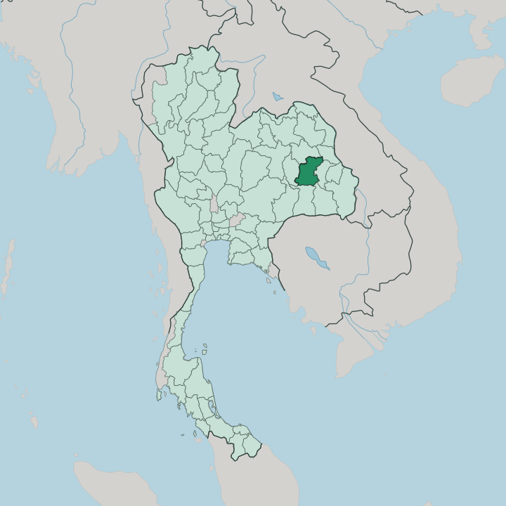


Towns & cities in Changwat Roi Et
Pick a town or city — each links to where to stay.
Most visitors base themselves in Roi Et town, which holds the province's widest range of hotels around the shoreline of Bueng Phlan Chai. It is small and walkable. South of the capital, the old Lao town of Suwannaphum makes a quieter, more historic stop, close to the district where the first settlers pitched camp above the Chi River.
Out on the jasmine-rice flats, Kaset Wisai sits within reach of the Ku Ka Sing Khmer sanctuary and the wide Thung Kula Ronghai plain. Beds thin out fast beyond these three.
About Changwat Roi Et
Rice made the name.
What is Changwat Roi Et known for?
The Thung Kula Ronghai plain in the south grows some of Thailand's most prized Hom Mali jasmine rice, and the grain built the province's reputation long before travellers came. Roi Et town wraps around Bueng Phlan Chai, an island-dotted lake, while the tallest standing Buddha in Thailand rises over the temple grounds of Wat Burapha Phiram nearby. Weavers here work the fine local Saket silk, and the reedy khaen mouth organ carries the sound of Isan music across the whole northeast.
Where is Changwat Roi Et?
Roi Et sits near the middle of Isan, the broad plateau that fills northeastern Thailand. A ring of six provinces encloses Roi Et, from Kalasin and Mukdahan in the north down to Sisaket and Surin on the southern flank. Kalasin lies to the north, Mukdahan to the northeast, Yasothon to the east, and Sisaket and Surin along the south, while Maha Sarakham closes off the western side.
No coast comes anywhere near. The land is mostly flat, a gently undulating plain lifted only a little above the surrounding country and drained by rivers that run east toward the distant Mekong. The Chi River is the main artery, curving across the province and gathering the smaller Lam Nam Yang along the way.
Water shapes the south. The Mun River traces part of the boundary with Surin, and between the two great rivers spreads the Thung Kula Ronghai, a wide, once-brackish plain that turns to jasmine paddy after the rains. Low hills of the Phu Phan range brush the far northern edge, the only real relief in an otherwise level province.
Roi Et town stands at the centre, built around its lake. Bangkok lies far to the southwest, a long overland haul across the plateau. Everything about the province is grounded in that Chi-valley flatland, and the rivers and their seasonal floods still decide where the rice grows and where the towns take root.
What is Changwat Roi Et like?
The culture here is Lao at heart. Most people speak the Isan dialect at home, a form of Lao carried west when settlers crossed from Champasak, and the food, music and Buddhism all lean the same way. Sticky rice is the staple, eaten by hand with grilled meats and fiery som tam.
The reedy drone of the khaen, an Isan mouth organ built from paired bamboo pipes, sets the tune at festivals, and the best instruments come from the small weaving-and-craft villages of the countryside. Silk matters too. Local looms turn out the fine Saket silk, a provincial specialty dyed and patterned in motifs handed down through generations.
Faith runs deep and public. Roi Et keeps the old Isan festival calendar, and its Bun Phawet celebrations retell the Vessantara Jataka over long temple days each cool season. The skyline answers with monuments.
Phra Maha Chedi Chai Mongkhon rises white and gold on a forested hill beyond the capital, one of the tallest chedi in the country, while a towering standing Buddha rises above the trees at Wat Burapha Phiram in the heart of Roi Et town. Rice ties it all together. The harvest, the merit-making and the markets follow the same slow agricultural year that has governed life on this plain for centuries.
What is the history of Changwat Roi Et?
The story starts with the Lao. Around 1718, settlers from the Kingdom of Champasak founded a mueang near Suwannaphum, in the Chi valley, during the Ayutthaya era. Later, King Taksin shifted the seat to its present ground at Saket Nakhon, and a first ruler took charge in 1775.
The name puzzles outsiders: Roi Et reads as 'one hundred and one', yet it really means eleven, a nod to the eleven ancient gates and the vassal towns the old mueang once commanded.
What is the climate of Changwat Roi Et?
Three seasons order the year. A hot, dry stretch bakes the Isan plain from March into May, the southwest monsoon then brings the rains that flood the paddies through the wet months, and a cooler, drier spell settles in from November. Rain rules the rice.
The Thung Kula Ronghai lives or dies by the monsoon, prone to drought in a weak year and to flooding in a strong one, and the jasmine crop ripens in the cool, rain-free weeks of the northern winter. Grey heat hangs heavy before the storms break.
How do you get to Changwat Roi Et?
Roi Et is well inland, and most visitors arrive by road or by air. Roi Et Airport, a short drive north of town, links the province to Bangkok with daily flights. It is the quickest way in.
By land, Route 214 threads through the province, running north to Kalasin and south toward Surin, and long-distance buses fan out to Bangkok and the other Isan towns across the plateau. No main railway reaches the town, so the airport and the highway carry the traffic.
Good for
Updated July 2026