Thailand
Changwat Sakon Nakhon, Thailand — Towns & Travel Guide


Changwat Sakon Nakhon is a province of upper northeastern Thailand, on the Khorat Plateau beside Nong Han, the largest natural lake in the northeast.
About Changwat Sakon Nakhon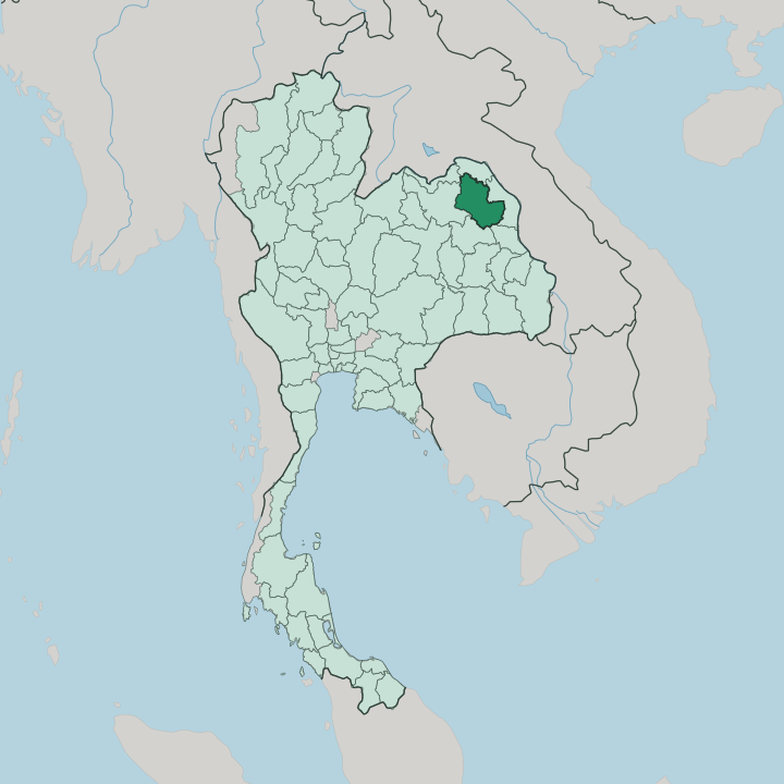


Towns & cities in Changwat Sakon Nakhon
Pick a town or city — each links to where to stay.
Most travellers base in the city. Sakon Nakhon sits on the western shore of Nong Han, a short walk from Wat Phra That Choeng Chum and the Indigo Fabric Road, and it holds most of the province's beds. Northwest of the lake lies Phanna Nikhom, the Phu Thai weaving district where the indigo is dyed.
The wooded Phu Phan Mountains fill the south. Around Phu Phan National Park the settlements thin out, giving way to forest monasteries, waterfalls, and quiet reservoirs. Pick the city for temples; take to the hills for the forest.
About Changwat Sakon Nakhon
What is Changwat Sakon Nakhon known for?
The province is Thailand's home of natural indigo. Weavers here dye cotton with fermented khram leaves, and the deep blue cloth sold along the Indigo Fabric Road below Wat Phra That Choeng Chum has become the emblem of Sakon Nakhon. It is equally a place of monks.
The Thai Forest Tradition of meditation took root in these hills, and Ajahn Mun spent his last years at the forest monastery of Wat Pa Ban Nong Phue before dying at Wat Pa Sutthawat on the edge of the town. Water and mountain frame the rest. Nong Han spreads across the middle of the province, and the wooded ridge of the Phu Phan Mountains closes off the south.
Where is Changwat Sakon Nakhon?
Sakon Nakhon lies in the upper northeast of Thailand, deep in the Isan region on the Khorat Plateau. Six neighbours wrap around Sakon Nakhon, Nong Khai and Bueng Kan to the north through to Udon Thani in the west. Nong Khai and Bueng Kan sit to the north, Nakhon Phanom to the east, Mukdahan to the southeast, Kalasin to the south, and Udon Thani to the west.
The land is a broad basin tilted toward its own lake. Nong Han, the largest natural body of fresh water in northeastern Thailand, spreads across the middle of the province, fed by streams off the surrounding high ground. To the south the plateau lifts into the Phu Phan Mountains, a long wooded range that walls the province off from Kalasin and carries its highest ground.
The Nam Pung rises in those hills and runs down into the lake. Water leaves Nong Han by a single outlet, the Huai Nam Khan, which threads southeast to join the Mekong on the Laos frontier. The great river never touches Sakon Nakhon directly, yet it drains almost all of it.
Rice paddies and low forest fill the flats between lake and ridge. It is farming country, ringed by hills.
What is Changwat Sakon Nakhon like?
Culture here runs to indigo and quiet devotion. Sakon Nakhon is the acknowledged home of Thai natural indigo, and the craft of fermenting khram leaves into blue dye passes down through the weaving households of Phanna Nikhom and the villages around it. Much of that skill belongs to the Phu Thai, one of several Lao-speaking peoples who crossed from the far bank of the Mekong and settled the plateau generations ago.
Everyday speech is Isan, the Lao dialect of the northeast, though school and government run in Thai. The province is also holy ground for Thai Buddhism. The forest meditation tradition of the northeast grew up in these woods, and Ajahn Mun, its great teacher, ended his life at a monastery on the edge of the town.
Pilgrims still come. Wat Phra That Choeng Chum, a white Lao-style stupa raised over an older Khmer shrine, stands at the heart of the old town and appears on the provincial seal. Once a year, at the close of the rains retreat, villages carve towering castles of beeswax and parade them to the temples while long boats race on Nong Han.
Faith, cloth, and water hold it together.
What is the history of Changwat Sakon Nakhon?
The name translates roughly as city of cities, a compound of the Sanskrit words for whole and town. A settlement has stood by the lake for a long time. Khmer builders raised shrines by the lake around the 11th century, and the older prang beneath Wat Phra That Choeng Chum survives from that distant age.
Later the country passed under the Lao kingdom of Lan Xang, whose culture still marks the province. The modern name is younger. King Rama III styled the town Sakhon Thawapi in 1830 before it settled into its modern name.
What is the climate of Changwat Sakon Nakhon?
Three seasons divide the year here. The climate is tropical savanna, and the calendar turns on the monsoon rather than on heat and cold. Rain arrives from the southwest and falls heaviest between May and October, when storms roll off the Phu Phan Mountains and Nong Han brims to its reed beds.
A cool, dry spell follows from November into February, the pleasantest stretch for travel, with mornings that turn genuinely chilly on the higher ground. Then the heat builds. March and April run hot and hazy before the rains come back.
How do you get to Changwat Sakon Nakhon?
Most travellers fly. Sakon Nakhon Airport takes daily flights from Bangkok, and the hop across the country takes about an hour. There is no railway into the province; the nearest line runs through Udon Thani to the west, where trains from Bangkok terminate before the last leg by road.
Buses and vans stitch the town to the rest of Isan and to the Mekong border towns in Nakhon Phanom, where crossings lead over into Laos. By car it is a long haul up from the central plains, most of a day on the road.
Good for
Updated July 2026