Thailand
Changwat Trang, Thailand — Towns & Travel Guide


Changwat Trang lines the Andaman Sea coast of southern Thailand, its shore fronting islands of limestone karst and dugong seagrass.
About Changwat Trang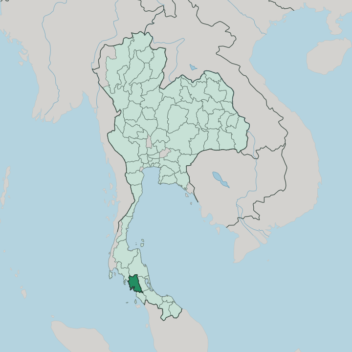


Towns & cities in Changwat Trang
Pick a town or city — each links to where to stay.
Most trips start in Trang town. The capital sits inland, a rail terminus where the Hokkien coffee shops pour kopi and steam dim sum before the morning minivans run out to the piers. Then comes the water.
Ko Muk hides the Emerald Cave, Ko Kradan keeps the clearest snorkelling reef, and Ko Libong grazes its dugongs over eastern seagrass beds. Base yourself in town for a first night, then choose an island for the sea.
About Changwat Trang
Trang is the quiet end of Andaman Thailand.
What is Changwat Trang known for?
The province fronts the Trang Archipelago, where Ko Libong shelters dugongs in its seagrass meadows and Ko Kradan draws snorkellers to shallow reef. Inland, the story is rubber. Trang was the first place in Thailand where rubber trees were planted, and the crop still shapes its hills and its wealth.
Breakfast is the other signature: dim sum and crisp roast pork in the Hokkien coffee shops of the old town.
Where is Changwat Trang?
Trang lies on the Andaman coast of southern Thailand, on the western flank of the Malay Peninsula. The sea is its whole western edge. Krabi wraps around the north, Nakhon Si Thammarat touches the north-east, Phatthalung sits inland to the east behind a wall of hills, and Satun continues the coast to the south toward the Malaysian border. That inland wall is the Banthat range.
Two rivers drain those hills. The Trang River rises in the Khao Luang highlands to the north and meets the sea at Kantang, once the province's main port and capital. The Palian River drains the southern hills.
Offshore, the coast breaks into the Trang Archipelago, a scatter of 46 islands where Ko Libong and Ko Kradan lie among the largest. The Andaman Sea washes all of that shore, part of the Indian Ocean between the peninsula and the Andaman Islands. Its islands are limestone, their cliffs rising straight from clear water.
Little of the land is flat. Rubber-planted hills fill most of the interior, with the plains pinched into a narrow belt between the mountains and the shore.
What is Changwat Trang like?
Trang eats like nowhere else in Thailand. Waves of Hokkien and Teochew Chinese arrived through the port at Kantang with the rubber trade, and their kitchens set the rhythm of the day here. Breakfast is dim sum with kopi.
The province's signature dish is mu yang, roast pork lacquered crisp and eaten with the sweet coffee, while charcoal-baked Trang cake goes home in paper bags. Kopitiam and shophouse stand side by side in the old town. Rubber money built those two-storey shophouses, and the wealth still shows in the town's temples and clan halls.
The mix runs deeper than food. Southern Thai Buddhists, Peranakan families of mixed Chinese and Malay descent, Muslim fishing villages along the south, and sea-nomad communities on the islands all share the province. Their calendars overlap.
The Vegetarian Festival turns the streets white each autumn, boats carry Buddha images in the Chak Phra procession, and couples exchange vows underwater off the reef islands. Cotton weaving carries on in villages such as Na Muen Si. Thai is the common tongue, layered with a broad southern dialect and, in the coffee shops, a little lingering Hokkien.
What is the history of Changwat Trang?
Trang is an old landfall. Its name comes from a Malay word for the light of dawn, the hour when trading ships from the strait first raised this coast. The land passed through the Srivijaya realm and the Kedah Sultanate before coming firmly under Siam.
Governor Phraya Ratsadanupradit moved the capital down to the port at Kantang and, in 1899, planted the first rubber trees grown in Thailand. Flooding forced one last move: in 1916 King Rama VI shifted the town inland to where it stands.
What is the climate of Changwat Trang?
Trang runs on the monsoon. The southwest monsoon drives rain and rough water onto the Andaman Sea from about May to October, when many island boats stop running. Drier months, roughly November to April, bring calm seas and the province's travel season.
Heat holds all year. The Banthat mountains along the Phatthalung border catch the eastbound clouds, so the inland hills stay wetter and greener than the narrow coastal plain.
How do you get to Changwat Trang?
Most arrivals come by air or rail. Trang Airport sits just outside the provincial capital, a short hop from Bangkok, while the southern railway runs all the way down from the capital to end at Kantang on the coast. Long-haul buses grind south from Bangkok too.
From Trang town, minivans shuttle out to the piers at Pak Meng and Kantang, where longtails and ferries cross to Ko Muk, Ko Kradan, and Ko Libong. Krabi lies just up the road to the north.
Good for
Updated July 2026