United States
Arkansas, United States — Towns & Travel Guide


Arkansas is a landlocked Southern state where the Ozark and Ouachita highlands drop east to the flat farm country of the Mississippi Delta.
Find your area →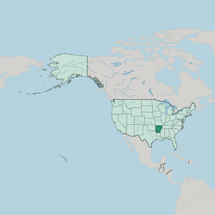
Towns & cities in Arkansas
Pick a town or city — each links to where to stay.
 United States
Little Rock
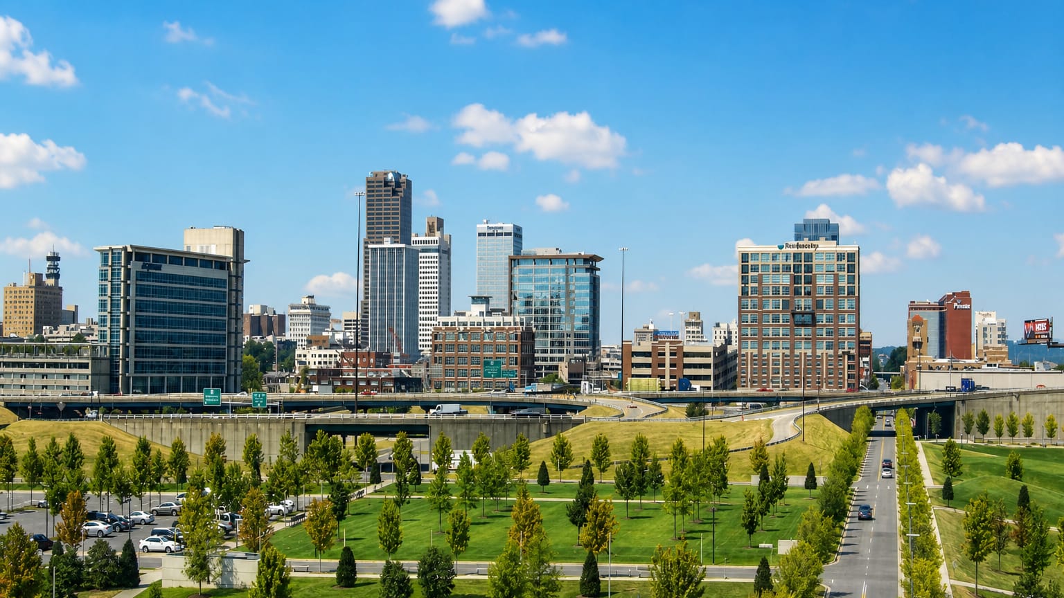
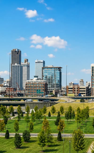
Little Rock is the capital of Arkansas, a river city settled in 1821 whose downtown carries the Clinton Presidential Center and the domed Old State House.Where to stay →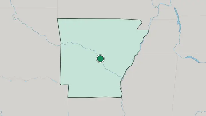
About Arkansas
Arkansas calls itself the Natural State.
What is Arkansas known for?
Its signature ground is wild: the Ozark highlands in the north, the pine-clad Ouachita Mountains in the west, and the Buffalo National River, set aside in 1972 as the first federally protected river in the country. Hot Springs built a resort town around its steaming mineral baths. Bentonville, in the far northwest, anchors the corporate world of Walmart and the galleries of the Crystal Bridges Museum of American Art.
Eastward, the Delta flattens into blues country and rice fields.
Where is Arkansas?
Arkansas is landlocked. It sits in the West South Central corner of the American South, bordered by Missouri to the north, Tennessee and Mississippi across the river to the east, Louisiana to the south, Texas to the southwest, and Oklahoma to the west. The Mississippi River draws the entire eastern boundary, separating the state from Tennessee and Mississippi.
Two upland ranges define the western half. The Ozark Plateau rises across the north, its Boston Mountains and Springfield Plateau cut by clear rivers, while the older Ouachita Mountains run in long east-west ridges of pine through the west. Between the two ranges, the Arkansas River Valley opens a broad trough that carries the river past Fort Smith and Little Rock.
The highest ground stands at Mount Magazine, above the river valley in the west. East of the valley, the land falls. The eastern third belongs to the Mississippi Alluvial Plain, the flat, dark-soiled Delta whose only relief is Crowley's Ridge, a narrow band of windblown loess running north to south.
The White River and the Arkansas River both cross this lowland toward the Mississippi. Water shaped all of it.
What is Arkansas like?
Arkansas lives outdoors. Float trips down the Buffalo National River, bass fishing on the big reservoirs, and deer hunting in the Ozark and Ouachita forests are woven into the calendar as much as any city pastime. Music runs just as deep, and it splits along the same geography.
The Delta towns of the east, above all Helena, gave the blues a home, while the Ozark hills kept old-time string bands and folk song alive. Two names loom over both. Johnny Cash was born at Kingsland and came up in the cotton fields of the Delta colony at Dyess, while Bill Clinton rose from Hope and Hot Springs to the governor's office in Little Rock.
Rice and soybeans fill the eastern fields; poultry drives the northwest. That same northwest corner, around Bentonville, turned Walmart money into the Crystal Bridges Museum of American Art. Football colours much of autumn.
The Razorbacks of the University of Arkansas, up in Fayetteville, pull Saturday crowds from every corner of the state. At Murfreesboro, visitors dig for real diamonds and keep what they find in the plowed field of Crater of Diamonds State Park. Barbecue and Delta tamales anchor the table.
What is the history of Arkansas?
The state takes its name from the Osage word for the Quapaw people, who farmed the lower Arkansas River when the French arrived. French traders founded Arkansas Post near its mouth in 1686. The land changed hands twice.
The Louisiana Purchase brought it under the United States in 1803, a separate Arkansas Territory followed in 1819, and statehood came in 1836 as the twenty-fifth state. Cotton and slavery took hold in the lowland south and east, and Arkansas joined the Confederacy in 1861.
What is the climate of Arkansas?
Arkansas has a humid subtropical climate. Summers turn hot and sticky across the whole state, with afternoon thunderstorms rolling over the Delta and the river valleys through the long growing season. Winters stay mild in the south but bite harder up in the Ozark and Ouachita highlands.
Rain falls all year. Spring brings the sharpest weather, when the state sits in the path of the tornadoes that sweep the lower Mississippi valley.
How do you get to Arkansas?
Most visitors reach Arkansas by air through Clinton National Airport at Little Rock, the busiest field in the state. A second airport, Northwest Arkansas National, serves the Bentonville and Fayetteville corner beside the Ozarks. Many arrive by road.
Interstate 40 crosses the state from east to west through Fort Smith and Little Rock, Interstate 30 runs southwest toward Texas, and a north-south corridor climbs through the Ozarks into Missouri. Amtrak's Texas Eagle also stops at Little Rock on its run between Chicago and Texas.
Common questions
What is the best area to stay in Arkansas?
Little Rock: getting your bearings across Arkansas.
Good for
Updated July 2026