United States
Montana, United States — Towns & Travel Guide


Montana is a vast northwestern state where the northern Rocky Mountains break down onto the Great Plains, the fourth largest in the United States.
Find your area →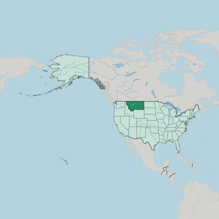
Towns & cities in Montana
Pick a town or city — each links to where to stay.
 United States
Billings
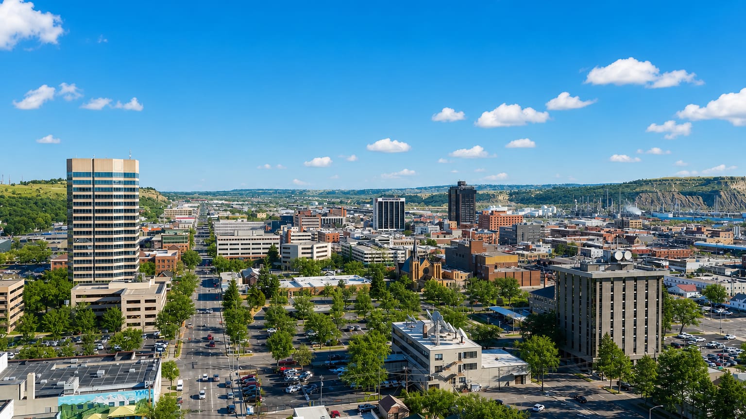
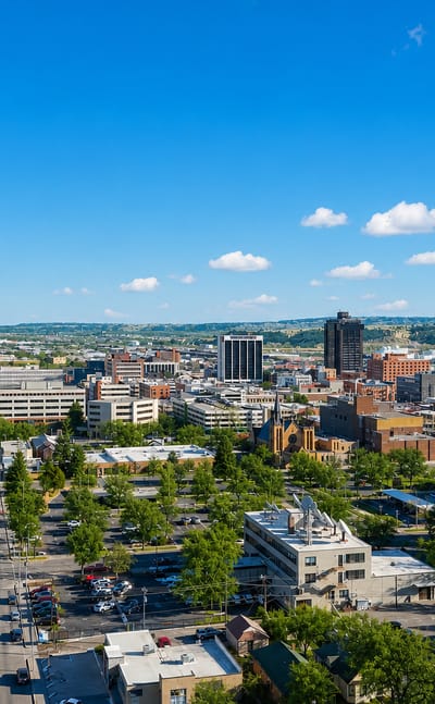
Sandstone rims edge the plains at Billings, the largest city in Montana, known for the Moss Mansion and the Yellowstone Art Museum.Where to stay →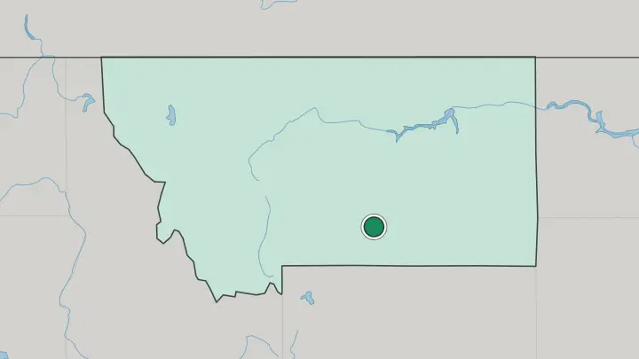
About Montana
What is Montana known for?
Two of the country's great national parks anchor Montana. Glacier National Park guards the Canadian border in the northwest, its peaks carved by ice into knife-edged ridges, while Yellowstone National Park pushes up against the state's southern edge. Between them runs the Continental Divide, the spine that sorts every river toward one ocean or another.
The rest is space. Cattle ranches, trout rivers, and wheat country fill the plains east of the mountains, and the sky overhead gives the state its old nickname, Big Sky Country.
Where is Montana?
Montana is the fourth largest state in the United States, and only Alaska, Texas, and California cover more ground. It fills the northwestern corner of the country. Canada runs along the entire northern edge, where three provinces, British Columbia, Alberta, and Saskatchewan, meet the state line. Idaho wraps the west and southwest, Wyoming lies to the south, and the two Dakotas square off the eastern side.
The land splits in two. The western half is mountain country, where the northern Rocky Mountains stack up in more than a hundred named ranges, with deep forest and glacial valleys among them. Ranges rise on both sides of the Continental Divide, which threads through the high country rather than walling the mountains off from the plains.
Granite Peak, the state's highest summit, stands well east of the Divide in the Beartooth Range. Eastward the ground opens into the Great Plains, a sweep of wheat, rangeland, and eroded badlands that runs to the horizon. What the Divide truly parts is the water.
Montana is the only state whose rivers drain to three separate watersheds, sending water to the Pacific, to Hudson Bay, and down the Missouri River toward the Gulf of Mexico. The Missouri itself gathers near Three Forks, where the Jefferson, Madison, and Gallatin rivers join. The Yellowstone River drains the southeast.
Glacier National Park crowns the northwest, and Yellowstone National Park spills over the southern boundary.
What is Montana like?
Space defines the culture as much as anything people built. Montana carries the nickname Big Sky Country, and the ranching life that filled the open range still shapes how the state sees itself. Cattle outfits, county fairs, and summer rodeos remain ordinary events rather than shows for visitors.
The cowboy artist Charlie Russell settled in Great Falls after years wrangling on the open range, and his canvases of the vanishing frontier hang in the museum that carries his name. Long before any of that, the plains and mountains belonged to Native nations who are still here. The Crow, the Blackfeet, and the Northern Cheyenne hold reservations across the state, and gatherings like Crow Fair fill the summer with drumming, dancing, and horseback processions.
Rivers run through the culture too. Fly fishing on cold trout water is close to a state religion, and the story that fixed that image in the wider world, Norman Maclean's account of the Blackfoot, was set in the hills above Missoula. The University of Montana there keeps a strong literary streak alive.
What ties it together is a taste for room to move, and Montanans guard their independence and their open country with equal stubbornness.
What is the history of Montana?
People have lived here for thousands of years, and the Crow, Blackfeet, and other nations held the land long before any map named it. The Lewis and Clark expedition crossed the region in 1805 on its way west. Prospectors followed the beaver trappers, and gold and silver strikes handed the state its Treasure State nickname.
Butte grew richest of all, a copper city that called itself the Richest Hill on Earth. Blood was spilled as well. In 1876 the Battle of the Little Bighorn played out on the southeastern plains, one of the last Native victories of the Plains wars.
Montana entered the Union in 1889 as the forty-first state.
What is the climate of Montana?
The Continental Divide splits the weather as cleanly as it splits the rivers. West of it, Pacific air brings milder winters, cooler summers, and rain spread through the year, and the high ranges pile up deep snow. East of the mountains the plains turn continental and dry, with hot summers, hard winters, and temperatures that can swing wildly inside a single day.
Winters bite. When the chinook winds pour down off the Rockies, they can lift a frozen afternoon well above freezing within an hour, melting snow across the eastern grasslands before the cold slides back.
How do you get to Montana?
Most visitors arrive by air, then drive, because the distances between sights are long and public transport is thin. Bozeman Yellowstone International Airport is the busiest gate, handy for Yellowstone and the Big Sky slopes. Billings, Missoula, and Helena all take direct flights too, and Glacier Park International near Kalispell is the closest landing for Glacier National Park.
There is one train. Amtrak's Empire Builder threads the northern Hi-Line, stopping at Whitefish and a string of prairie towns on its run between Chicago and the coast. Once on the ground, a rental car is all but essential.
Common questions
What is the best area to stay in Montana?
Billings: the eastern plains and the Little Bighorn battlefield.
Good for
Updated July 2026