Vietnam
Khanh Hoa, Vietnam — Towns & Travel Guide


Khánh Hòa is a coastal province on the south-central shore of Vietnam, its beaches, bays and Cham towers centred on the resort city of Nha Trang.
Find your area →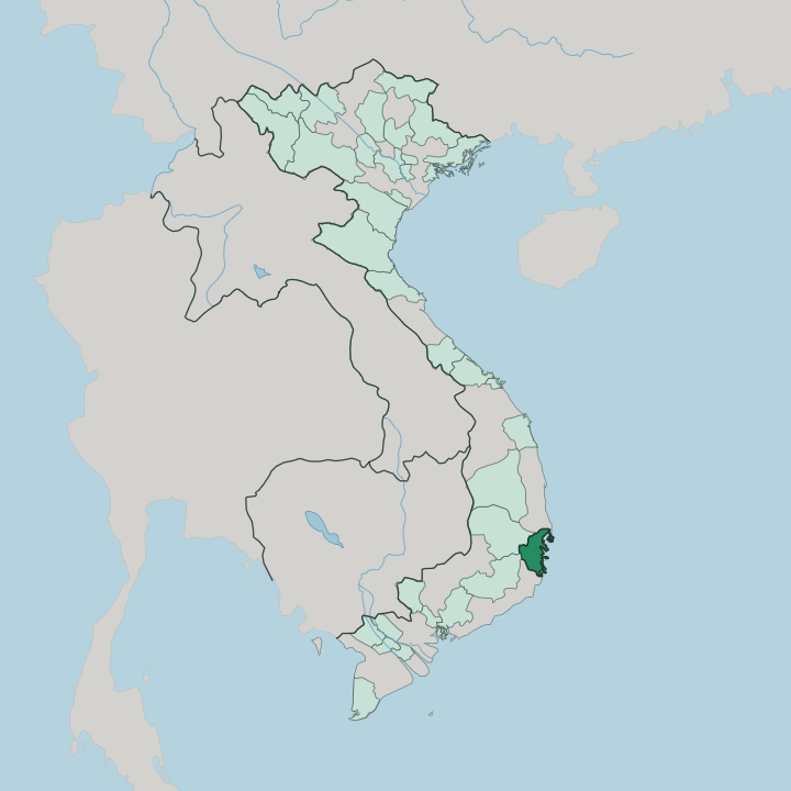


Towns & cities in Khanh Hoa
Pick a town or city — each links to where to stay.
 Vietnam
Nha Trang
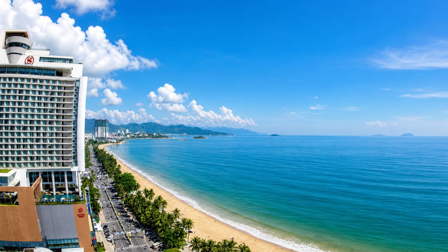
Long beaches curve along the sea at Nha Trang, a coastal resort city in Khánh Hòa on the South Central Coast of Vietnam, known for its diving.Where to stay →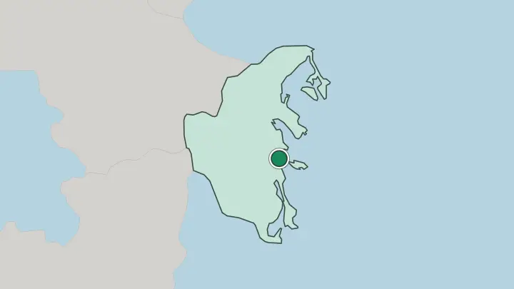
About Khanh Hoa
Nha Trang is the draw.
What is Khanh Hoa known for?
The province wraps around Nha Trang Bay, a broad sweep of the South China Sea studded with offshore islands that has made this stretch Vietnam's best-known beach coast. Diving, island-hopping and the Po Nagar towers built by the Cham above the Cái River give the city its shape. Cam Ranh Bay lies to the south, its long Bãi Dài shore lined with resorts.
Warm water runs the length of it.
Where is Khanh Hoa?
Khánh Hòa runs along Vietnam's south-central coast. It faces the South China Sea to the east, and climbs inland to meet Đắk Lắk in the northwest and Lâm Đồng in the southwest. The coastline is long.
It runs south for hundreds of kilometres from the headland at Đại Lãnh, folding into creek mouths, lagoons and more than two hundred islands and islets along the way. Behind the shore the land rises fast into mountains that run the length of the interior, their spurs reaching down close to the sea. The highest point, Vọng Phu, rises over two kilometres on the Đắk Lắk border.
Three great bays notch this coast. Vân Phong lies to the north, Nha Trang Bay in the middle, and the deep, near-landlocked harbour of Cam Ranh Bay just south of the city. Flat ground is scarce here.
A broad lowland spreads around Ninh Hòa in the north. The Cái River threads through Nha Trang itself, dividing the old quarter from the beach and passing below the Po Nagar hill. Hanoi lies far up the coast; Ho Chi Minh City is the closer of Vietnam's big cities, off to the southwest.
What is Khanh Hoa like?
The Cham left the deepest mark. Their brick towers at Po Nagar still stand above the Cái River, and the goddess honoured there, Thiên Y Thánh Mẫu, is still worshipped at the spring Tháp Bà festival that draws pilgrims up the hill. Fishing shapes the rest.
Coastal villages keep the Cầu Ngư rite, a whale-worship ceremony that asks the sea for a safe return and good catches. Old Cham names cling to the land, to rivers and hills and the towers themselves. Seafood runs through every meal.
Food carries strong local names. Nha Trang is known for bún sứa, a clear noodle soup thickened with jellyfish, while the town of Ninh Hòa gives its name to nem nướng, grilled pork rolled at the table in rice paper with herbs. Out on the islands, salanganes build the edible nests that make the province Vietnam's centre for bird's-nest harvesting, a trade guarded since the Cham.
The common tongue is Vietnamese. Along the shore, tourism is its own culture of dive boats, beachfront cafés and cable cars strung out to the islands. The sea sets the rhythm of it all.
What is the history of Khanh Hoa?
For centuries this coast was Kauthara, a southern seat of the Cham kingdom of Champa. A temple stele records that King Satyavarman restored the Po Nagar sanctuary here in 781, after raiders had wrecked it. Champa held on until Vietnam pushed south.
Nguyễn lords annexed Kauthara in 1653, and under the emperor Minh Mạng the province took its lasting name, Khánh Hòa, in 1832, drawing the old Cham land fully into Vietnam. The towers outlived the kingdom that raised them.
What is the climate of Khanh Hoa?
Khánh Hòa runs hot and mostly dry. Warm sea air holds temperatures in a narrow band through the year, and the mountains behind the coast shield Nha Trang from much of the rain that soaks central Vietnam. The long dry spell stretches from about January into August, bright and sun-filled.
Then the northeast monsoon turns the weather around. Most of the year's rain falls in a short, heavy burst from September to December, when storms can push in off the South China Sea. The water stays warm regardless.
How do you get to Khanh Hoa?
Cam Ranh International Airport is the way in for most. It sits south of Nha Trang, near the shore of Cam Ranh Bay, and handles domestic flights alongside international routes. Trains are the scenic alternative.
The North-South Railway threads down the coast and stops at Nha Trang, roughly a day out from Hanoi and a night from Ho Chi Minh City. National Highway 1 carries the buses and cars along the same coastal line. From the airport it is a short run north into the city.
Common questions
What is the best area to stay in Khanh Hoa?
Nha Trang: a first visit to Khánh Hòa.
Good for
Updated July 2026