Vietnam
Tỉnh Lạng Sơn, Vietnam — Towns & Travel Guide


Lạng Sơn is a limestone border province in northeastern Vietnam, its Friendship Pass the main overland gate between Hanoi and China.
About Tỉnh Lạng Sơn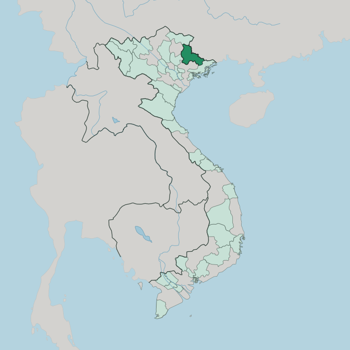


Towns & cities in Tỉnh Lạng Sơn
Pick a town or city — each links to where to stay.
Most stay in Lạng Sơn city. The city sits on both banks of the Kỳ Cùng River, close to Kỳ Lừa market and the hillside cave-temples, and it makes the easiest base for reaching the border or the mountains. Đồng Đăng puts you at the Friendship Pass for a morning crossing into China. Mẫu Sơn trades the heat for pine forest and Dao villages.
Homestays wait in the Tày and Nùng valleys.
About Tỉnh Lạng Sơn
Trade defines Lạng Sơn.
What is Tỉnh Lạng Sơn known for?
The province holds Vietnam's busiest overland crossing into China, the Friendship Pass above the town of Đồng Đăng, where trucks and traders have moved goods between Hanoi and Guangxi for generations. Karst caves riddle the hills around Lạng Sơn city, and the Kỳ Cùng River loops through its centre. Higher up, the pine slopes of Mẫu Sơn stay cool when the lowlands swelter.
Tày and Nùng villages fill the valleys.
Where is Tỉnh Lạng Sơn?
Lạng Sơn is border country. It fills the northeastern corner of Vietnam, a jumble of karst limestone hills and narrow valleys that press against Guangxi along a border running for 231 mountainous kilometres. Forested ridges cover most of the province, and flat ground is rare.
The Mẫu Sơn massif rises in the east, its pine ridges cold enough for winter frost. Star anise orchards scent the hillsides. Southwest of the main city, the Chi Lăng pass narrows the road to a defile between limestone walls.
The southern lowlands around Hữu Lũng lie lower and warmer. Its defining feature is the Kỳ Cùng, the only large river in northern Vietnam that runs the wrong way, flowing northwest across the frontier into China rather than south toward the sea. On the far side it joins the Zuo River and drains into the Pearl River basin.
The river slides through the middle of Lạng Sơn city before turning for the border at Đồng Đăng. Beyond it stands Pingxiang, in China. That single corridor, funnelling road and rail from Hanoi up to the Friendship Pass, has shaped the province more than any peak.
What is Tỉnh Lạng Sơn like?
This is Tày and Nùng country. Those two upland peoples outnumber the Kinh majority across most of the province, and their stilt houses, terraced fields and Central Tai speech set the tone of daily life here. Vietnamese is the official language, but Tày and Nùng are heard in every market.
Those markets are the social heart. At the Kỳ Lừa fair, Tày and Nùng singers trade improvised hát sli and hát lượn verses back and forth across the crowd. Kỳ Lừa itself has drawn traders since the seventeenth century, when merchants from Guangxi crossed to barter cloth, salt and forest goods.
Sunday brings farmers down from the hills to sell buffalo, herbs and rice spirit. Ritual matters too. The Then practice of the Tày and Nùng, sung prayers carried over a plucked lute, is listed by UNESCO as intangible heritage.
Dao communities keep their own new-year rites up on Mẫu Sơn. The table is border cooking at its richest. Đồng Đăng is known across Vietnam for roast suckling pig, and Lạng Sơn kitchens turn out roast duck, sour phở chua and slow-braised khâu nhục. Star anise flavours much of it.
What is the history of Tỉnh Lạng Sơn?
Armies came this way. For centuries the passes of Lạng Sơn carried every overland assault from China toward the Vietnamese capital, and holding them meant holding the northern door to the whole country. In 1427 Lê Lợi's rebels ambushed and destroyed a Ming relief army in the defile at Chi Lăng.
That victory helped end Chinese rule. Much later, in 1979, Chinese troops crossed at Đồng Đăng and fought street by street through Lạng Sơn city.
What is the climate of Tỉnh Lạng Sơn?
Winters here bite. High and far north, Lạng Sơn runs cooler than most of Vietnam, and the northeast monsoon drags cold, dry air down off the Chinese hills from November onward. Frost settles on Mẫu Sơn, and in the coldest snaps the peak has seen ice and rare snow.
Spring turns warm and misty. Summer is the wet season, when the monsoon soaks the karst and swells the Kỳ Cùng.
How do you get to Tỉnh Lạng Sơn?
Most travellers come up from Hanoi. The province has no airport of its own, so arrivals fly into Hanoi and then drive the expressway north, a run of a few hours through Bắc Giang to the edge of the hills. A railway also climbs from Hanoi to Đồng Đăng, the last station before China.
There the line reaches the Friendship Pass crossing. Through-trains cross into Pingxiang and run on to Nanning and Beijing.
Good for
Updated July 2026