Argentina
Jujuy Province, Argentina — Towns & Travel Guide


Jujuy is Argentina's high-Andean northwest corner, where the Quebrada de Humahuaca climbs from red canyon towns to salt-white puna.
About Jujuy Province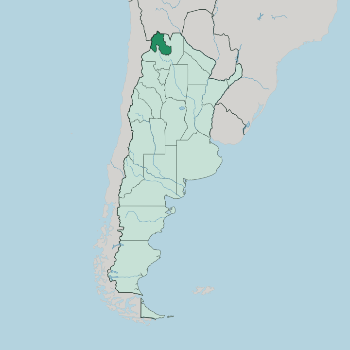
Towns & cities in Jujuy Province
Pick a town or city — each links to where to stay.
Base yourself in the Quebrada, not the capital. San Salvador de Jujuy is the province's transport hub and largest city, but most travellers push straight up the Río Grande valley to sleep among the painted hills. Tilcara sits at the geographic middle of the canyon, an even drive to Purmamarca one way and Humahuaca the other, which makes it the natural home base for exploring the whole valley.
Purmamarca suits anyone who wants the Cerro de los Siete Colores from the window and the Salinas Grandes as a morning run over the Lipán pass. The capital is for logistics. Stay there only for a late flight or an early bus.
About Jujuy Province
One canyon carries almost the whole draw.
What is Jujuy Province known for?
The Quebrada de Humahuaca cuts north-south through banded rock, and its villages, Purmamarca under the Cerro de los Siete Colores, Tilcara with its hilltop pucará, Humahuaca itself, are why travellers come. West of the canyon the land flattens into the Salinas Grandes, a blinding salt flat on the puna. Add the Andes on the Chile and Bolivia borders and the subtropical Yungas dropping away east, and a single province holds four landscapes at once.
Where is Jujuy Province?
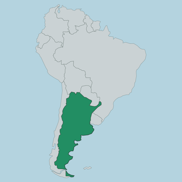
Jujuy occupies the extreme northwest of Argentina, wedged against Bolivia to the north and Chile to the west, with Salta Province wrapping its southern and eastern flanks. It is a small province by Argentine measure but a steep one. The land rises from east to west in three great steps.
In the far west spreads the Puna de Atacama, a high plateau above three thousand metres where the Salinas Grandes lies white and flat between distant volcanic peaks. Between plateau and lowland runs the Quebrada de Humahuaca, the canyon that the Río Grande has cut north to south through rock striped in ochre, rust and green. The river gives the canyon its spine, dry and stony in winter and running full in the summer rains.
East of the canyon the Andes break down into the Sierras Subandinas, and behind those ridges the land plunges into the Yungas, humid subtropical forest that could not look less like the salt desert an hour's drive west. The provincial capital, San Salvador de Jujuy, sits where the Río Grande valley opens toward that greener, lower country. From there the ground climbs steadily toward the Bolivian frontier at La Quiaca.
Four worlds crowd into one border province. That vertical range, from cloud forest to salt pan, is the single fact that explains everything else about the place.
What is Jujuy Province like?
Jujuy feels closer to the Andes than to the rest of Argentina. Its culture is Andean first. The Kolla and other indigenous communities of the Quebrada de Humahuaca kept their languages, their weaving and their reverence for Pachamama, the earth mother whom August offerings still honour with food buried in the ground.
Quechua words thread through local Spanish. Across the canyon villages the coplas still sound. These short rhymed verses, sung to a hand drum called the caja, carry courtship and mourning and mockery in the same breath.
Carnival is the year's loudest event. For a week before Lent the towns of the Quebrada de Humahuaca unearth the diablo from a mound, drench everyone in flour and streamers, and dance the erke and the charango until the figure is buried again. The food follows the altitude.
Llama and quinoa, corn humita steamed in its husk, empanadas and the thin flatbread tortilla come off griddles in Purmamarca and Tilcara, where craft stalls around the plaza sell the region's dense wool. This is a province that looks up the mountains toward Bolivia as readily as south toward Buenos Aires. That double gaze, half Argentine and half Andean, is what a visitor feels first.
What is the history of Jujuy Province?
People held this ground early. Long before the Spanish, the Omaguaca peoples farmed and fortified the Quebrada de Humahuaca, and the ruins at Tilcara's pucará still guard the valley. The Inca absorbed the canyon in the late fifteenth century, running their road down it toward the mines of the south.
Spanish San Salvador de Jujuy was founded in 1593, third time lucky after two earlier settlements failed. The independence wars scarred the province hardest of all: in 1812 General Manuel Belgrano ordered the whole population to abandon Jujuy and burn everything behind them, the scorched-earth retreat that Jujeños still commemorate as the Éxodo. Jujuy split from Salta Province to govern itself in 1834.
What is the climate of Jujuy Province?
Altitude writes the weather here, not season. On the Puna de Atacama and up the Quebrada de Humahuaca the air is dry and thin, brilliantly sunny by day and bitterly cold once the sun drops behind the ridge, the swing between noon and midnight can be enormous. Rain, when it comes, falls in the summer months from roughly December to March, turning the Río Grande from a dry stony bed into a real river and briefly greening the canyon.
Down in the eastern Yungas the pattern flips to warm and humid, the wettest corner of the province. Winter is cold, clear and dependable, which is why most travellers come between April and October.
How do you get to Jujuy Province?
Air is the fast way in. Most visitors fly into Horacio Guzmán International Airport outside San Salvador de Jujuy, an hour and a half from Buenos Aires and a short drive from the capital. From the terminal one highway threads up the Río Grande valley into the Quebrada de Humahuaca, linking Purmamarca, Tilcara and Humahuaca in turn.
Long-distance buses cross the plateau to the Bolivian border at La Quiaca and over the Andes toward Chile. Others arrive overland from neighbouring Salta Province, an easy half-day by road.
Updated July 2026