Argentina
Santa Cruz Province, Argentina — Towns & Travel Guide


Santa Cruz spreads across Argentina's far south, the Patagonian province of the Perito Moreno Glacier and the granite towers of Mount Fitz Roy.
About Santa Cruz Province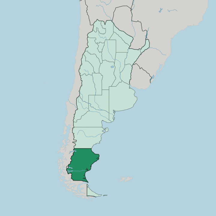
Towns & cities in Santa Cruz Province
Pick a town or city — each links to where to stay.
El Calafate is the base most travellers pick, a lakeside town on Lago Argentino that runs shuttle buses out to the Perito Moreno Glacier every morning. Trekkers head north instead. El Chaltén sits right under Mount Fitz Roy, and its trailheads start where the last street ends.
Río Gallegos, the capital, anchors the far south near the Atlantic coast and works as an air and road gateway rather than a sightseeing stop. Choose El Calafate to see the ice, El Chaltén to walk the peaks, or Río Gallegos when you are passing through the province's south.
About Santa Cruz Province
Ice defines this province.
What is Santa Cruz Province known for?
Its western edge holds part of the Southern Patagonian Ice Field, and from that vast reserve the Perito Moreno Glacier grinds down to Lago Argentino, calving blue slabs into the water below. Los Glaciares National Park protects both that glacier and the sheer granite spire of Mount Fitz Roy in the north. East of the Andes the land flattens into windswept steppe that runs all the way to the Atlantic coast.
Río Gallegos, the capital, sits down at the southern end.
Where is Santa Cruz Province?
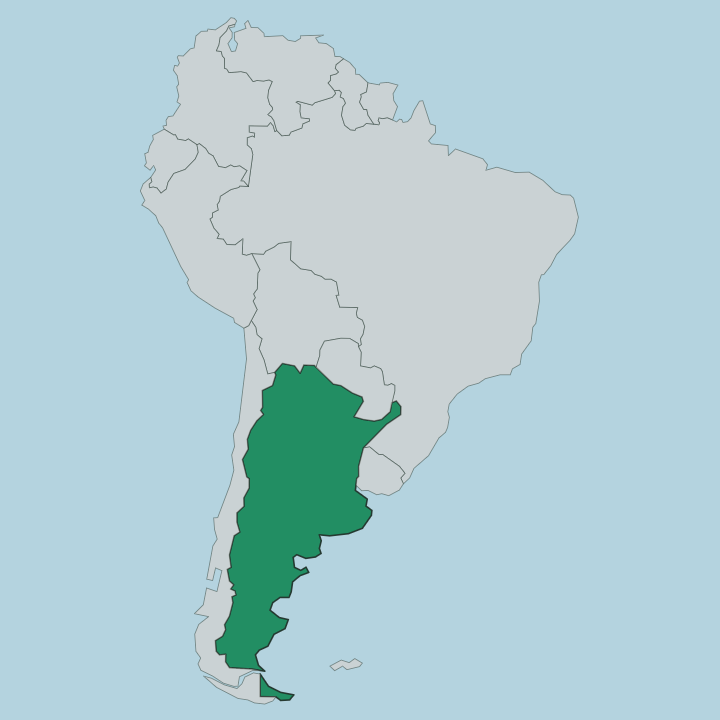
Santa Cruz fills the far south of mainland Argentina, the second-largest province in the country and the emptiest stretch of its Patagonian tail. Chubut Province lies to the north. Chile wraps the western and southern flanks, sharing the crest of the Andes, while the Atlantic Ocean forms the entire eastern shore. The province splits cleanly in two. Along the western border the Andes rise, and part of the Southern Patagonian Ice Field spills across the range into Los Glaciares National Park, feeding the Perito Moreno Glacier and the deep glacial lakes of Lago Argentino and Lake Viedma below it.
East of the mountains the ice gives way to plateau. Dry, treeless tableland runs for hundreds of kilometres toward the coast, cut by the Santa Cruz River, which drains the glacial lakes and flows east to the Atlantic Ocean. This is some of the least peopled land in the country.
The wind never really stops out here. Río Gallegos stands at the southern end near the Atlantic, and one hollow in the steppe, the Laguna del Carbón, drops to the lowest point anywhere in the Western Hemisphere.
What is Santa Cruz Province like?
Life here has always bent to the wind and the distance. The Tehuelche people hunted guanaco across these plains for thousands of years before Europeans came, tracking the herds on foot with the boleadora. Their name for the great peak, Chaltén, still stands beside the mapmakers' Fitz Roy.
When settlers finally arrived it was wool that pulled them in, and the sheep estancia became the shape of rural society across the steppe. Spanish, Scottish, Welsh and Croatian families took up land on holdings so large that neighbours might be a day's ride apart. That ranching world still marks the province.
Lamb roasted slowly over an open fire, the Patagonian asado, is the plate that says home. The old estancias have opened their gates to travellers, trading wool cheques for guest rooms. Río Gallegos grew up as the port that shipped the wool out and now runs the government of the province.
Spanish is the language of daily life. What binds it together is a plain hardiness, the temperament of people who chose to live where the land gives little back easily.
What is the history of Santa Cruz Province?
Ferdinand Magellan sailed into the bay at Puerto San Julián in 1520 and wintered his fleet there, the first European mark on this coast. Real settlement came far later. After the army pushed south in the late nineteenth century the region was organised as the Territory of Santa Cruz, and its capital moved to Río Gallegos in 1888.
Wool drew immigrants, and their labour built the estancias, until a bitter strike over working conditions was crushed by the army in the early 1920s. Santa Cruz was finally granted full status as a province of Argentina in 1955.
What is the climate of Santa Cruz Province?
The wind rules the weather here. Cold, dry and relentless, it tears across the steppe off the Southern Patagonian Ice Field and makes this the windiest corner of Argentina, whipping up dust over the open tableland for much of the year. Winters are long and raw, summers short and cool, with rain scarce east of the Andes and much heavier up on the ice near the Chilean border.
Snow settles on the western ranges. Pack for the gusts before you pack for the cold.
How do you get to Santa Cruz Province?
Most travellers fly straight to El Calafate, whose airport takes daily flights from Buenos Aires and links the town to the Perito Moreno Glacier within a couple of hours. Río Gallegos has the province's other main airport, down near the Atlantic coast. From either town paved roads run north to El Chaltén for the Mount Fitz Roy trails, and buses cross the nearby border into Chile.
Distances out here are long. The steppe swallows the highway between towns.
Good for
Updated July 2026