Brazil
Rondônia, Brazil — Towns & Travel Guide


Rondônia is a Brazilian state in the Amazon, on the Madeira River, with Porto Velho as its capital and main river port.
About Rondônia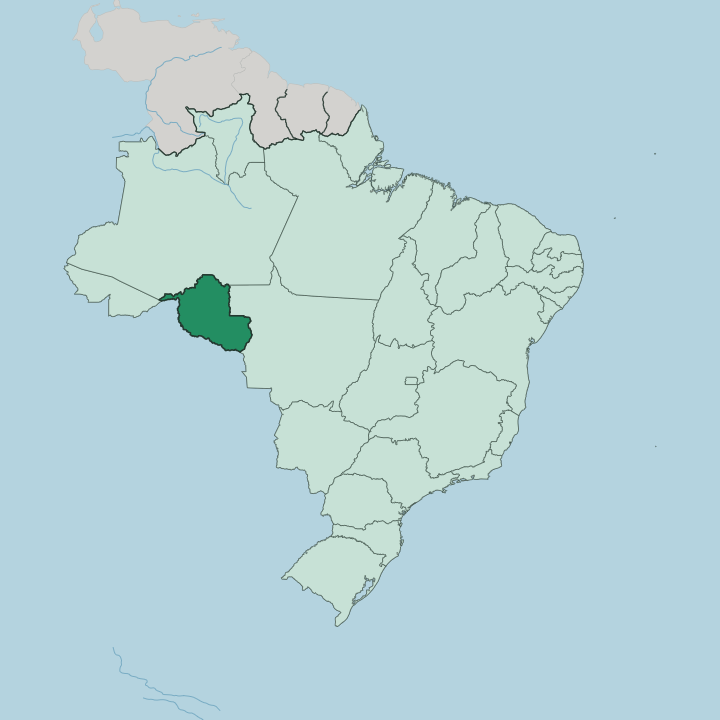
Towns & cities in Rondônia
Pick a town or city — each links to where to stay.
Porto Velho is the obvious first base. The capital sits on the Madeira River and holds the state's main airport, so most trips into Rondônia begin there before heading out along the BR-364. Ji-Paraná breaks the long road at the Ji-Paraná River.
Guajará-Mirim faces Bolivia across the Mamoré, with boat trips onto the border rivers. Choose Porto Velho for beds and connections; go south to the Guaporé Valley for flooded forest and slow river days.
About Rondônia
What is Rondônia known for?
Rondônia is Brazil's Amazon cattle frontier. The Madeira River runs past its capital, Porto Velho, once the terminus of the Madeira-Mamoré railway that crews built through rubber-boom forest between 1907 and 1912 at a brutal cost in lives. Ranches and croplands spread along the BR-364 highway, the road that carried settlers in from the south.
Much of the old forest has fallen to pasture. Cândido Rondon, the army engineer who strung telegraph lines across the region, gave the state its name.
Where is Rondônia?
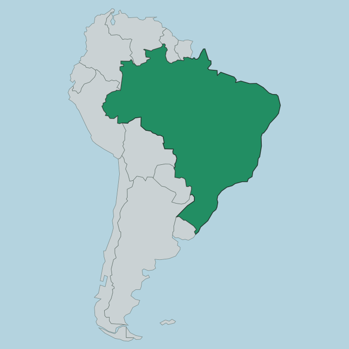
Rondônia sits in Brazil's North Region, deep in the western Amazon basin and far from any coast. Four neighbours ring it. Acre lies to the west, Amazonas to the north, and Mato Grosso to the east, while Bolivia runs along the whole southern edge. That southern border is a river line: the Guaporé and the Mamoré trace it, the former feeding the latter, which meets the Beni downstream to form the Madeira.
The Madeira sweeps north past Porto Velho and on into Amazonas, carrying the state's water toward the trunk of the Amazon. Its name honours Cândido Rondon, the army engineer who mapped this country. The land is mostly low Amazon forest and floodplain, broken by the Pacaás Novos highlands that rise in the interior.
Rivers order everything. The Ji-Paraná, also called the Machado, and the Jamari drain the central plateau northward to the Madeira. Around Porto Velho the Madeira once broke into a long chain of rapids, the barrier that first forced the railway and then the Santo Antônio and Jirau dams.
Forest still holds the far corners and the indigenous reserves. Elsewhere the trees give way to a fishbone of cleared plots fanning off the BR-364, the pasture and cropland that reshaped the state within a single lifetime.
What is Rondônia like?
Rondônia is one of Brazil's youngest societies, assembled within living memory. Two streams made it. Along the rivers live the older peoples, among them the Karitiana near Porto Velho and the Paiter Suruí and Uru-Eu-Wau-Wau of the forest interior, whose reserves still hold much of the standing timber.
The other stream arrived by road: farming families from Paraná, Rio Grande do Sul and Minas Gerais who followed the BR-364 south in search of land. Their arrival gave the towns a southern accent, gaúcho barbecue and Pentecostal churches set down in the Amazon. Cattle and coffee shape daily life more than any monument.
The rubber days survive along the Guaporé and Mamoré, where old tapping trails and telegraph posts recall Rondon's march through the forest. Kitchens mix the two worlds. Fish from the Madeira, tambaqui and tucunaré, share the table with the beef and beans of the settler south, and açaí turns up as it does across the Amazon.
Portuguese is the common tongue, though more than twenty indigenous languages are still spoken in the reserves. Faith runs to the evangelical here as much as the Catholic.
What is the history of Rondônia?
Rondônia's modern story starts with rubber. Between 1907 and 1912 crews laid the Madeira-Mamoré railway around the Madeira's rapids, a line so deadly it earned the name the Devil's Railroad. The federal government carved out the Guaporé Territory in 1943 and renamed it Rondônia in 1956, after Cândido Rondon.
Paving the BR-364 in the following decades opened the forest to settlers from the south, who arrived faster than the land could absorb them. Rondônia was made a full state in 1981.
What is the climate of Rondônia?
Rondônia runs hot and humid all year. The calendar splits in two. From November into April the rains come hard, and the Madeira and its tributaries rise until the forest floor itself lies underwater in places.
May through October is the drier stretch, when the rivers fall and sandbars surface along the Guaporé. Late in that dry spell the sky often hazes over with smoke from fires on the cleared land. Nights stay warm.
How do you get to Rondônia?
For nearly all travellers, reaching Rondônia means a flight into Porto Velho. Porto Velho's Governador Jorge Teixeira de Oliveira airport takes the state's incoming flights, linking it to São Paulo, Brasília and Manaus. By land, the BR-364 is the spine: it runs in from Cuiabá to the east and out toward Rio Branco in Acre to the west, a long haul either way.
Boats still work the Madeira. They run downstream to Manaus. At Guajará-Mirim a river crossing leads over the Mamoré into Bolivia.
Updated July 2026