Brazil
Mato Grosso, Brazil — Towns & Travel Guide


Mato Grosso is a vast Central-West state of Brazil where the Amazon, the Cerrado, and the Pantanal wetlands share one enormous territory.
About Mato Grosso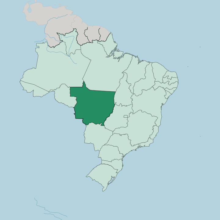
Towns & cities in Mato Grosso
Pick a town or city — each links to where to stay.
Cuiabá is the obvious base. The capital sits at the centre of the state and holds the airport, the highways, and most of the hotels, and nearly every Pantanal or Amazon trip begins there. Chapada dos Guimarães, an hour north, trades city rooms for eco-lodges below its cliffs.
Wildlife lodges lie further out. Poconé opens the Transpantaneira road into the northern Pantanal, while Alta Floresta, far up near the Amazon, is the jumping-off point for the Cristalino forest lodges.
About Mato Grosso
Wildlife is the headline.
What is Mato Grosso known for?
The Pantanal, the world's largest tropical wetland, spreads across the state's south-west and holds the densest jaguar population anywhere on earth, drawing wildlife travellers to the rivers around Porto Jofre each dry season. North of the capital Cuiabá, the sandstone cliffs and waterfalls of Chapada dos Guimarães break the flat interior. Farmland fills the rest.
Soybean and cattle ranches have turned the central Cerrado into one of Brazil's great agricultural frontiers, while the Amazon rainforest closes over the far north.
Where is Mato Grosso?
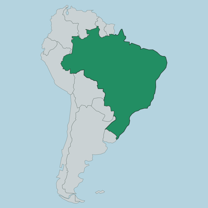
Mato Grosso fills much of Brazil's Central-West, the third largest of the country's states and one of its most thinly settled. Six Brazilian states ring it. Rondônia and Amazonas lie to the west and north-west, Pará across the north, Tocantins and Goiás to the east, and Mato Grosso do Sul along the south, while Bolivia meets its western edge. Cuiabá sits close to the middle of the whole territory, and a monument in the city marks the geodesic centre of South America.
The land itself is a high, flat tableland. The central Mato Grosso Plateau rises to around nine hundred metres and works as a great watershed: rivers on its northern side run down to the Amazon basin, while those on the southern side feed the Paraguay River and, through it, the distant River Plate. That divide also sorts the state into three natural worlds.
Dense Amazon rainforest covers the north, the wooded Cerrado savanna spreads across the centre, and the seasonally flooded Pantanal fills the low south-west. Near Cuiabá the ground buckles upward again at Chapada dos Guimarães, a red sandstone escarpment cut by canyons and waterfalls. The rest rolls away almost level.
What is Mato Grosso like?
The name means thick woods, and for two centuries the forest kept the state apart from the rest of Brazil. That isolation bred a culture of its own. The state is, above all, a farming frontier, its central plateau given over to soybeans, maize, cotton, and huge herds of cattle that rank it among the country's great agricultural engines.
Machinery and grain silos mark the newer towns. Older ones remember a different economy. Long before the ranchers came, the plains and river valleys belonged to indigenous peoples such as the Bororo and the Xavante, and the Bororo so fascinated the French anthropologist Claude Lévi-Strauss that his months among them shaped the book Tristes Tropiques.
Cuiabá gives the state its urban face. Its cooking leans on the rivers, with grilled pintado and pacu fish, and on the tereré, an iced version of the yerba-mate drink shared in the heat. In the towns of the Pantanal fringe, old string dances called siriri and the sung-and-danced cururu still turn up at festivals.
Portuguese is the everyday language, spoken with a distinctive cuiabano accent that carries traces of the region's long separation from the coast. The heat shapes daily rhythms as much as anything. Life slows through the middle of the day.
What is the history of Mato Grosso?
Gold made Mato Grosso. Paulista bandeirantes struck placer gold on the Cuiabá River in 1719, and the rush that followed raised Cuiabá almost overnight, supplied by the monções, canoe convoys paddling up from São Paulo. In 1748 the crown split off a separate captaincy of Mato Grosso to hold the frontier against Spanish America, with Vila Bela as its first capital.
Cuiabá took the seat in 1835. The province became a state of the Brazilian republic in 1889, and telegraph lines strung across it by Cândido Rondon finally tied the interior to the coast.
What is the climate of Mato Grosso?
Mato Grosso runs hot the year round, splitting the calendar into two seasons rather than four. Rains arrive around October and fall in heavy afternoon storms until about April. Then the taps shut off.
Through the dry months from May to September the Pantanal slowly drains, its floodwaters retreating to leave lakes and river channels where fish, caiman, and jaguars gather in plain sight. The northern forests stay wetter, closer to the damp of the Amazon. Dust and clear skies rule the south.
How do you get to Mato Grosso?
Almost everyone reaches Mato Grosso by plane. Marechal Rondon International Airport sits at Várzea Grande, just across the Cuiabá River from the capital, and links the state to São Paulo, Brasília, and Brazil's other big cities by direct flights. From the terminal the roads take over.
A paved highway drops south to Poconé, where the raised Transpantaneira track pushes on into the Pantanal toward Porto Jofre. For the deep Amazon north, a second flight to Alta Floresta saves days of driving. Distances here are continental.
Updated July 2026