DoaluKnow the place before you book.
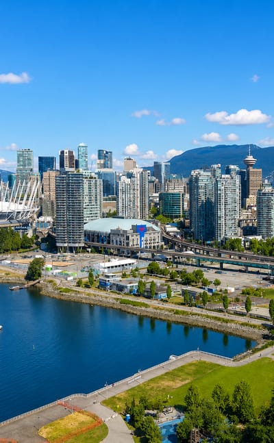
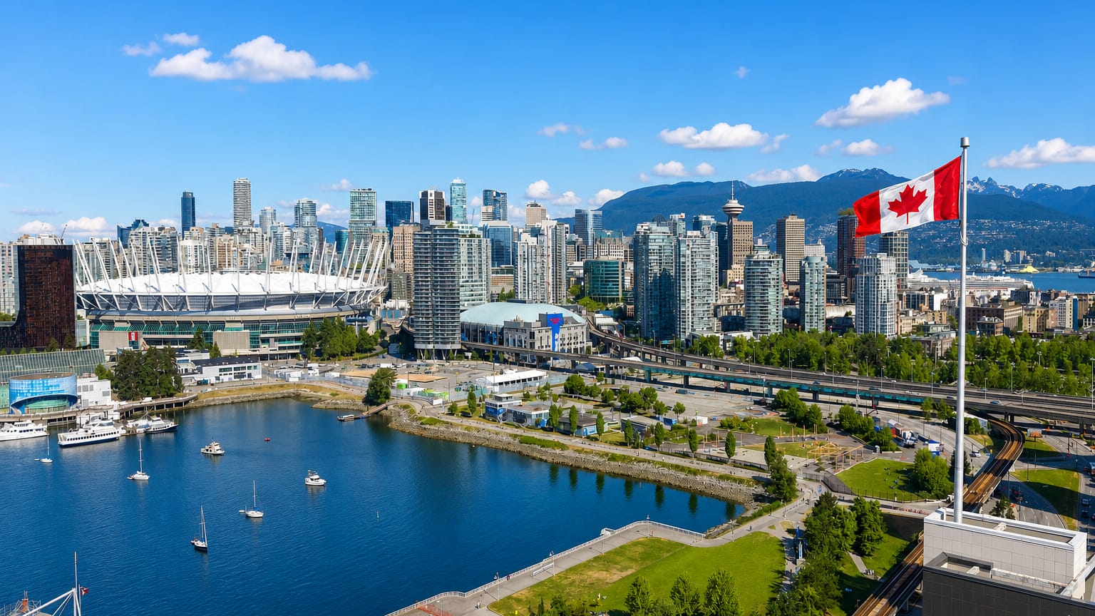
Vancouver skyline with BC Place stadium and False Creek boats below the North Shore mountains and a Canadian flag.

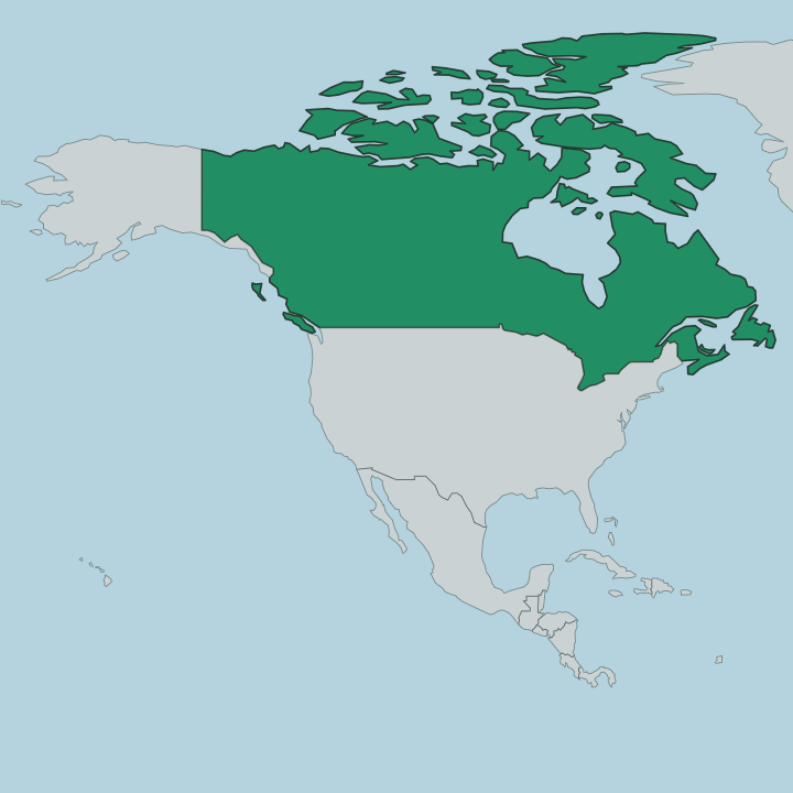
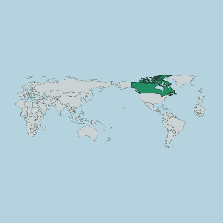
Canada · British Columbia

Where to Stay in Vancouver, British Columbia

The North Shore Mountains rise above the water at Vancouver, a coastal city in British Columbia known for its miles of shoreline and its galleries.

Find your area →
Where to stay in Vancouver

The right area depends on your trip — here's what each neighbourhood is best for.

Aerial over the leafy streets and playing fields of Dunbar-Southlands, Vancouver, toward the Strait of Georgia.VancouverCanada

Dunbar-Southlands

Dunbar-Southlands is a Vancouver neighbourhood on the city's western side, running north from the Fraser River toward English Bay.Dunbar-Southlands →
Aerial view over Arbutus Ridge in Vancouver, leafy streets and green-roofed mid-rises toward sea and mountains.VancouverCanada

Arbutus Ridge

Big lots, big houses. Arbutus Ridge fills the ground between 16th Avenue and 41st Avenue on Vancouver's West Side, residential end to end.Arbutus Ridge →
Aerial view of Oakridge in Vancouver, its shopping centre ringed by tree-lined streets of houses, sea beyondVancouverCanada

Oakridge

Oakridge is a multicultural residential and commercial neighbourhood of Vancouver, British Columbia, where St. John's Vancouver stands among its streets.Oakridge →
Vancouver skyline with BC Place stadium and False Creek boats below the North Shore mountains and a Canadian flag.VancouverCanada

Champlain Heights

Vancouver counts Champlain Heights among its neighbourhoods, a residential quarter of the British Columbia city in Canada.Champlain Heights →
Glass towers, marina and a docked seaplane along the waterfront of Coal Harbour in Vancouver.VancouverCanada

Coal Harbour

Coal Harbour is a Vancouver neighbourhood on the shoreline of Burrard Inlet, the water that separates the Downtown Peninsula from Stanley Park.Coal Harbour →
Aerial view over Shaughnessy's leafy streets and homes in Vancouver, with English Bay and the North Shore mountainsVancouverCanada

Shaughnessy

Shaughnessy is an almost entirely residential neighbourhood of Vancouver, named for Canadian Pacific Railway president Thomas Shaughnessy.Shaughnessy →
Vancouver skyline with BC Place stadium and False Creek boats below the North Shore mountains and a Canadian flag.VancouverCanada

South Cambie

South Cambie is one of Vancouver's smallest neighbourhoods, a medical district wedged between a large park and the lots of Shaughnessy.South Cambie →
Vancouver skyline with BC Place stadium and False Creek boats below the North Shore mountains and a Canadian flag.VancouverCanada

Punjabi Market

Punjabi Market, also known as Little India, is a commercial district on Main Street in the Sunset neighbourhood of Vancouver, British Columbia.Punjabi Market →
All neighbourhoods (31)
Vancouver skyline with BC Place stadium and False Creek boats below the North Shore mountains and a Canadian flag.VancouverCanada

North Delta

North Delta is a commuter community in the Lower Mainland of British Columbia, the largest of the three that make up the City of Delta.North Delta →
Aerial view over Sunset in south Vancouver: Fraser River waterfront, downtown towers and North Shore mountains.VancouverCanada

Sunset

Sunset is a diverse Vancouver neighbourhood around Fraser Street, held between Marpole, Oakridge and Victoria-Fraserview in British Columbia.Sunset →
Vancouver skyline with BC Place stadium and False Creek boats below the North Shore mountains and a Canadian flag.VancouverCanada

South Granville

South Granville is a Vancouver neighbourhood and business improvement area along Granville Street, edged by Kitsilano, Fairview and Shaughnessy.South Granville →
Aerial over the Fraser delta marshes and the riverside town of Ladner, British Columbia.VancouverCanada

Ladner

Ladner is a neighbourhood of Delta, a Vancouver suburb in British Columbia, created in 1868 as a fishing village on the Fraser River.Ladner →
Boats resting on the tidal flats at Tsawwassen, British Columbia, with coastal mountains beyondVancouverCanada

Tsawwassen

Tsawwassen is a residential peninsula community in the City of Delta, holding the BC Ferries terminal that sails for Vancouver Island.Tsawwassen →
Yaletown's glass towers rising above the False Creek marina in Vancouver on a clear day.VancouverCanada

Yaletown

Yaletown is a district of Downtown Vancouver, bordered by False Creek and by Robson and Homer Streets, rebuilt from rail yards after the 1986 World's Fair.Yaletown →
English Bay Beach, seawall lawn and West End towers on Vancouver's waterfront on a clear day.VancouverCanada

English Bay

English Bay is an open bay off Vancouver, reaching from Prospect Point to Point Grey and edging Stanley Park, the West End and Kitsilano.English Bay →
Rainbow crosswalk and pride banners at a Davie Street intersection in Vancouver's Davie Village.VancouverCanada

Davie Village

Davie Village is a Vancouver neighbourhood inside the West End, centred on Davie Street and known as the city's gay village.Davie Village →
Vancouver skyline with BC Place stadium and False Creek boats below the North Shore mountains and a Canadian flag.VancouverCanada

Olympic Village

Olympic Village is a district of Vancouver whose entry carries the name and the parent city, and nothing else on the record.Olympic Village →
Vancouver skyline with BC Place stadium and False Creek boats below the North Shore mountains and a Canadian flag.VancouverCanada

Inlet Centre

Inlet Centre is one of the neighbourhood names recorded under Vancouver, in British Columbia, Canada, on a list that also runs to Gastown and Yaletown.Inlet Centre →
Vancouver skyline with BC Place stadium and False Creek boats below the North Shore mountains and a Canadian flag.VancouverCanada

Cedar Cove

Cedar Cove is one of the named districts of Vancouver, in the Canadian province of British Columbia.Cedar Cove →
Vancouver's harbour beside the Downtown Eastside, with port container cranes, a SeaBus and the North Shore hills.VancouverCanada

Downtown Eastside

The Downtown Eastside is one of Vancouver's oldest neighbourhoods, on the ground just east of the central business district where the city first took root.Downtown Eastside →
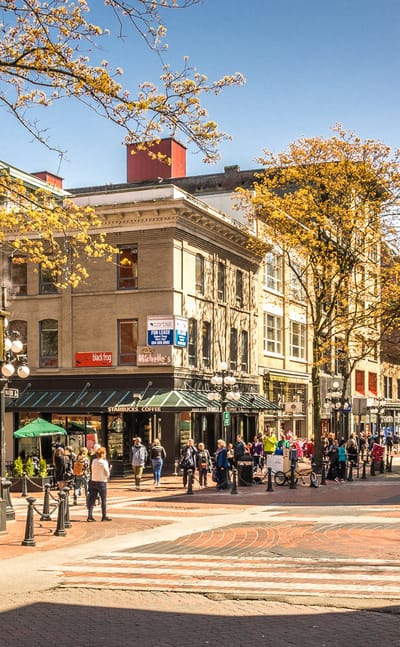
The steam clock on brick-paved Water Street among Victorian buildings in Gastown, VancouverVancouverCanada

Gastown

Gastown is Vancouver's original townsite, built around Maple Tree Square where the city began. Its spine is cobbled Water Street.Gastown →
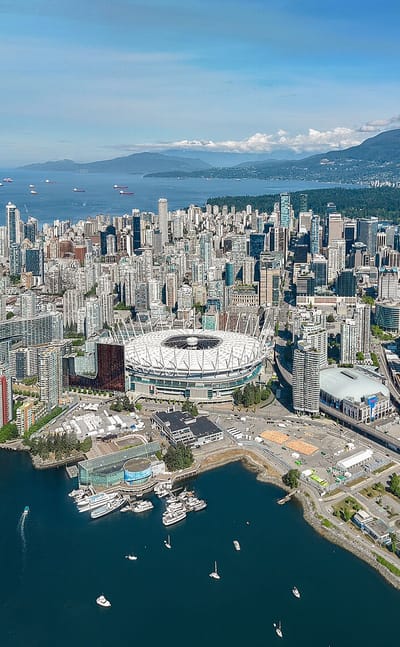
Aerial view of Downtown Vancouver with BC Place, False Creek, Coal Harbour and the North Shore mountains.VancouverCanada

Downtown Vancouver

Downtown Vancouver is the central business and shopping core of Vancouver, set on a peninsula between Burrard Inlet and False Creek.Downtown Vancouver →
Dr. Sun Yat-Sen Classical Chinese Garden in Vancouver's Chinatown, with pavilion, rockery pond and towers behindVancouverCanada

Chinatown

Chinatown sits on the eastern edge of downtown Vancouver, one of the largest historic Chinese neighbourhoods in North America and still the centre of the…Chinatown →
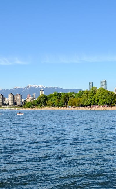
Kitsilano beachfront, English Bay and the Vancouver skyline backed by the snow-capped North Shore MountainsVancouverCanada

Kitsilano

Kitsilano is a neighbourhood on the west side of Vancouver, spread along the south shore of English Bay. Locals call it Kits.Kitsilano →
Vancouver skyline with BC Place stadium and False Creek boats below the North Shore mountains and a Canadian flag.VancouverCanada

Japantown

Japantown is the historic name for the blocks along Powell Street in Vancouver's Downtown Eastside, a short way east of the main downtown.Japantown →
Vancouver skyline with BC Place stadium and False Creek boats below the North Shore mountains and a Canadian flag.VancouverCanada

West End

The West End fills the western third of Vancouver's downtown peninsula, packed between the office towers of the central business district and the trees of…West End →
Vancouver skyline with BC Place stadium and False Creek boats below the North Shore mountains and a Canadian flag.VancouverCanada

Hogan's Alley, Vancouver

Hogan's Alley is a historic neighbourhood on the east edge of downtown Vancouver, pressed against Chinatown in the Strathcona district.Hogan's Alley, Vancouver →
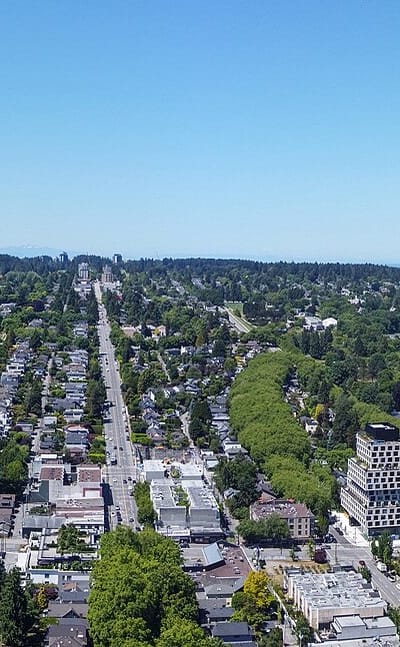
Aerial view of leafy West Point Grey, Vancouver, looking over English Bay to the North Shore mountains.VancouverCanada

West Point Grey

West Point Grey is a residential neighbourhood at the northwestern corner of Vancouver, British Columbia, spread across the tip of the Point Grey…West Point Grey →
Vancouver skyline with BC Place stadium and False Creek boats below the North Shore mountains and a Canadian flag.VancouverCanada

Kerrisdale

Kerrisdale is an affluent residential neighbourhood in southwest Vancouver, built around a shopping district along West 41st Avenue and West Boulevard.Kerrisdale →
Vancouver skyline with BC Place stadium and False Creek boats below the North Shore mountains and a Canadian flag.VancouverCanada

Strathcona, Vancouver

Strathcona is one of Vancouver's oldest residential neighbourhoods, laid out on the east side of the downtown peninsula in British Columbia.Strathcona, Vancouver →
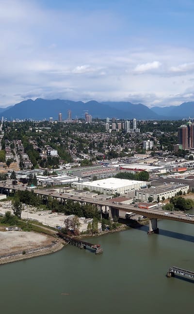
Marpole's Fraser River waterfront in Vancouver, with a bridge crossing and the North Shore mountains behindVancouverCanada

Marpole

Marpole is a residential neighbourhood at the southern edge of Vancouver, where the city meets the North Arm of the Fraser River.Marpole →

About Vancouver

What is Vancouver known for?

Vancouver is known as the largest city on the coast of British Columbia, set between the sea and the North Shore Mountains in the Lower Mainland. Its shoreline runs for miles along the coast. The Vancouver Art Gallery and the Bill Reid Gallery of Northwest Coast Art anchor its cultural life, and Science World rises beside the water.

The mountains define the view. Chinatown keeps a long history in the Chinese Canadian Museum.

What are the main landmarks in Vancouver?

Vancouver's landmarks gather between the harbour and the North Shore Mountains. The Vancouver Art Gallery and the Bill Reid Gallery of Northwest Coast Art hold the city's art, while the Museum of Vancouver and the Vancouver Maritime Museum tell its story by the water. Science World stands beside the water at the edge of downtown, and the Vancouver Lookout rises over the centre.

Bloedel Conservatory crowns a hill above the city. The Chinese Canadian Museum stands in the old Chinatown.

What is the history of Vancouver?

Vancouver grew from a sawmill on the coast of British Columbia, and was incorporated as a city in 1886. The first settlement gathered around Hastings Mill, cutting the timber of the coast for markets across the Pacific. Ships came for the wood.

The arrival of the transcontinental railway made the young city the terminus of a line that crossed the whole country, and it grew quickly along the water below the North Shore Mountains. Immigrants arrived from across the Pacific and beyond. Among the earliest were the Chinese communities whose story the Chinese Canadian Museum and the Chinatown Storytelling Centre now record, settled in the quarter east of the centre.

The Roedde House Museum preserves a home from those early decades. Vancouver spread outward from the harbour as its trade grew, and institutions such as the Museum of Vancouver and the Vancouver Maritime Museum came to hold its record. The mill is long gone.

The city it started still faces the sea and the mountains of the Lower Mainland.

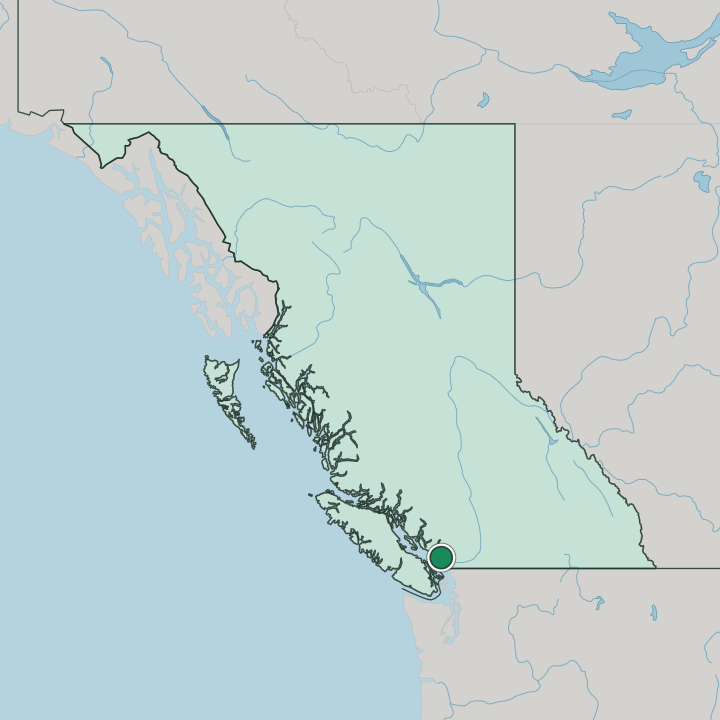
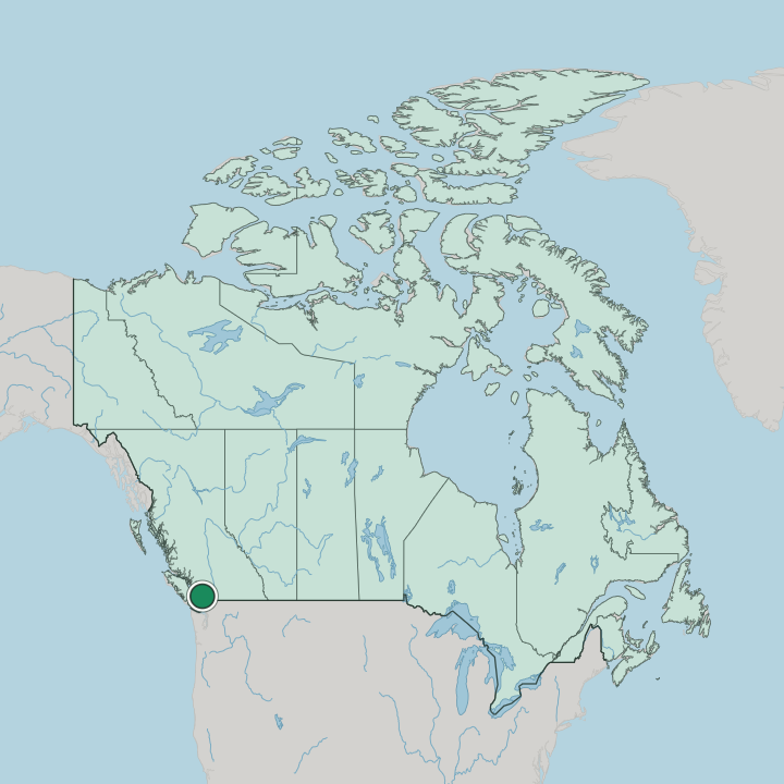
Where is Vancouver?

Vancouver stands on the coast of British Columbia, in the Lower Mainland of Western Canada, hemmed between the sea and the North Shore Mountains. The city sits on the flat coastal ground toward the Fraser Valley. Water reaches it on several sides.

The mountains rise close behind the northern shore, sharp against the sky. Beyond the built-up area the coast and the valley open toward the wider mainland.

What is the climate of Vancouver?

Vancouver has a mild, wet oceanic climate, one of the gentlest of any Canadian city. Winters are cool and grey, with long spells of rain rolling in off the Pacific and low cloud hanging over the North Shore Mountains. The summer months turn warm and dry.

When the clear months come, the coast and the peaks stand out sharply above the Lower Mainland. Snow falls on the mountains far more than in the city below.

How do you get to Vancouver?

Vancouver is reached by air, sea, and road across British Columbia and the wider Pacific. Its international airport sits south of the centre, on the flat ground toward the Fraser Valley. Ferries cross the coastal waters to the city.

Highways run east through the Lower Mainland toward the interior, and rail lines that once ended here still cross the country to the coast below the North Shore Mountains.

Good for

More cities in British Columbia

Updated September 2026