Algeria
Adrar, Algeria — Towns & Travel Guide


Adrar is a vast Saharan province of southwestern Algeria, a string of date-palm oases fed by ancient foggara water tunnels across the open desert.
About Adrar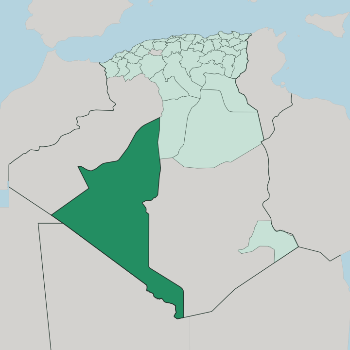


Towns & cities in Adrar
Pick a town or city — each links to where to stay.
Adrar town is the only real base, and nearly every bed, the market, and the airport are there. Almost everyone starts here. From the capital, day trips reach the palm groves of the Touat and the ksour scattered among them.
Reggane lies far to the south, the last oasis before the Tanezrouft and a stop only for those pushing toward the empty desert. Aoulef sits east in the Tidikelt, its gardens fed by the same foggara tunnels. Choose Adrar for everything practical.
Head out to the oases when you want the date gardens and the silence.
About Adrar
Adrar is oasis country.
What is Adrar known for?
In the deep Sahara of southwestern Algeria, life here clings to date palms watered by the foggara, a network of hand-dug underground channels that pull groundwater to the groves without a single pump. The province takes its name from its red-earth capital. For centuries the Touat oases watered caravans hauling gold, salt, and dates between the Maghreb and the Sudan.
Reggane marks the southern edge, where the palms give out and the empty Tanezrouft begins.
Where is Adrar?
Adrar fills a huge block of southwestern Algeria, almost all of it open Sahara. The land is flat and pale. Sand-dune plains and stony reg stretch to every horizon, broken only where water reaches the surface.
The heart of the province is the Touat, a string of small oases running roughly 160 kilometres from Bouda in the north down to Reggane in the south. These oases line the eastern edge of the Wadi Messaoud, the dry continuation of the Oued Saoura, and it is groundwater under that old riverbed, not rain, that keeps the palms alive. The town of Adrar sits near the middle of that line.
North of the palm belt rises the Grand Erg Occidental, a sea of dunes the size of a small country. South, past Reggane, the ground empties into the Tanezrouft, a gravel waste so bare that early motor tracks ran for days without a landmark. To the east lies the Tidikelt, another oasis region around Aoulef, on the long road toward In Salah.
The province reaches southwest to the Mauritanian frontier. Everything here is desert. Distances are measured in hundreds of kilometres of nothing, and the oases feel like green islands in an ocean of sand and stone.
What is Adrar like?
Life in Adrar is built around water and the palm. The oases were dug and settled by Berber people, the Zenata, whose engineers threaded the foggara tunnels beneath the sand centuries ago. That water is shared, not owned outright.
An old communal code divides each foggara's flow by measured share, down to the last garden, and disputes over it are settled by custom as much as by law. The date harvest still sets the rhythm of the year, and the tall palms shade smaller plots of wheat, henna, and vegetables below. The towns wear the desert's own colour.
Ksour, fortified villages of red mud-brick, cluster against the heat, their windowless walls and narrow lanes built to hold shade and repel raiders. Adrar counts hundreds of such ksour across the province. Islam shaped the oases as much as water did.
The Touat was a stop for scholars and pilgrims on the caravan road, and its zawiyas, the Sufi lodges that give Zaouiet Kounta its name, kept libraries and taught the Qur'an. Arabic is the language of daily life, though the Berber speech of the old oasis families still survives. Out here, hospitality is close to law: a stranger refused shade could die.
What is the history of Adrar?
The Touat oases grew rich on the caravan trade. From medieval times their date gardens and wells provisioned the camel routes carrying gold, salt, and enslaved people between the Maghreb and Timbuktu. Long claimed from afar by Morocco, the oases were seized by France around 1900.
The desert's emptiness later drew grimmer use. In 1960 France exploded its first atomic bomb in the Tanezrouft near Reggane, becoming the fourth nation to join the nuclear club. The town joined independent Algeria in 1962, and became the seat of its own province in the reorganizations that followed.
What is the climate of Adrar?
Adrar has one of the harshest desert climates in Algeria. Summers are brutal, with the heat among the fiercest of any inhabited place in the country and the air bone-dry. Rain barely comes at all, a thin scatter of millimetres a year, some years none, so the palms depend entirely on the foggaras, not the sky.
Winters are short and mild by day, though desert nights turn cold. Dust storms and the dry Saharan wind rake the oases from spring into summer. The sun here is relentless.
How do you get to Adrar?
Flying is how nearly everyone gets to Adrar. Touat-Cheikh Sidi Mohamed Belkebir Airport, just outside the town, links the oasis to Algiers and a few other Algerian cities with regular flights across the Sahara. The alternative is the long haul overland.
Sealed roads run north through the desert toward Béchar and the Mediterranean coast, and south toward In Salah, but they cross hundreds of kilometres of open Sahara between fuel stops. The distances are immense. Once in Adrar, the oases of the Touat lie within a day's drive of the capital by road.
Updated July 2026