Hungary
Szabolcs-Szatmár-Bereg, Hungary — Towns & Travel Guide


Szabolcs-Szatmár-Bereg is Hungary's north-eastern corner, where the Tisza loops through orchard country to the Ukrainian, Romanian and Slovak borders.
About Szabolcs-Szatmár-Bereg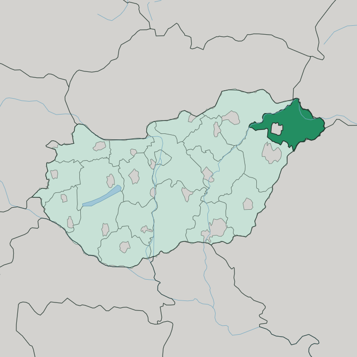
Towns & cities in Szabolcs-Szatmár-Bereg
Pick a town or city — each links to where to stay.
Nyíregyháza is the obvious base. Most visitors sleep at its Sóstó quarter, a spa and zoo suburb of thermal baths and pine woods set a short ride north of the busy city centre. Kisvárda anchors the northern Rétköz, near the Ukrainian frontier and the Záhony rail crossing.
Vásárosnamény guards the mouth of the Bereg, where the Szamos joins the Tisza, closest to the wooden churches. Pick your ground. Choose Sóstó for a spa town; head east into the Bereg if the medieval belfries are why you came.
About Szabolcs-Szatmár-Bereg
This is apple country.
What is Szabolcs-Szatmár-Bereg known for?
The sandy Nyírség plateau around Nyíregyháza grows much of Hungary's fruit, and the Szatmár-Bereg villages further east still slow-cook plums into a thick, sugarless jam over open fires. Two things pull travellers out here: the painted wooden churches and belfries of the Upper Tisza, and Máriapócs, the Greek Catholic shrine whose weeping icon has drawn pilgrims since 1696. The Tisza itself frames the whole region.
Where is Szabolcs-Szatmár-Bereg?
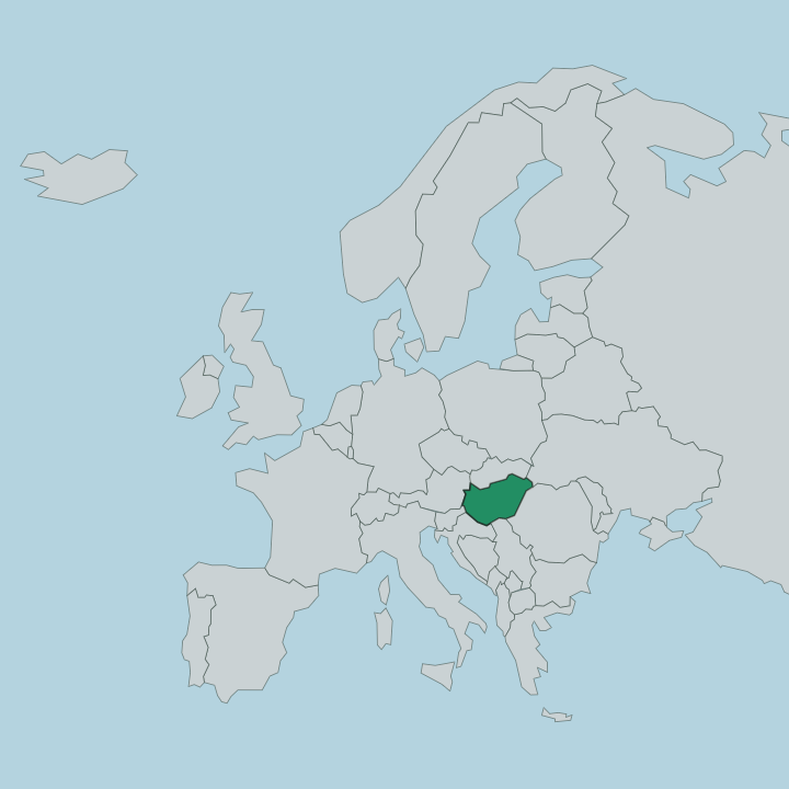
Szabolcs-Szatmár-Bereg fills the far north-eastern tip of Hungary, wedged against three foreign borders. Ukraine lies to the north-east, Romania to the south-east, and Slovakia touches the county's northern edge. Inside Hungary it meets only two neighbours, Hajdú-Bihar to the south and Borsod-Abaúj-Zemplén to the west. The land splits cleanly in two.
West of the water spreads the Nyírség, a low plateau of wind-blown sand whose name comes from nyír, the birch that once cloaked its dunes, and where Nyíregyháza sits at the centre of the orchards. East and along the frontier lies the Upper Tisza Valley, the flat floodplain the river built. The Tisza is the spine of it all.
It enters Hungary at the county's eastern edge and runs some 235 kilometres within these boundaries, gathering the Szamos and its other tributaries as it goes. The Rétköz, a marshy lowland in the north near Kisvárda, drains toward that same river. Little of the county rises far above the plain.
Reeds, oxbow lakes and dyked meadows define the Bereg and Szatmár districts along the water, a landscape shaped by centuries of flooding before the great river regulations tamed it.
What is Szabolcs-Szatmár-Bereg like?
Faith and folk craft sit close together here. The county holds the densest cluster of medieval village churches in Hungary, and the Route of Medieval Churches strings some twenty of them together, from the smiling-saint frescoes of the late-Romanesque church at Csaroda to the painted coffered ceiling and freestanding wooden belfry at Tákos. Máriapócs adds a second, Eastern strand.
Its Greek Catholic basilica remains the spiritual heart of Byzantine-rite Catholicism in the Carpathian Basin, and pilgrims still climb here for the weeping icon of the Mother of God. The everyday culture is agrarian and stubbornly regional. Around Nyíregyháza live the tirpák, descendants of Slovak settlers who repopulated the sandy Nyírség in the eighteenth century and kept their own dialect, dress and kitchen.
Plum-jam boiling is the signature ritual of the Szatmár-Bereg, an autumn labour of copper kettles and open flame. Nyíregyháza carries the institutional life: the Móricz Zsigmond Theatre, the Jósa András Museum, and the Sóstó open-air village museum that gathers the region's old timber farmhouses onto one wooded site. Hungarian is the language everywhere.
Yet the daily rhythms here still bend to the harvest.
What is the history of Szabolcs-Szatmár-Bereg?
The county's name stacks up three older lands. Szabolcs, Szatmár and Bereg were separate Hungarian counties for most of a thousand years, and the earthwork fort at Szabolcs on the Tisza guarded this ground as far back as the Árpád age. War redrew everything.
In 1920 the Treaty of Trianon cut the historic Szatmár and Bereg counties in two, handing their eastern halves to Romania and Czechoslovakia and leaving Hungary only the western remnants. Those truncated pieces were merged in 1950 into a single county under the triple name it still carries.
What is the climate of Szabolcs-Szatmár-Bereg?
The climate is continental and, for the Great Plain, comparatively wet. Winters bite cold across the open Nyírség sand, summers turn hot, and the shoulder seasons carry the rain that makes this the fruit basket it is. Roughly 550 to 600 millimetres of precipitation falls in an average year, more than most of lowland Hungary sees.
Orchards drink it. That extra moisture is what ripens the apple and plum trees across the Nyírség. Spring meltwater and heavy rain still swell the Tisza, and the Upper Tisza floodplain floods when the river runs high.
How do you get to Szabolcs-Szatmár-Bereg?
Nearly everyone reaches Szabolcs-Szatmár-Bereg by road or rail. Nyíregyháza is the hub. The nearest airport is at Debrecen, roughly an hour's drive south-west of Nyíregyháza, while Budapest lies a longer haul to the west by motorway or train.
The M3 motorway and the main railway both run out to Nyíregyháza, the county's transport hub, with regional trains branching on to Kisvárda, Mátészalka and Nyírbátor. Záhony, on the northern edge, is the busy road-and-rail gateway into Ukraine. Trains cross the Tisza bridges to reach the eastern towns.
Updated July 2026