Hungary
Zala megye, Hungary — Towns & Travel Guide


Zala megye fills Hungary's south-western corner, where the Zala River drains toward Lake Balaton and thermal springs feed the spa town of Hévíz.
About Zala megye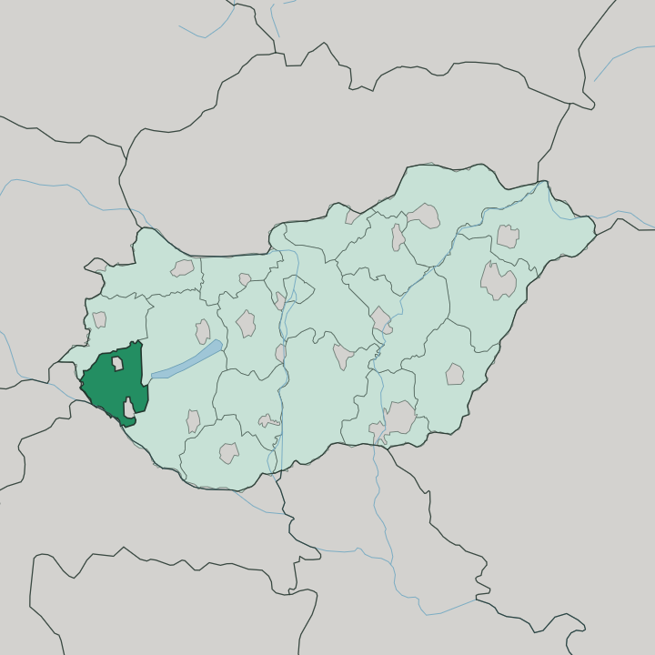
Towns & cities in Zala megye
Pick a town or city — each links to where to stay.
Make one of Zala's lakeside towns your base. Hévíz wraps a whole town around its warm thermal lake, where the bathing carries on year round and never stops even through the coldest days of winter. Keszthely gives the county its foothold on Lake Balaton, on the western shore where the Zala River flows in.
Zalaegerszeg is the working seat, set on the right bank of the Zala with the Göcsej village museum on its edge. Nagykanizsa holds the south. Pick the lake and spa towns for water, the inland pair for the county at work.
About Zala megye
What is Zala megye known for?
Thermal water made this county's name. Hévíz sits over the largest thermal lake in the world that people can swim in, and its warm spring never freezes over. The Zala River gives the county both its name and its shape, curling east through wooded hills before it empties into Lake Balaton near Keszthely.
Zalaegerszeg is the seat and the working heart. Oil built its modern fortune, drilled from the Zala basin around Nagykanizsa in the last century, while the old Göcsej hills to the south kept their timber cottages and folk crafts intact.
Where is Zala megye?
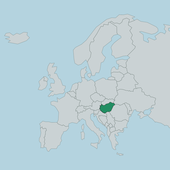
Zala megye occupies the south-western corner of Hungary, in the region the Hungarians call Western Transdanubia. Two foreign borders close it off. Croatia lies along the south and Slovenia along the south-west, so this is where Hungary runs out of land. Inland, the county touches Vas to the north-west, Veszprém to the north-east, and Somogy to the east.
The land is not flat. Foothills of the Alps roll in from the west, the Keszthely Mountains rise in the north-east, and the wooded Zala hills fold across the south and east in the country traditionally called Göcsej. The Zala River threads through all of it, rising near the Slovenian border and running east until it reaches Lake Balaton.
Only a corner of that great lake, the bay at Keszthely, sits inside the county. The rest of the water lies eastward, beyond the county line. Beech woods cover much of the higher ground, thick enough to hold game.
Zalaegerszeg stands on the Zala in the county's middle, with Nagykanizsa well to the south near the meeting of old trade roads.
What is Zala megye like?
Two Zalas live side by side. One is the resort county of the spas, where visitors come to bathe in warm water at Hévíz, Zalakaros, and the smaller springs, and to walk the promenades of Keszthely by Lake Balaton. The other is the old peasant country of the Göcsej hills, a maze of steep wooded ridges and scattered hamlets that stayed poor, remote, and stubbornly traditional long after the lowlands changed.
Folk building is the mark of it. Zalaegerszeg keeps the country's first open-air ethnographic museum, where timber cottages, barns, and small churches from the eighteenth and nineteenth centuries were carried in from the surrounding villages and set up again. Craft runs alongside the buildings, from pottery to the folk customs of the region.
Keszthely offers the county's other cultural pole, a Balaton-side town of museums and grand houses rather than village timber. The everyday language is Hungarian, and it is the language you will hear in every market square from the lake shore to the Slovenian border. Small Croat and German communities have long lived in the south.
The split between spa gloss and hill tradition is the county's real character.
What is the history of Zala megye?
The county is old. It was first drawn up under King Stephen I around the year 1000 under the name Kólon, and only in the eighteenth century took the name of the Zala River that runs through it. For centuries it was farming and border country, close to the frontier with the lands the Ottomans and later the Habsburgs held to the south.
The modern turn came underground. Oil was struck in the Zala basin around Nagykanizsa, and by the 1940s that field was the largest source of crude in the country, valuable enough that the last German offensive of the Second World War was fought partly to hold it. Refining and industry followed the oil into Zalaegerszeg, and the quiet farming county gained a working, industrial spine.
What is the climate of Zala megye?
Zala megye has a damp, mild-continental climate, wetter than the Hungarian plains to the east. Warm air reaching up from the Adriatic softens the winters, so the cold here bites less than it does out on the lowlands, and rain falls more freely across the year. Winters here run mild.
Summer keeps the Göcsej woods warm and lush. The Göcsej hills and the beech woods that cover them stay lush through the season, and the western foothills catch the heaviest rain. Snow comes in winter but rarely lingers long over the Zala valley.
How do you get to Zala megye?
Come in from Balaton. The county's north-eastern corner touches Lake Balaton at Keszthely, and the roads and railways that serve the lake carry on into Zala from there. Nagykanizsa in the south has been a junction for centuries, a meeting point of routes where trade once moved between the Adriatic, Graz, and Vienna, and its rail lines still run toward Croatia and Slovenia across the nearby borders.
Zalaegerszeg anchors the interior, linked west and north by road. Cross-border crossings into both neighbours lie close at hand.
Good for
Updated July 2026