Japan
Kochi Prefecture, Japan — Towns & Travel Guide


Kōchi Prefecture wraps the Pacific coast of southern Shikoku around Tosa Bay, the most heavily forested prefecture in all of Japan.
About Kochi Prefecture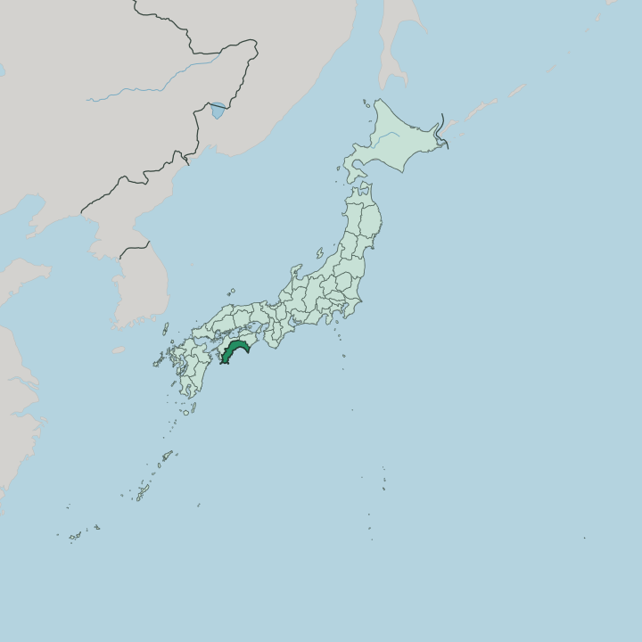


Towns & cities in Kochi Prefecture
Pick a town or city — each links to where to stay.
Most visitors base themselves in Kōchi, the castle town on the coastal plain and by far the largest place in the prefecture. Its covered Hirome Market and centuries-old Sunday street market make it the easy first choice. Past the capital, the mountains close in.
Head west for the Shimanto River and the old river port of Nakamura, south-west for the wild capes at Ashizuri, or east along the coast to Muroto, where a whole seabed of raised rock forms a UNESCO geopark. Choose Kōchi for its food and its history; choose the coast or the river country when you want the emptier corners of Shikoku.
About Kochi Prefecture
Rivers and raw fish.
What is Kochi Prefecture known for?
The Shimanto River, the longest stream on Shikoku, runs its entire course without a single dam, which is why people across Japan still speak of it as the last clear river in the country. Kōchi gave the nation katsuo no tataki, skipjack bonito seared hard over a roaring fire of rice straw and served in thick pink slabs. It also invented Yosakoi, a summer street dance powered by the clatter of small wooden clappers called naruko.
And it raised Sakamoto Ryōma, the low-ranking Tosa samurai who helped bring down the shogunate.
Where is Kochi Prefecture?
Kōchi fills the whole southern flank of Shikoku, the smallest of Japan's four main islands. It faces the open Pacific Ocean across the broad arc of Tosa Bay. Behind it, the Shikoku Mountains rise in a long wall that seals the prefecture off from Ehime, Tokushima and Kagawa to the north.
More of Kōchi is forest than of any other prefecture in Japan, and level ground is scarce. Only around the capital and a few river mouths does the land flatten into plain. Everywhere else it climbs.
Two rivers define the interior. The Shimanto River, the longest on the island, winds through the western hills to the sea without a single dam on its main stem, and low chinkabashi bridges duck beneath it when the water rises. The Niyodo River runs a shorter, steeper course off the mountains, so clear that its particular shade of blue has a name of its own.
At the prefecture's two ends the coast hardens into cape. Cape Ashizuri, the southernmost point of Shikoku, juts out at Tosashimizu in the far west. Cape Muroto anchors the east, where slabs of former seabed heaved up out of the Pacific carry a UNESCO Global Geopark.
The Kuroshio Current sweeps warm water past both.
What is Kochi Prefecture like?
People here still call themselves Tosa folk, after the old province, and the name carries a temperament. Tosa is known across Japan for plain talk, stubborn men, strong-willed women and a serious appetite for drink. Sake flows at the long communal feasts called Tosa no okyaku, complete with trick cups that cannot be set down until they are drained.
The food is built around the sea. Katsuo no tataki is the emblem: skipjack bonito seared over flaming rice straw, sliced thick, and dressed with garlic, salt and citrus. Locals eat it standing up at Kōchi's Hirome Market, an indoor warren of stalls where strangers share tables.
Summer belongs to Yosakoi. The festival began in Kōchi in 1954 and fills the streets each August with teams dancing to amplified folk tunes, each dancer clacking a pair of naruko. The prefecture also punches far above its weight in national history.
Sakamoto Ryōma, born a lower samurai in the castle town, brokered the alliance that brought down the shogunate, and his fellow Tosa man Itagaki Taisuke later launched the movement for an elected parliament. Their old domain is still crowned by Kōchi Castle, one of only a dozen Japanese castles to keep its original wooden keep, and the only one to also keep the lord's palace inside the walls.
What is the history of Kochi Prefecture?
For centuries this was Tosa Province. The warlord Chōsokabe Motochika hammered all of Shikoku into one domain in the late sixteenth century, only to lose the wider island to Toyotomi Hideyoshi in 1585 and keep just Tosa. His son Morichika then forfeited even that, backing the losing side at Sekigahara in 1600.
Victory there handed Tosa to Yamauchi Kazutoyo, whose family then built Kōchi Castle and ran the Tosa Domain through the Edo period. Their low-ranking retainers nursed a grudge that turned to purpose. Men from Tosa became engines of the Meiji Restoration, and when the domains were abolished the land was renamed Kōchi Prefecture in 1871.
What is the climate of Kochi Prefecture?
Warm, wet and battered by storms. The Kuroshio Current drives warm water up against the Kōchi coast, giving the prefecture mild winters and long, muggy summers. Rain arrives in earnest: the Pacific side of Shikoku catches some of the heaviest downpours in Japan, fed by the summer rainy season and by typhoon after typhoon spinning up out of the ocean.
Only Kagoshima takes more of those storms. The Muroto Typhoon of 1934 tore ashore near the cape and still ranks among the fiercest ever recorded in the country. Between the heavy rains, the prefecture still sees an unusual amount of sun.
How do you get to Kochi Prefecture?
The mountains make Kōchi hard to reach, and that is half its appeal. Most air travellers land at Kōchi Airport, out on the plain at Nankoku, which carries Sakamoto Ryōma's name and quick flights up to the big Japanese hubs. The train is slower and more scenic.
JR's Dosan Line climbs over the Shikoku Mountains from Okayama on the main island, twisting down river gorges before it reaches the coast at Kōchi. Buses run the same passes. After that, a car is the only sensible way to reach the Shimanto River or the far capes.
Good for
Updated July 2026