Mexico
Estado de Durango, Mexico — Towns & Travel Guide


Estado de Durango is a landlocked state of northern Mexico, where the Sierra Madre Occidental falls from pine forest to high desert and old silver towns.
About Estado de Durango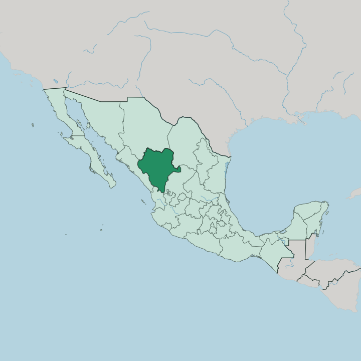


Towns & cities in Estado de Durango
Pick a town or city — each links to where to stay.
Most trips start in the capital, Victoria de Durango, whose colonial core sits under the iron hill of Cerro del Mercado. Two other hubs draw visitors out. In the Comarca Lagunera, Gómez Palacio shares nine bridges over the Nazas River with neighbouring Torreón, a flat industrial belt of hotels and commerce.
West, the pine highlands of the Sierra Madre Occidental rise toward El Salto and the Espinazo del Diablo road to the coast. Choose the capital for history and the sierra for cool forest air.
About Estado de Durango
What is Estado de Durango known for?
Durango means three things to most Mexicans: mountains, mining, and movies. The Sierra Madre Occidental fills two-thirds of the state with pine and oak forest, and its ore built the capital, Victoria de Durango, beside the iron mountain of Cerro del Mercado. Filmmakers came for the light.
Since the mid-twentieth century the plains and canyons around the capital have doubled as the American West for more than a hundred features and dozens of Westerns. This was also Pancho Villa country, the revolutionary who rode out of the Durango sierra into national legend.
Where is Estado de Durango?
Durango is landlocked, wedged into northern Mexico where the Central Mexican Plateau climbs into the Sierra Madre Occidental. Chihuahua lies to the north and Coahuila to the northeast, Zacatecas to the southeast, and Nayarit and Sinaloa close off the southwest and west. It is the fourth-largest state in the country. The Sierra Madre Occidental covers roughly two-thirds of its territory, a broad wall of pine and oak forest that shuts out Pacific moisture and keeps the interior dry.
Along the far western edge the range shatters into La Quebrada, a country of deep barrancas and fast rivers dropping toward Sinaloa. This is some of the most rugged land in Mexico. East of the mountains the land opens.
Central valleys of farmland and grazing hold the capital, Victoria de Durango, in the fertile Guadiana basin. Northeast the ground turns to the Bolsón de Mapimí, an arid inland sink on the rim of the Chihuahuan Desert where the water drains nowhere and evaporates. The Nazas River is the state's great artery, gathering in the western sierra and running east toward the cotton fields of the Comarca Lagunera, while the San Pedro Mezquital cuts southwest to the Pacific.
Rain and drought sit side by side here.
What is Estado de Durango like?
Two images fix Durango in the national imagination: the cowboy and the scorpion. The dry hills around Victoria de Durango stood in for Texas and Arizona in scores of films, and the old sets at Villa del Oeste still stage mock gunfights for visitors who come dressed for the part. Locals wear the alacrán as a badge.
The venomous scorpion of the semi-desert gives the state its nickname, La Tierra del Alacrán, and lends its name to sports teams and mezcal labels alike. Norteño and banda carry the soundtrack, accordion-driven and made for the ranch dances and rodeos of the north. The state has bred outsized national figures.
Pancho Villa, born Doroteo Arango in the Durango countryside, rode the Revolution from here, and Guadalupe Victoria, the first president of independent Mexico, lent the capital his adopted name. Older still are the Tepehuán and Huichol peoples of the western Sierra Madre Occidental, whose communities keep their own languages in the high country. Food leans to the ranch: dried beef, wheat-flour tortillas, and caldillo durangueño, the local beef-and-chile stew.
It is cowboy cooking, plain and filling.
What is the history of Estado de Durango?
Spanish conquistador Francisco de Ibarra founded the capital in 1563, drawn by the iron mountain of Cerro del Mercado and the silver he expected to find in the surrounding sierra. For two centuries the city ran Nueva Vizcaya, a vast colonial province spanning what became Durango and Chihuahua. Statehood came in 1824, after independence.
The city was renamed Victoria de Durango for Guadalupe Victoria, the first president of Mexico and a son of the state. Mining money built its cathedral and mansions.
What is the climate of Estado de Durango?
Climate here follows altitude. The Sierra Madre Occidental wrings the rain out of Pacific air, so the peaks and pine forests stay cool and damp while the eastern lowlands bake. Around Victoria de Durango the year runs mild and dry, warm days giving way to cool highland nights.
The northeastern Bolsón de Mapimí is true semi-desert, scorching in summer and thin on rain. Winter can bring frost and even snow to the high sierra. Most rain falls in a short summer wet season.
How do you get to Estado de Durango?
Air is the quick way in. General Guadalupe Victoria International Airport, on the edge of the capital, connects Durango to Mexico City and to a scatter of border and US cities. Overland, the engineering marvel is Federal Highway 40D, the tolled Baluarte bridge route that finally tamed the Sierra Madre Occidental crossing toward Mazatlán.
The old free highway still switchbacks over the Espinazo del Diablo. Long-haul buses roll into the capital from across northern Mexico.
Good for
Updated July 2026