Mexico
Estado de San Luis Potosí, Mexico — Towns & Travel Guide


San Luis Potosí climbs from the Altiplano's silver desert over the Sierra Madre Oriental into the jungle rivers of the Huasteca Potosina.
About Estado de San Luis Potosí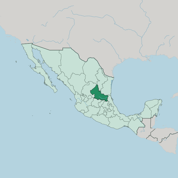


Towns & cities in Estado de San Luis Potosí
Pick a town or city — each links to where to stay.
The two ends of the state ask for two different bases. San Luis Potosí, the capital, sits on the western plateau, a colonial grid of stone churches and shaded plazas along the old Camino Real de Tierra Adentro, and it makes the natural start for the Altiplano and its silver towns. For the eastern rivers, Ciudad Valles serves better, the road hub from which the Huasteca Potosina's waterfalls fan out.
Real de Catorce and Xilitla suit travellers chasing one particular thing, ghost-town silver or surrealist concrete. Choose by region.
About Estado de San Luis Potosí
What is Estado de San Luis Potosí known for?
Two very different landscapes carry the state's name. In the western desert stands Real de Catorce, a silver boomtown that grew into one of the world's richest mines before its mountain seams gave out. The eastern jungle holds the Huasteca Potosina, where the Cascada de Tamul drops over a limestone lip and the Sótano de las Golondrinas swallows a river of birds each dusk.
Xilitla adds Las Pozas, the concrete surrealist garden the English poet Edward James raised in the rainforest. Silver and water, in one state.
Where is Estado de San Luis Potosí?
San Luis Potosí sits in the middle of Mexico, a wedge of land tilted from the high interior down toward the coastal plain. Nine states ring it, no other in the country touches so many. Coahuila and Nuevo León lie to the north, Tamaulipas and Veracruz to the east, Zacatecas to the west, and Jalisco, Querétaro, Guanajuato and Hidalgo close it off to the south.
The state has no coast of its own. Yet its eastern rivers all drain to the Gulf of Mexico, and that pull toward the sea shapes everything east of the mountains. The divide is the Sierra Madre Oriental, which runs across the state from north-west to south-east.
West of that range lies the Altiplano, a stretch of the Mexican Plateau where high desert basins carry the old mining towns of the Sierra de Catorce. Between the range and the lowlands, the Zona Media rolls in limestone hills, and springs like the Media Luna feed the Río Verde. East of the crest the land falls away into the Huasteca Potosina, a green tangle of gorges and rivers where the Río Santa María and Río Tampaón cut toward the Pánuco.
One state holds desert and rainforest at once. The mountains decide which is which.
What is Estado de San Luis Potosí like?
The state carries two cultures that rarely mix. On the western plateau the culture is mestizo and mining-born, wrapped around the baroque churches and stone plazas that the silver money built in San Luis Potosí. The east is indigenous ground.
The Téenek, or Huastec, and the Nahua have farmed the Huasteca Potosina for centuries, and the Xi'iúy, better known as Pame, hold the sierra between the two worlds. Their harvest festival, the Xantolo, turns the Day of the Dead into days of arches, marigolds and masked dancing across the Huasteca villages. That split runs straight to the table.
San Luis Potosí is proud of its enchiladas potosinas, corn tortillas stained deep red with ancho chile and folded around cheese and onion. The Huasteca answers with the zacahuil, a tamal as long as an arm, packed with pork and masa and steamed in banana leaf for a whole village. Roving huapango musicians tie it together, their falsetto verses and stamped-out rhythms filling saints' days from the plateau to the coast lowlands.
Two kitchens, one state. The mountains keep them apart, and the fiestas bring them briefly together.
What is the history of Estado de San Luis Potosí?
Silver made the place. The capital was laid out in 1592 as San Luis de Mezquitique, once ore was struck in the hills, and for two centuries the state was the richest mining ground in New Spain. Real de Catorce, where silver was found in 1772, grew into one of the world's leading silver producers before the mines emptied.
Statehood came on the 22nd of December in 1823. And in 1910 the city gave the Mexican Revolution its opening document, the Plan de San Luis Potosí, drafted by Francisco Madero to call the country to arms against Porfirio Díaz.
What is the climate of Estado de San Luis Potosí?
One range splits the weather in two. West of the Sierra Madre Oriental the Altiplano is high desert, dry and bright, with cold nights and the odd winter snowfall over the Sierra de Catorce. The mountains wring the moisture out of the Gulf winds before they reach the interior.
East of the crest the Huasteca Potosina stays warm and wet, its summer storms filling the Río Tampaón and greening the gorges. Rain is the whole difference here.
How do you get to Estado de San Luis Potosí?
Most travellers land at the capital. Ponciano Arriaga International Airport sits just outside San Luis Potosí, with the busiest run being the short hop from Mexico City, alongside links to Monterrey and Houston. From the terminal, Highway 57 carries the old Camino Real de Tierra Adentro traffic north through the desert and south toward the capital of Mexico.
Reaching the Huasteca Potosina takes longer. The mountain road east over the Sierra Madre Oriental winds for hours down to Ciudad Valles and the waterfall country.
Good for
Updated July 2026