Peru
Departamento de Apurímac, Peru — Towns & Travel Guide


Apurímac is a rugged Andean region of southern Peru, named for the deep canyon river the Inca called the chief oracle.
About Departamento de Apurímac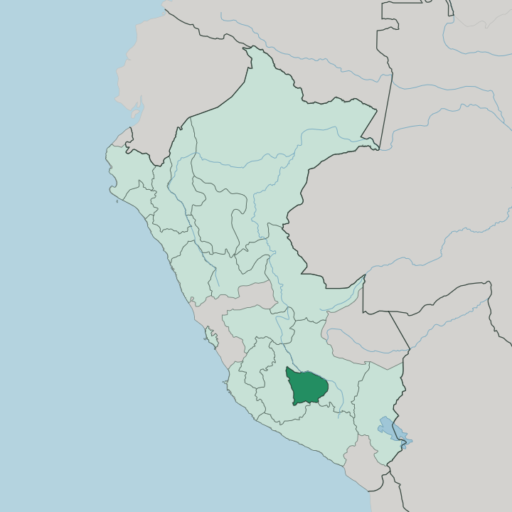
Towns & cities in Departamento de Apurímac
Pick a town or city — each links to where to stay.
Abancay is the obvious base. The regional capital sits in a warm valley above the Pachachaca River, and its buses and the trailhead at Cachora put Choquequirao and the Saywite monolith within reach. Andahuaylas is the other hub, higher and colder on the far side of the region, closest to the old Chanka heartland and the only town with an airport.
Choose Abancay for the canyon country and the Inca ruins; choose Andahuaylas if you fly in or want the agricultural highlands around Lake Pacucha.
About Departamento de Apurímac
What is Departamento de Apurímac known for?
Apurímac takes its name from the river the Inca revered as the chief oracle. The canyon it cuts is its signature. Its gorges plunge as much as 3,000 metres, deeper than almost any river valley in the Andes, and the same water is counted among the most distant sources of the Amazon.
Choquequirao, the Inca ridge-city reached on foot from Cachora, is the region's great draw. Abancay anchors it all.
Where is Departamento de Apurímac?
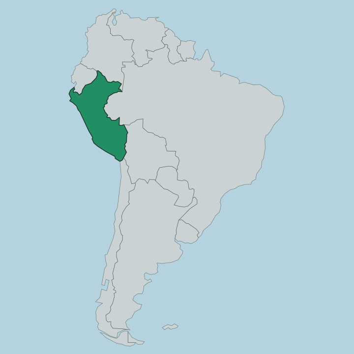
Apurímac lies in the southern highlands of Peru, walled in by mountains on every side. It is a land of steep relief. Most of its territory rises above 3,000 metres, and the terrain pitches between deep river canyons and high grassland with little level ground between them.
The Departamento de Cusco borders it to the east and the Departamento de Ayacucho to the west, with Arequipa along part of the south. The region is named for the Apurímac River, which forms much of its eastern boundary with Cusco as it carves one of the deepest canyons in the Americas. Two valleys hold most of the population.
Abancay, the capital, sits in a warmer basin above the Pachachaca River in the east of the region. Andahuaylas lies west across the mountains, higher and cooler, in the broad agricultural valley that was the Chanka homeland. Between and around them the land climbs into puna grassland grazed by alpaca.
The Apurímac gathers glacial meltwater from the high peaks and runs generally northwest, its water eventually feeding the Amazon far downstream.
What is Departamento de Apurímac like?
Apurímac is overwhelmingly Quechua country. Most people here speak Quechua, more than in almost any other region of Peru, and Spanish runs second rather than first across its villages and market towns. That deep Andean identity long predates the Inca.
The valley around Andahuaylas was the heartland of the Chanka, the warrior people who nearly took Cusco before Pachacuti's army broke them in the fifteenth century, and Chanka festivals and pride still colour the town's calendar. Daily life follows the land. Farmers work terraced slopes for maize, potatoes, and wheat, and herders drive alpaca across the high puna above the crops.
The Inca left their mark in stone, from the carved Saywite monolith near Curahuasi to the ridge-city of Choquequirao above the canyon. Music, weaving, and Catholic feast days folded into older Andean ritual carry the culture forward. It is a rural region at heart, closer to its fields and its ruins than to any city.
What is the history of Departamento de Apurímac?
The Chanka came first. From their base in the Andahuaylas valley they mustered thousands of warriors and marched on Cusco, and in 1438 Prince Cusi Yupanqui, later Pachacuti, turned them back and folded their land into the growing Inca state. Spanish rule followed the conquest, and Abancay was founded as a colonial town in 1572.
The modern department was created on April 28, 1873, drawing scattered highland provinces into one region named for its great river.
What is the climate of Departamento de Apurímac?
In Apurímac, how high you stand decides the climate you get. Abancay sits low and warm enough to earn the nickname the valley of eternal spring, while Andahuaylas, nearly 600 metres higher, runs cool by day and cold at night. Two seasons split the year.
Across the region a dry season from May to September brings clear skies and sharp sunlight, and a wet season from November to March swells the Apurímac and its tributaries with rain. The high puna above the valleys stays cold year round.
How do you get to Departamento de Apurímac?
Most travellers come overland from Cusco. The paved highway west from the Departamento de Cusco climbs to Abancay in roughly five hours and passes the Cachora turnoff for the Choquequirao trek along the way. Buses from Cusco, Lima, and the coast run into both Abancay and Andahuaylas.
Flying is quicker to the far side of the region, where Andahuaylas Airport takes short domestic hops from Lima. From Abancay it is roads, not runways, that reach the canyon and the ruins.
Good for
Updated July 2026