Vietnam
Gia Lai, Vietnam — Towns & Travel Guide


Gia Lai runs from Vietnam's basalt Central Highlands, coffee country of the Jarai, down to the beaches of Quy Nhơn.
About Gia Lai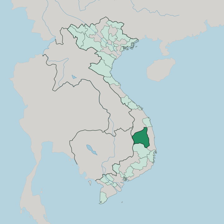


Towns & cities in Gia Lai
Pick a town or city — each links to where to stay.
The coast holds the most beds. Quy Nhơn, the province's seaside city, lines its crescent bay with the fullest run of hotels in Gia Lai, from beach resorts to town guesthouses. Pleiku anchors the highlands.
The plateau town makes a practical base for the crater lake, the coffee estates and the Jarai villages nearby, though rooms there thin out fast beyond it. East along the Ba River, Kon Ka Kinh National Park keeps only simple ranger lodging, while the Jarai lowlands around Ayun Pa in the south see few outside beds. Base on the coast or the plateau; venture out by day.
About Gia Lai
Gia Lai is highland coffee country with a coastline.
What is Gia Lai known for?
The province climbs from the beaches of Quy Nhơn to the basalt plateaus of Vietnam's Central Highlands, where robusta bushes, pepper vines and rubber stands cover the red earth around Pleiku, the main town of the uplands. Two peoples give the highlands their character: the Jarai, whose language gives Gia Lai its name, and the Bahnar of the eastern valleys. Volcanic scenery draws travellers.
The crater lake of Biển Hồ and the cone of Chư Đăng Ya, ringed each dry season by wild sunflowers, sit within a short drive of the town.
Where is Gia Lai?
Gia Lai reaches from the highlands to the sea. Its western half sits high on the basalt plateaus of Vietnam's Central Highlands, while its eastern half drops through the Trường Sơn range to the beaches around Quy Nhơn. Inland, the land sits high.
Basalt tablelands roll between roughly seven hundred and eight hundred metres, cut by river valleys and studded with the worn cones of old volcanoes. It is the second-largest province in the country by area, and one of the least crowded. Quảng Ngãi borders it to the north and Đắk Lắk to the south, while the ridges of the Trường Sơn range separate the coastal lowlands from the plateau behind them. To the west the plateau runs down to Cambodia, meeting Ratanakiri across a forested frontier.
Two river systems drain the highlands in opposite directions. The Ba River, the longest river of the central coast, rises in these highlands and swings southeast toward the sea. West of the watershed, the Sê San gathers the rain and carries it into the Mekong through Cambodia.
Water shapes the scenery close to Pleiku as well. Biển Hồ, a flooded volcanic crater the Jarai call Tơ Nưng, holds the town's drinking water and its best-known view. Higher and wilder, Kon Ka Kinh National Park rises east of Pleiku above the Ba River valley, the forested roof of the province.
What is Gia Lai like?
Highland culture here is older than Vietnamese settlement. The Jarai and the Bahnar have farmed these plateaus for centuries, and their villages still set the tone away from the towns. Both peoples build a nhà rông at the village heart, a communal house whose thatched roof rises in a steep blade above the stilt homes around it.
The Jarai speak an Austronesian tongue, cousin to Malay and unrelated to Vietnamese, while the Bahnar language belongs to the Mon-Khmer family. Gongs bind the two. The bronze gong ensembles of the Central Highlands are named by UNESCO as a masterpiece of intangible heritage, sounded at harvests, weddings and funerals.
Death is marked with unusual art. Around Jarai and Bahnar cemeteries stand nhà mồ, tomb houses ringed by carved wooden figures of mourners, and after a final abandonment ceremony the forest is left to reclaim them. Jar wine drunk through long reeds passes hand to hand at every festival.
The other daily culture is coffee. Robusta from the red basalt fills the province's fields, and Pleiku runs on strong iced glasses of it. Old French names still cling to the map, a trace of the plantation decades, but the rhythm of the villages is Jarai and Bahnar first.
What is the history of Gia Lai?
The Jarai and Bahnar came first. Their upland chiefdoms held the plateau long before Vietnamese or French rule reached it, and the province still carries the Jarai name. France pulled the highlands into the Annam protectorate around 1904 and cleared forest for coffee and rubber estates.
War came hard. Pleiku became a major base in the Vietnam War, and a 1965 raid on its airfield helped push the United States into open ground fighting.
What is the climate of Gia Lai?
Altitude tempers the tropics here. The plateau keeps the highlands of Gia Lai milder than the humid coast, and the year splits cleanly into a wet half and a dry half. Rain floods the months from May into November, when the monsoon drives afternoon downpours across the coffee slopes.
Then the dry season takes over. From around February the white coffee blossom opens across the fields near Pleiku, and by the end of the year wild sunflowers gild the volcanic slopes at Chư Đăng Ya.
How do you get to Gia Lai?
Two airports serve the province. Phù Cát Airport near the coast at Quy Nhơn is the busier gateway, and Pleiku Airport sits on the plateau above its town, linking Gia Lai by daily flights to Hồ Chí Minh City and Hà Nội, the two ends of the country. No railway climbs the highlands, but the north-south line runs down the coast to Quy Nhơn.
Overland, National Highway 14 runs the spine of the plateau south toward Buôn Ma Thuột, while Highway 19 climbs inland from the coast at Quy Nhơn to Pleiku and on to the Cambodian border. Sleeper buses do the rest.
Good for
Updated July 2026