Colombia
Departamento de Caldas, Colombia — Towns & Travel Guide


Caldas is Colombia's coffee heartland, its Andean ridges climbing from the Cauca River to the snows of Nevado del Ruiz.
About Departamento de Caldas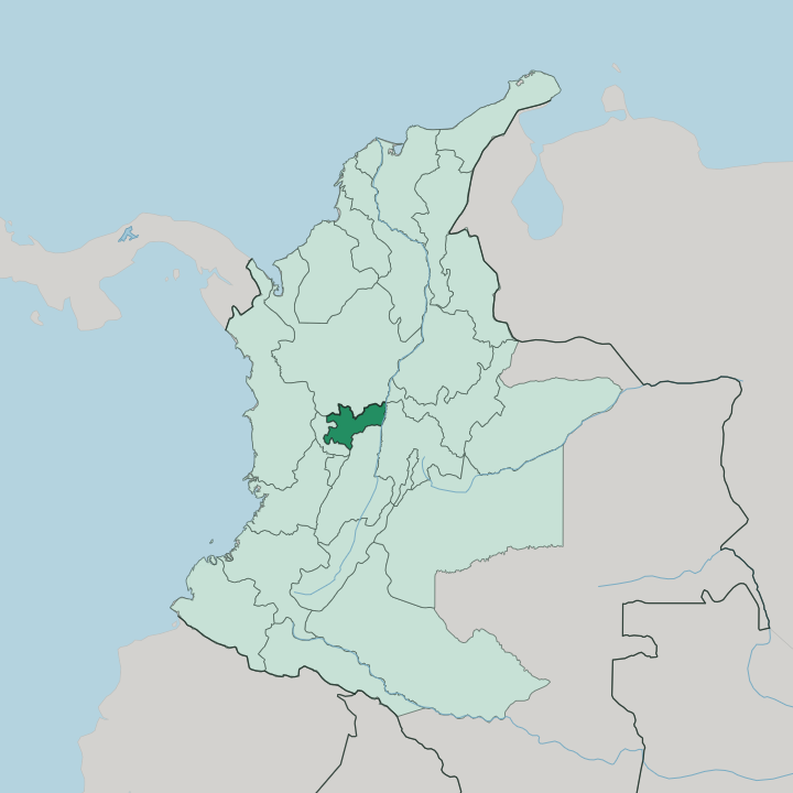
Towns & cities in Departamento de Caldas
Pick a town or city — each links to where to stay.
Manizales is the obvious base, a university city strung along one ridge of the Cordillera Central with plantations dropping away on either side. Coffee farms take over from there. Around Chinchiná and Palestina, working haciendas open their doors to guests who want to walk the rows and watch the bean go from branch to cup.
North of the capital the old paisa towns wait, Salamina and Aguadas among them, their balconied streets built in the wax-palm high country. Choose Manizales for the city and the volcano; choose a hacienda near Chinchiná to sleep among the coffee; head for Salamina when you want the quiet, timber-fronted north.
About Departamento de Caldas
Caldas is coffee country.
What is Departamento de Caldas known for?
It sits at the heart of the Eje Cafetero, the belt that Colombia registered with UNESCO in 2011 as the Coffee Cultural Landscape, and its steep green slopes carry more Arabica than almost any corner of the country. Manizales, the capital, rides a knife-edge ridge of the Cordillera Central high above those plantations. Behind the city rises Nevado del Ruiz, a glacier-capped volcano that also marks the department's roof.
Heritage towns anchor the north.
Where is Departamento de Caldas?
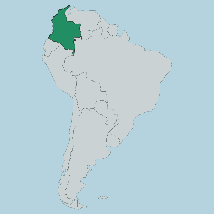
Caldas sits in the west-centre of Colombia, deep in the Andean region. Two of the country's great rivers frame it. The Cauca River runs down its western edge, marking much of the boundary with Risaralda, while the Magdalena River drains the far east toward the border with Tolima and Cundinamarca.
Between the two rivers the Cordillera Central heaves up, and it is on this central range that most of the department lives. Antioquia lies to the north, the land Caldas was carved from. Quindío closes the short southern flank. The relief is unforgiving.
From the hot Cauca canyon in the west the ground climbs through the temperate coffee belt to páramo grassland and, at the department's roof, the glacier and snows of Nevado del Ruiz on the Tolima line. That single volcano, shared with Tolima, is the highest point of both departments. Los Nevados National Natural Park spreads across the high ground, its melting ice feeding the streams that water the plantations below.
Little of Caldas is flat. Ridge follows ridge, and roads switchback between them, so that towns only a short distance apart on the map can sit an hour or more apart by the winding mountain road that joins them.
What is Departamento de Caldas like?
Caldas is paisa to the core. Its towns and customs were shaped by the Antioqueño colonization, the nineteenth-century push of settlers south from Antioquia who cleared the ridges, founded the villages and planted the coffee that still defines the place. That inheritance shows in the architecture.
Salamina and Aguadas keep whole streets of balconied timber houses painted in hot colours, the classic bahareque style the colonists brought with them. Coffee is not only an export here; it is the daily rhythm of the countryside, and the tinto is poured from dawn. Spanish is the language, spoken in the quick, sing-song paisa accent of the coffee zone.
Not everything is Antioqueño, though. The town of Riosucio, in the west, grew from Indigenous and mixed roots and holds a famous devil-masked carnival that owes nothing to the coffee-farm image of the department. Craft runs deep.
Aguadas is known across Colombia for the fine iraca-palm sombrero that carries its name. Manizales, the capital, throws its own great fair each year around the bullring and the coffee, drawing the whole region up onto the ridge. Between the volcano above and the plantations below, the culture of Caldas stays tied to the mountain and the bean in a way few Colombian departments can match.
What is the history of Departamento de Caldas?
Caldas is a young department with old roots. The land was settled through the Antioqueño colonization, when families from Antioquia moved south along the Cordillera Central through the eighteen-hundreds, founding towns like Salamina and Aguadas and turning the forest into coffee farms. The department itself was created in 1905, carved chiefly from southern Antioquia with slices of the old Cauca and, two years later, Tolima.
Manizales was named its capital. What had been the frontier of Greater Antioquia became the core of Colombia's coffee axis.
What is the climate of Departamento de Caldas?
Altitude, not season, sets the weather in Caldas. Sitting close to the equator, the department has no summer or winter, only wet spells and drier ones spread through the year. What changes is height.
The hot Cauca canyon in the west stays warm all year, the coffee belt around Manizales holds a mild spring-like range, and the páramo and the glacier of Nevado del Ruiz keep a cold, thin air near freezing. Cloud and mist ride the ridges most mornings. That reliable temperate band is exactly what makes the slopes so good for Arabica.
How do you get to Departamento de Caldas?
Most travellers reach Caldas by air into Manizales, whose ridge-top airport handles flights from Bogotá and the other Colombian hubs. The roads climb hard. Manizales sits high on the Cordillera Central, so arriving overland from Medellín in Antioquia to the north, or up from the coffee cities of Risaralda and Quindío, means hours of switchbacks between the ridges.
The wider coffee axis is well linked by bus. Once you are up on the range, road is the only way out to Salamina, Aguadas and the coffee towns.
Good for
Updated July 2026