Italy
Regione Autonoma Valle d'Aosta, Italy — Towns & Travel Guide


Italy's smallest region, ringed by the Alps' highest peaks, Mont Blanc, the Matterhorn, Monte Rosa and Gran Paradiso.
About Regione Autonoma Valle d'Aosta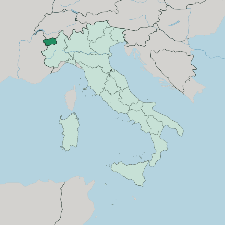
Towns & cities in Regione Autonoma Valle d'Aosta
Pick a town or city — each links to where to stay.
Aosta makes the easiest base. The Roman town sits on the valley floor where the Buthier joins the Dora Baltea, and regional trains reach it from Turin. Courmayeur, under the Italian face of Mont Blanc, is the largest resort and the Italian mouth of the tunnel to Chamonix.
Breuil-Cervinia climbs high toward the Matterhorn. For something slower, Cogne lies inside Gran Paradiso National Park, a cross-country base with ibex grazing the meadows above the houses. Choose by what you want.
Pick Aosta for a town at the valley's heart; pick the side valleys when you want the glaciers and the ski lifts at your door.
About Regione Autonoma Valle d'Aosta
This is the roof of Italy.
What is Regione Autonoma Valle d'Aosta known for?
Four of the Alps' great summits stand on its rim: Mont Blanc to the west, the Matterhorn and Monte Rosa along the Swiss border to the north, and Gran Paradiso to the south. The Dora Baltea runs the length of the floor, and side valleys climb from it toward the glaciers and the ski towns of Courmayeur and Breuil-Cervinia. Aosta, the capital, keeps a Roman theatre and an arch to the emperor Augustus.
Bilingual road signs read in Italian and French.
Where is Regione Autonoma Valle d'Aosta?
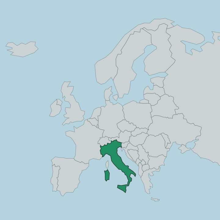
Valle d'Aosta sits in the far north-west of Italy, wedged into the highest corner of the Alps. It is the country's smallest and least populated region. France lies over the western watershed, Switzerland across the northern ridges, and Piedmont opens to the south and east where the mountains finally drop away. Almost the whole territory is mountain.
Its rim carries four of the range's giants: Mont Blanc, the tallest in the Alps, on the French border; the Matterhorn and Monte Rosa along the Swiss frontier; and Gran Paradiso, the highest peak standing wholly on Italian ground, in the south. Down the middle runs the Dora Baltea, rising from the glaciers of Mont Blanc and flowing south-east through the valley floor to meet the Po beyond the regional border. From that central trench a fan of side valleys climbs on either hand toward the ice, Valtournenche toward the Matterhorn, Valsavarenche and the Val di Cogne into Gran Paradiso, the Valdigne up to Courmayeur and Mont Blanc.
The floor is the only lowland the region has. Everything else tilts upward. Villages, vineyards and the old fortress castles line the trench, and the passes above them, the Great St Bernard chief among them, were the routes that carried travellers over the Alps for two thousand years.
What is Regione Autonoma Valle d'Aosta like?
The valley faces two ways at once. Italian and French are both official, a legacy that the region's autonomy statute wrote into law, and older still is the Valdôtain speech of the villages, a Franco-Provençal dialect closer to the tongues of the Savoyard and Swiss valleys next door than to standard Italian. Signs, menus and place names carry the French forms alongside the Italian.
Mountain life shaped the rest. Fontina, the region's washed-rind cow's-milk cheese, comes from the high summer pastures and melts into fonduta and the barley-and-bread soup seupetta; red wines climb the terraced slopes above the Dora Baltea on some of the highest vineyards in Europe. The old Challant family fortresses still stand along the floor.
Fénis, with its double ring of crenellated walls and painted courtyard, is among the best-preserved medieval castles in all of Italy. Craft runs through the winters too. Woodcarving fills the Sant'Orso fair in Aosta each January, when carvers bring their work down from the valleys to the old Roman streets.
It is a border culture, alpine before it is Italian, and it knows it.
What is the history of Regione Autonoma Valle d'Aosta?
Rome made the valley. In 25 BC the legions crushed the Salassi who held these mountains and founded Augusta Praetoria Salassorum on the floor, the city that became Aosta, its grid, theatre and triumphal arch still legible in the streets. The valley guarded the roads to the Great St Bernard and the western passes, so whoever ruled the Alps wanted it.
The House of Savoy took it in the Middle Ages and granted the communities a charter of liberties, the root of a self-rule the valley has guarded ever since. That long habit of autonomy hardened into the special statute Italy granted the region in 1948.
What is the climate of Regione Autonoma Valle d'Aosta?
In the Aosta Valley, height governs the climate. The valley floor around Aosta is moderately continental and, shut behind the high peaks, one of the drier corners of the Alps, the main west-to-east trench catches little rain. Climb, and it turns fully alpine: winters are long and cold, and snow lingers eight or nine months on the highest ground below Mont Blanc and Monte Rosa.
Summers stay short and cool on the heights while the floor warms. The glaciers never leave.
How do you get to Regione Autonoma Valle d'Aosta?
Most travellers come up from Turin. The A5 motorway runs from the Piedmont plain into the valley at Pont-Saint-Martin and climbs the floor toward Aosta, and the regional railway follows the same line with a change at Chivasso or Ivrea. From the north-west, road traffic arrives straight through the mountains: the Mont Blanc Tunnel links Chamonix in France to Courmayeur, while the Great St Bernard Tunnel and its pass carry the route down from the Swiss Valais.
Turin's airport is the nearest. Inside the region, buses fan out from Aosta up the side valleys to the ski towns.
Good for
Updated July 2026