Mexico
Estado de Morelos, Mexico — Towns & Travel Guide


Morelos is a small, warm state just south of Mexico City, the capital's weekend country, where Cuernavaca keeps its famous eternal spring.
About Estado de Morelos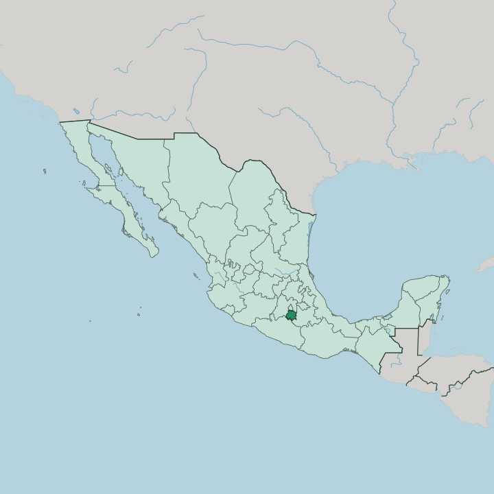


Towns & cities in Estado de Morelos
Pick a town or city — each links to where to stay.
Cuernavaca is the obvious base. The capital sprawls across ravines as a city of walled gardens and weekend villas, gathered around the Palace of Cortés and the flowering Jardín Borda near the cathedral. Tepoztlán suits a slower stay, its cobbled market lanes running beneath the Tepozteco cliffs.
Cuautla, warmer and lower, is spa country. Old sugar haciendas across the lowlands open as hotels, some with mineral pools. Pick Cuernavaca first; take Tepoztlán or Cuautla for the weekend-town pace.
About Estado de Morelos
Morelos is where Mexico City goes to warm up.
What is Estado de Morelos known for?
Its capital, Cuernavaca, has drawn weekenders and retirees for generations with a mild climate that barely shifts between seasons, earning it the name City of the Eternal Spring. The pyramid of El Tepozteco stands above the Pueblo Mágico of Tepoztlán, while the hilltop ruins of Xochicalco crown a ridge in the west of the state. This is also Zapata country.
Emiliano Zapata was born here, and the state carries the name of independence hero José María Morelos y Pavón.
Where is Estado de Morelos?
Morelos is a small landlocked state just over the mountains from Mexico City. It is the second-smallest state in Mexico, after Tlaxcala. The southern rim of Mexico City forms part of its northern border, the State of Mexico wraps around the north and west, Puebla lies to the east, and Guerrero closes it off to the south and west.
The land tilts south. Volcanic highlands rim the north, and the ground falls away into warm river valleys below them. Roughly two in five parts of the state stand as mountains, another two in five as open valley floor, and the rest as hills between.
Popocatépetl, the great snow-capped volcano, stands on the eastern skyline at the corner Morelos shares with Puebla and the State of Mexico. The Sierra de Chichinautzin, a young volcanic ridge, seals the state off from the Valley of Mexico to the north. Below it, the land is warm.
Streams gather off the mountains into the Amacuzac and the Cuautla, which run south out of the state and drain, by way of the Amacuzac, into the Balsas River that empties far off toward the Pacific. Cuernavaca sits in a temperate valley near the middle of it all. The sea is nowhere near.
What is Estado de Morelos like?
Morelos is Zapata country, and it wears the fact openly. Emiliano Zapata was born in the village of Anenecuilco, and the cry of his revolution, Tierra y Libertad, land and liberty, rose from the sugar estates that once worked much of this land. The great haciendas stand as ruins or hotels.
Their fields grew cane for four centuries. In the villages of the north and east, Nahua families still speak Nahuatl, and the old Tlahuica towns keep their patron-saint fiestas through the year. Carnival brings out the Chinelos.
These masked dancers, in robes and upturned beards that mock the old Spanish overlords, hop through the streets of Tlayacapan, Tepoztlán and Yautepec to a brass band. Dominican friars left their mark too. The fortress-like convent at Tepoztlán and its neighbours on the slopes of Popocatépetl date from the first years after the conquest.
Cuernavaca has long pulled writers and painters up from the capital, among them Malcolm Lowry, who set Under the Volcano in its ravines. Spanish is the common tongue. Market stalls sell salted cecina, the thin dried beef of Yecapixtla, cooked to order with cream and nopales.
What is the history of Estado de Morelos?
The Tlahuica farmed these valleys long before the Aztecs taxed them. After the conquest, Hernán Cortés took Cuernavaca as the seat of his marquisate, planted the first sugar cane, and built a fortress-palace on the main square. Sugar made the region rich and unequal.
For most of the colonial and early national centuries the territory hung off the vast State of Mexico. That changed in 1869. President Benito Juárez split off the new state and named it for José María Morelos y Pavón, the independence priest who held nearby Cuautla through a royalist siege in 1812.
What is the climate of Estado de Morelos?
Warmth is the whole point. Cuernavaca sits at a height that keeps it mild all year, neither cold in winter nor harsh in summer, and the name City of the Eternal Spring is only a small exaggeration. Rain keeps to a season.
Storms build most afternoons from June into September, then the skies dry out and stay clear through the winter months. The southern lowlands around Cuautla run hotter, while the air cools on the climb toward Popocatépetl and the pine lakes of Zempoala.
How do you get to Estado de Morelos?
Almost everyone comes down from Mexico City. The old road and the Autopista del Sol both climb south over the Chichinautzin ridge from the capital and drop into Cuernavaca in little more than an hour, one of the busiest weekend runs in the country. The state's small airport at Temixco sees little scheduled traffic.
Travellers fly instead into Mexico City and its outlying airports, then finish the trip by the frequent Pullman de Morelos coaches or by car. Buses leave for the state all day.
Good for
Updated July 2026