Peru
Departamento de Huancavelica, Peru — Towns & Travel Guide


Huancavelica is a high Andean department of central Peru, a cold mercury-country of puna grassland above the Mantaro river.
About Departamento de Huancavelica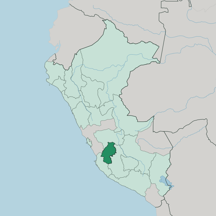
Towns & cities in Departamento de Huancavelica
Pick a town or city — each links to where to stay.
One town holds the beds. Huancavelica city is the base, a small colonial place on the Andean plateau where the Tren Macho line reaches its end after climbing up beside the river. Rooms cluster near the Plaza de Armas and the old cathedral, a short walk from the thermal baths of San Cristóbal.
Most travellers arrive off the train from Huancayo. You want the town for its walkable centre and its handful of plain hostales, not for luxury, which this cold mercury region simply does not have. Beyond the capital, Pampas in Tayacaja and Lircay in Angaraes offer only the barest lodging.
About Departamento de Huancavelica
Mercury made this region.
What is Departamento de Huancavelica known for?
The Santa Bárbara mine above the capital fed the silver of the whole Spanish empire, and its forced labour earned it the name la mina de la muerte, the mine of death. That grim history sits under a landscape of thin cold air, treeless puna, and Quechua-speaking herding villages. The scissors dance, the Chanka danza de tijeras, is danced across these highlands to violin and harp.
Few outsiders come this far into the central Andes.
Where is Departamento de Huancavelica?
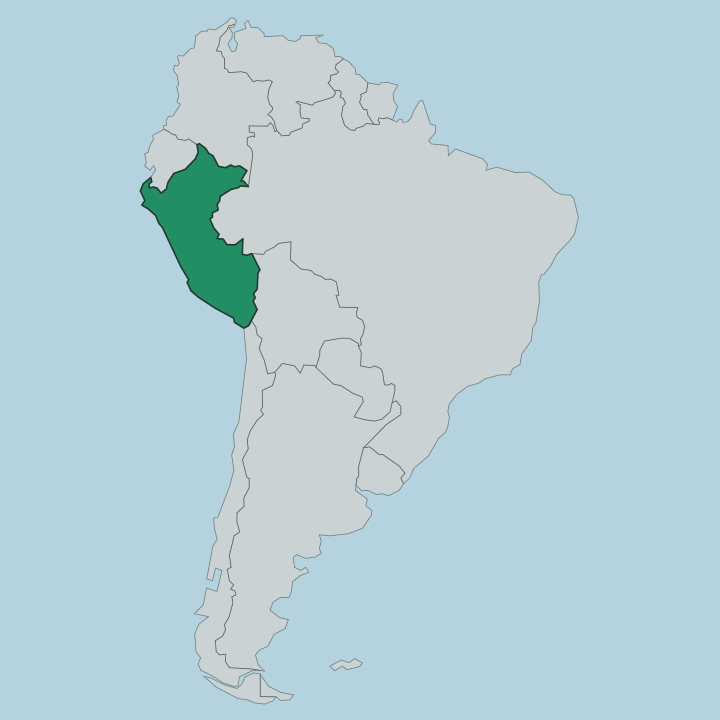
Huancavelica fills a block of the central Peruvian Andes, inland and high, about a day southeast of Lima. It is small by Peruvian standards. The Junín Department lies to the north, Ayacucho to the east, and the desert-coast department of Ica drops away to the west toward the Pacific.
Everything here is vertical. Valley floors sit near 1,950 metres, while the snow line of the eastern cordillera climbs past 5,000 metres of altitude, so a single province can hold maize terraces and glaciers within a few hours' walk. The Mantaro river is the region's spine.
It curves down out of the Junín Department and cuts a deep gorge along Huancavelica's northern edge before swinging south into Ayacucho. Between the river valleys spreads the puna, the treeless high grassland grazed by llamas and alpacas that covers most of the department. The capital sits at roughly 3,676 metres, wedged in a narrow bowl below the old Santa Bárbara workings.
Water, land, and settlement all follow the same rule here: up in the puna it is cold and open, down in the river cuts it is warmer and green.
What is Departamento de Huancavelica like?
This is one of the most Quechua regions of Peru. Around two-thirds of people here speak the Chanka variety of Quechua, and highland herding life runs the calendar as much as the Spanish colonial towns do. The dominant art is the danza de tijeras, the scissors dance, whose Chanka roots reach back through Huancavelica, Ayacucho and Apurímac.
A dancer works against a rival, each shadowed by a violin and a harp, snapping loose steel blades in one hand through leaps and contortions. It reads as a duel. UNESCO listed the dance as intangible cultural heritage in 2010.
Wool and fibre carry the daily craft. Alpaca and llama fleece off the puna become the weavings and knitting sold in the highland markets, and the market towns still gather villages down from the surrounding hills. Catholic feast days overlay the older Andean cycle of planting and grazing, so a saint's procession and a herders' ritual can share the same week.
The food is plateau food: potatoes in dozens of native varieties, freeze-dried chuño made in the frost, mutton and the odd cuy. Little of this is staged for visitors. It is simply how the department lives, high and cold and largely turned inward on itself.
What is the history of Departamento de Huancavelica?
Mercury built this region. Deposits at Santa Bárbara came to light in the 1560s, and viceroy Francisco de Toledo founded the town of Huancavelica in 1572 to work them under the Spanish crown. That mercury refined the silver of Potosí, which is why a viceroy in 1648 called the two mines the twin pillars of Spain.
The cost fell on Andean draft labourers, rotated in under the mita and poisoned in the tunnels. The department later joined the Peru that declared independence in 1821.
What is the climate of Departamento de Huancavelica?
It is cold. Sitting so high in the Andes, the department runs chilly all year, and the capital averages only around 7 to 9 degrees despite its position near the equator. The year splits in two: a wet season roughly September to April, then a dry, frost-hard stretch from May to August when clear nights on the puna can drop well below freezing.
Strong sun by day and hard cold by night give a huge daily swing. Down in the Mantaro valleys it stays milder and greener than the exposed high grassland above.
How do you get to Departamento de Huancavelica?
No useful airport serves it. You come overland instead, and most travellers route through Huancayo in the Junín Department to the north, itself reached by paved highway or the tourist train up from Lima. From Huancayo the narrow-gauge Tren Macho climbs to Huancavelica city in about five hours, running beside the Mantaro river through Izcuchaca and a string of tunnels.
Paved national roads also link the capital to Ayacucho and, over the western cordillera, down toward Ica and the coast. Inside the department, buses and shared cars reach the province towns.
Updated July 2026