Peru
Departamento de Ica, Peru — Towns & Travel Guide


Ica is Peru's sun-baked desert coast, home to the Nazca Lines, the Huacachina oasis and the vineyards that make pisco.
About Departamento de Ica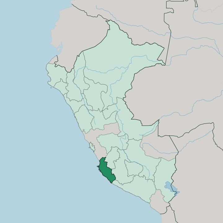
Towns & cities in Departamento de Ica
Pick a town or city — each links to where to stay.
Ica city is the base. Close to the wineries and a short ride from the Huacachina oasis, it puts the dunes, the bodegas and the road south all within easy reach of one bed. Pisco and the Paracas coast draw travellers north for the Ballestas boats and the reserve.
Nazca sits at the far south, the town you sleep in to fly over the lines at dawn. Chincha Alta anchors the valleys of the north. Choose Ica for wine and dunes; choose Paracas for the sea and Nazca for the geoglyphs.
About Departamento de Ica
Ica is desert.
What is Departamento de Ica known for?
Its plains run flat between the Pacific Ocean and the Andes rising inland, an unbroken belt of sand and dune that sets it apart from every other stretch of Peru's southern coast. The Nazca Lines are scraped into that desert floor in the south, geoglyphs of a monkey, a hummingbird and long straight tracks read only from the air. Near the capital, the palm-ringed lagoon of Huacachina sits in a hollow of towering dunes.
Grapes grow in the river valleys, and from them come Peru's wine and its pisco brandy.
Where is Departamento de Ica?
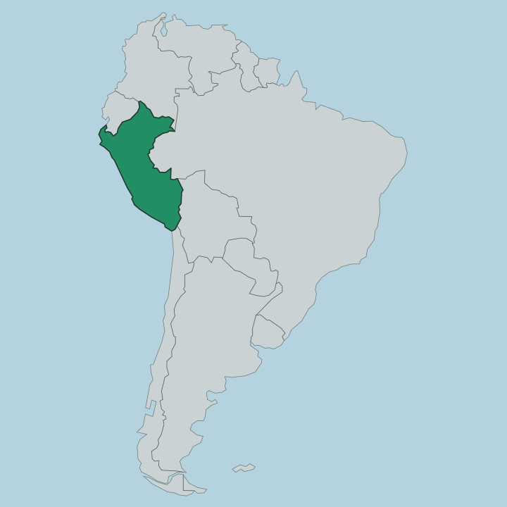
Ica lies along the southern coast of Peru, a long ribbon of desert facing the Pacific Ocean. It is the one southern coastal region built entirely of plains, because here the Andes hold back from the shore and leave a broad belt of sand between mountain and sea. The Pacific Ocean forms the whole western edge.
Inland to the east rise the highland regions of Huancavelica and Ayacucho, the Lima Region borders it to the north, and Arequipa lies to the south along the coast road. Rivers thread down from the sierra and cut green valleys through the sand, the Ica River among them, and these strips of irrigated land carry almost all the farming and most of the towns. The desert dominates everything else.
Dunes march toward the sea across empty pampas, some rising into the great sand hills that ring the Huacachina lagoon outside the capital. On the coast the Paracas Peninsula juts into the Pacific, its cliffs and bays sheltering the Paracas National Reserve. Fierce onshore winds, the paracas that give the peninsula its name, scour the flats and raise sandstorms across the open ground.
It is a land of sun and sand, water only where a river reaches it.
What is Departamento de Ica like?
Ica lives on the vine. The dry heat and free-draining sand of the river valleys suit grapes better than almost anywhere in Peru, and the harvest feeds two things at once: wine, and the clear grape brandy called pisco that took its name from the port of Pisco on this coast. Bodegas old and new work the valleys around the capital, and the grape festival each autumn turns the pressing into a public celebration.
This is Spanish-speaking country, and the culture carries the layers you would expect of a place settled that long. Those layers run deep. The Paracas people wove funerary textiles here more than two thousand years ago, and the Nazca who followed drew their vast geoglyphs into the desert and shaped fine painted pottery.
Around Chincha in the north, the valleys hold one of the strongest Afro-Peruvian communities in the country, its music and food a distinct thread in the regional mix. Cachiche, a village outside the capital, keeps a folk reputation for witchcraft alive around a carved huarango tree. Sun, sand and the vine tie it all together.
What is the history of Departamento de Ica?
People have lived on this coast for thousands of years. The Paracas culture flourished on the peninsula before the Nazca rose inland and etched their lines into the desert, and the Inca later drew the valleys into their empire. Spanish rule arrived when Jerónimo Luis de Cabrera founded the town of Ica in 1563, and vineyards and cotton soon followed.
When the war for independence reached the coast, José de San Martín came ashore at Paracas and made Pisco his first headquarters. A magnitude 8.0 earthquake struck in 2007, levelling much of Pisco and scarring the region badly.
What is the climate of Departamento de Ica?
Ica is one of the driest places on earth. The region sits at the northern edge of the Atacama, and barely any rain reaches it in a whole year, so the sky stays clear and the sun beats down almost daily. The capital rises just above the coastal fog that greys much of Peru's shore, keeping its clear light while towns nearer the sea sit under low mist through the cooler months.
Days are warm to hot; nights in the desert cool off fast. The Pacific winds do the rest.
How do you get to Departamento de Ica?
Most travellers come overland from Lima. The Pan-American Highway runs the length of the coast and links the capital of Peru to Ica in around five hours by road, passing Paracas and Pisco on the way south. Ica has no commercial airport of its own, so international arrivals land at Jorge Chávez in Lima and continue by bus or car.
Small planes fly the tourist overflights above the Nazca Lines from the airstrips at Nazca and Pisco. On the ground, the highway ties the whole desert together.
Updated July 2026