Uzbekistan
Jizzakh Region, Uzbekistan — Towns & Travel Guide


Jizzakh Region spreads across central Uzbekistan, from the irrigated Hungry Steppe up into the Turkestan Range and Zaamin's junipers.
About Jizzakh Region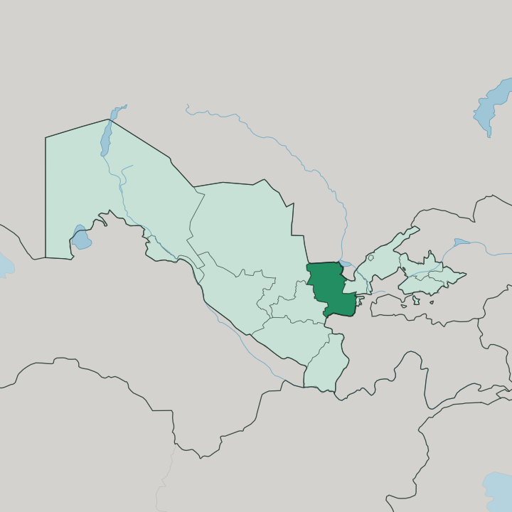
Towns & cities in Jizzakh Region
Pick a town or city — each links to where to stay.
The capital is the practical base. Jizzakh is a road-and-rail stop on the Sangzor between Tashkent and Samarqand, easy to reach and easy to leave. For the mountains, travellers head to Zaamin in the south, the resort village below Zaamin National Park.
The Hungry Steppe farm towns of the north hold little. Base yourself in Jizzakh for transit, or in Zaamin when the Turkestan Range and its junipers are the reason you came.
About Jizzakh Region
What is Jizzakh Region known for?
Jizzakh Region is known for the leap from steppe to mountain. Its lowland north is the Hungry Steppe, or Mirzachoʻl, a loess plain that Soviet canals turned into cotton and grain fields. The south rises hard into the Turkestan Range, where Zaamin National Park protects Uzbekistan's oldest reserve and juniper forests locals call the country's Switzerland.
Snow leopard and Turkestan lynx prowl. Jizzakh, the capital, sits between the two on the old Silk Road that still ties Tashkent to Samarqand.
Where is Jizzakh Region?
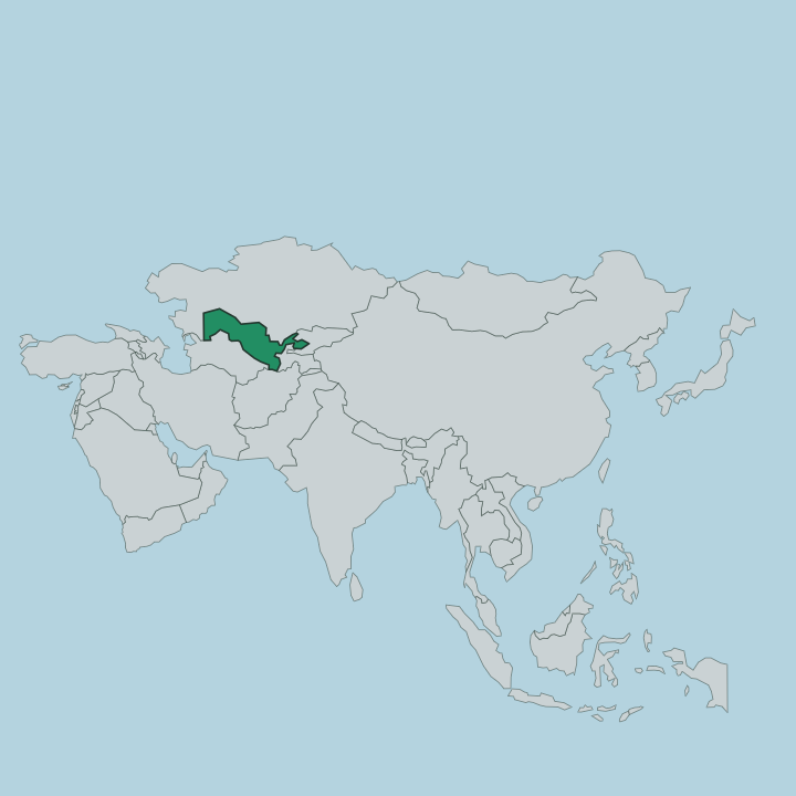
Jizzakh Region sits in central Uzbekistan, wedged between the Syr Darya lowlands and the mountain wall along the Tajik frontier. It borders Tajikistan to the south. Samarqand Region lies west, Navoiy Region north-west, and Sirdaryo Region east, while Kazakhstan runs along the north. The land tilts from top to bottom.
Its northern third is the Hungry Steppe, the Mirzachoʻl, a flat loess plain on the left bank of the Syr Darya that irrigation canals reclaimed from desert for cotton and grain. South of the plain the ground climbs into the Turkestan Range, the mountain spine that separates Jizzakh from Tajikistan and shelters Zaamin National Park in its junipers. The Nuratau Mountains close off the west.
Between steppe and range runs the Sangzor river, the water that feeds the capital and carries the old Silk Road highway from Tashkent through to Samarqand. That single valley threads the whole region together.
What is Jizzakh Region like?
Two lives share the region. On the Hungry Steppe the cotton and grain towns follow the irrigation calendar, a landscape of canals, fields, and farm settlements the Soviet planners built out of the Mirzachoʻl. Uzbek is the common language here, as across Uzbekistan.
Life on the plain is agricultural and unhurried. The south belongs to the mountains and to the herders and holidaymakers who go up to Zaamin. Families from across Uzbekistan drive to the resort village below Zaamin National Park for the cool juniper air, a habit that dates to Soviet sanatorium days.
The Nuratau Mountains hold petroglyphs, old graves, and megaliths among their gorges, marks of the thousands of years people have worked this ground. Jizzakh itself carries its Silk Road inheritance, a caravan stop whose name comes from a Sogdian word for a small fort. Craft, hospitality, and the long trading memory of the route run through the towns along the Sangzor.
It is a working region, not a museum one.
What is the history of Jizzakh Region?
Jizzakh guarded a Silk Road pass long before it was a region. The town grew as a caravan stop between Samarqand and the Fergana Valley, its Sogdian name meaning a small fort set to watch the road. Genghis Khan's armies levelled it in 1220 during the Mongol sweep through Khwarazm.
The modern region is far younger, carved out of Sirdaryo Region and given separate status in 1973, once Soviet canals had made the Hungry Steppe worth governing on its own. Old road, new borders.
What is the climate of Jizzakh Region?
The region runs on a sharp continental climate. Summers on the Hungry Steppe are hot and dry, the plain baking under a near-cloudless sky, while winters stay short and mild by Central Asian measure. Rain is scarce and falls mostly in spring.
Height changes everything, though. Up in Zaamin National Park and the Turkestan Range the air turns cool and green, which is exactly why Uzbek families climb there when the Mirzachoʻl below is at its hottest.
How do you get to Jizzakh Region?
Most travellers reach Jizzakh by land from Tashkent or Samarqand. The region straddles the main highway and railway between those two cities, and high-speed trains on the Tashkent-Samarqand line stop at Jizzakh along the Sangzor. There is no major airport here; visitors fly into Tashkent and continue overland.
For Zaamin National Park you drive on south from the capital into the Turkestan Range, since the mountains keep their own pace.
Good for
Updated July 2026